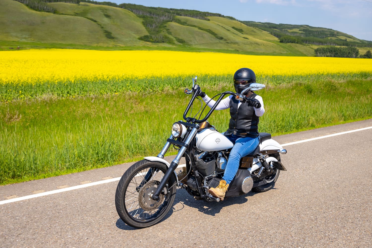
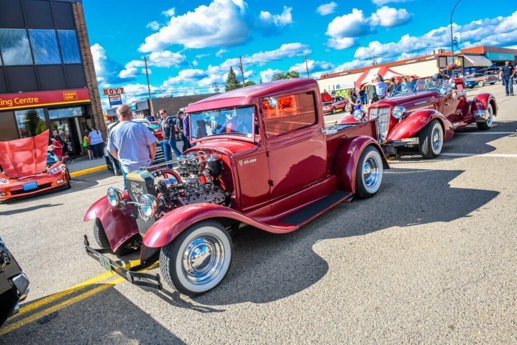
Mighty Peace Motorcycle Guide
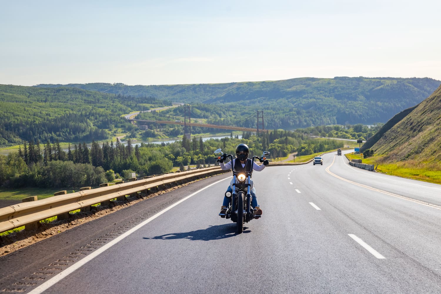
Discover the thrill of the open road and experience the freedom of exploration as you embark on an unforgettable journey through the Mighty Peace region. The following Motorcycle Tour Guide will lead you through beautiful landscapes, historical landmarks in the area, and showcase the many wonders that can be found here.
This guide will take you on a journey through winding roads, past rolling hills and vast river valleys, with stops at some of the area's most significant sites and hidden gems.
From Indigenous and pioneer landmarks to current day attractions, each stop offers a glimpse into the region's diversity, while the scenic beauty of the Peace Country provides the perfect backdrop for an unforgettable ride.
Northern Sunrise County
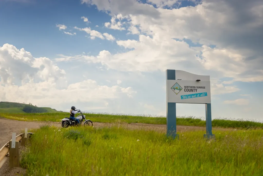
Stop 1: Sagitawa Lookout
Named after the Cree word Sagitawa, which means “where the rivers meet”, this jaw dropping starting point offers riders the perfect start to their day by providing them with one of the best overhead views of the Town of Peace River and the confluence of the Peace, Smoky, and Heart rivers. Complete with a picnic area, historical information, and plenty of parking space, you won’t have any trouble getting a group of motorcyclists together before cruising off for a day on the road.Stop 2: Judah Hill
2.3km from Sagitawa Lookout
Directions: Take a sharp left turn onto Judah Hill Rd and continue down the road until you reach the Town of Peace River.
As you depart Sagitawa Lookout, you will have the opportunity to travel down Judah Hill, a scenic and exciting route that leads into the bustling Town of Peace River. As you make your descent, you will notice the landscape unfolding before your eyes, with crystal clear views of the river valley and surrounding rolling hills. This thrilling ride offers the perfect blend of sweeping curves and picturesque panoramas, making it a memorable experience for any motorcyclist.
Town of Peace River
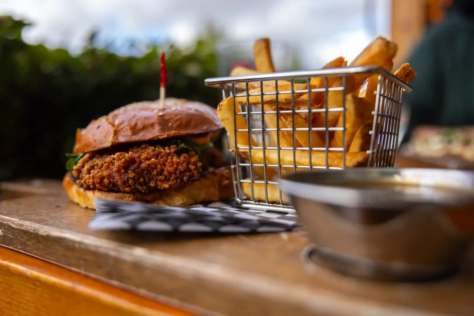
Stop 3: What the Chuck
2km from Judah Hill Rd.
Directions: Turn left onto Highway 744, then turn right onto 103 Street. After 600m take another right onto 101 Street, and then turn right onto 100 Ave and then left back onto 101 Street. Go through the roundabout and take the second exit onto 100 Street and in 150m it will be on your right.
It’s easy to work up an appetite on the road, which is why a stop at What the Chuck is a must for all riders! This gourmet burger restaurant allows you to create your own burger from a variety of patties, toppings, and buns, and has some of the most mouth-watering side dishes that will perfectly compliment your meal. Don’t forget to try one of their specialty coffees or retro inspired milkshakes before you take off on the next leg of your tour.
MD of Peace
Stop 4: Shaftesbury Trail
6.7km from What the Chuck
Directions: Turn left onto 94 Ave, then right onto 98 Street. At the roundabout, take the third exit onto 98 Street. After 1.2km, keep right onto Highway 684 South. Turn left onto 86 Street and after 4.6km you will reach the start of the Shaftesbury Trail.
The Shaftesbury Trail is a motorcyclist’s paradise. Well known by locals and visitors alike, this stretch of highway will make time stand still as you cruise alongside the mighty Peace River with undisturbed views of the high riverbanks on one side and rolling, lush terrain on the other. Be sure to take your time here as there are many wildlife who call this area home – plus it doesn’t hurt to prolong your drive on one of the most scenic routes in the Mighty Peace.
Stop 5: Strong Creek Park
8.6km from Shaftesbury Trail
Directions: Stay on the Shaftesbury Trail for 8.6km and the destination will be on your left.
If you’re needing a pitstop to stretch your legs and rest, then Strong Creek Park is for you. This quiet location offers riders camp shelters, water, and outhouses, as well
as beautiful views of the Peace River valley. Take a moment to soak in your surroundings here, catch up with fellow riders, or simply pull over and take a leisurely walk around this clean and inviting park.
Stop 6: Mackenzie Cairn
4.3km from Strong Creek Park
Directions: Continue on the Shaftesbury Trail for 4.3km and the monument will be on your left.
Indulge in the history of the Mighty Peace by stopping at the Mackenzie Cairn monument. A national historic site since 1929, it was built to commemorate Alexander Mackenzie’s travels and Fort Fork, where he and his crew wintered from 1792 to 1793. You will be able to stand at the monument and look across the river to where Fort Fork once stood and imagine what it must have been like many centuries ago.
Stop 7: Shaftesbury Ferry
8.2km from Mackenzie Cairn
Directions: Stay on Shaftesbury Trail for another 8.2km, then turn left to access the ferry.
Treat yourself to a unique and scenic crossing of the Peace River by taking the Shaftesbury Ferry before continuing your trip on the other side. This is one out of six ferries in operation in the entire province, making it a memorable mode of transportation from the moment you board. As you ride onto the ferry, you'll enjoy panoramic views of the river and surrounding landscape, adding a touch of adventure to your journey. The short, but scenic, ride across the water offers the perfect opportunity to stretch your body and take in the natural beauty before revving up your engine again.
Birch Hills County
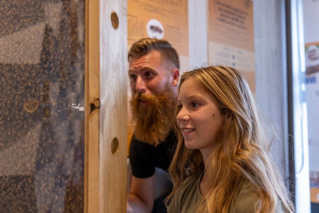
Stop 8: Valley Bee Café
53.5km from Shaftesbury Ferry
Directions: Exit the ferry and continue for 49km, then turn left onto Highway 49. In 3.3km turn left, then take another left onto Range Road 242. In 600m turn left onto Township Road 780, then it will be on your left.
Enjoy the open road and changing scenery as you make your way to Valley Bee Café. This stretch of highway offers motorcyclists a thrilling ride with smooth, open curves and stunning landscapes that make every mile an enjoyable experience. Upon your arrival you will be greeted with a larger than life, colourful mural, friendly faces, and tasty refreshments after your journey. Sit in front of the observation window to catch a glimpse into the honey extraction room or browse the many locally made items throughout the building. This is truly one sweet spot to stop at!
MD of Peace
Stop 9: Peace River Cabins and Outdoors
58km from Valley Bee Café
Directions: Turn right onto Range Road 242, then in 600m turn right. In 150m turn right onto Highway 49, and after 3.3km turn right onto Highway 740. After 49km, board the
Shaftesbury Ferry. Exit the ferry and turn left onto Township Road 821A. In 3.7km turn left and you have arrived.
As you make your way back into the MD of Peace, Peace River Cabins and Outdoors is ready to show you the many wonders that the region has to offer. This riverbank location boasts a variety of accommodations, including rustic or full-service cabins, a teepee, or a two-bedroom suite with WIFI. Prolong your tour and spend a night or throw your kickstand down for a couple hours and take part in one of their many outdoor experiences, such as hiking or kayaking.
Stop 10: Bricks Hill
9.3km from Peace River Cabins and Outdoors
Directions: Turn right onto Township Road 820A. After 8.8km turn left onto Highway 684, then in 200m the destination is on your right.
Before climbing this well-known hill, take a moment to pull over into the roadside turnout at its base and learn about its history on the available interpretive sign. As you ascend Brick’s Hill, you will have a bird’s eye view of the river valley below and will love every second of this slow and steady route banked by rolling hills and farmland.
Stop 11: Queen Elizabeth Provincial Park
21km from Brick’s Hill
Directions: Stay on the route for 11km, then turn left onto Highway 2. After 4.8km turn right onto Range Road 242. Continue straight for 5.8km, crossing Highway 685, then turn right onto Township Road 833A and enter the park beneath the large wooden arch.
As you make your way under the iconic wooden arch at the entrance, you will immediately feel at ease at Queen Elizabeth Provincial Park. Slowly make your way into the scenic campgrounds and park your motorcycle at the day use area for a chance to explore and take in the pristine lake views. Equipped with picnic tables, fire pits, and a shelter, this is an ideal location to stop and relax in the middle of your travels. Take a stroll through the various forest trails or enjoy some bird watching to unwind before kickstarting your engine and taking off again.
Town of Fairview
Stop 12: Fairview Welcome Sign
55km from Queen Elizabeth Park
Directions: Turn right onto Range Road 242, then in 5.8km turn right onto Highway 2. Stay on Highway 2 for 49km, then turn right onto 110 Street and arrive at the Welcome Sign.
The massive, wooden welcome sign in Fairview, expands gracefully over the entrance to Main Street, serving as a striking landmark that beckons motorcyclists to explore the town. Its rustic charm and grand scale make it an inviting feature, promising an authentic and memorable visit to the “Heart of the Peace”.
MD of Fairview
Stop 13: Historic Dunvegan
25km from Fairview Welcome Sign
Directions: Turn right onto Highway 2, then turn left onto 113 Street. Continue for 25km and turn left into Dunvegan onto Township Road 801A.
Historic Dunvegan Park offers motorcyclists a fascinating stop with its blend of centuries old history and scenic, natural beauty. As you ride into the park, you will experience well preserved historical sites and engaging exhibits that showcase the area's heritage and origins. The parks' spacious grounds and day use area as well as the nearby Maples day use area provide ample parking and a perfect spot to take a break and look upon the incredible views of the Peace River and iconic Dunvegan Bridge. Before hitting the road again, be sure to stop in at the Dunvegan Market Gardens for a warm bite to eat!
Stop 14: Dunvegan Inn & Suites
26km from Historic Dunvegan
Directions: Turn right onto Highway 2 and the destination is on your left.
Enjoy free Wi-Fi in every room and complimentary access to the local swimming pool just a short stroll away. On-site laundry and daily dry-cleaning services add extra comfort to your stay.
Start your day with breakfast or enjoy a midday bite at The Café, open daily from 6 AM to 9 PM. Feeling lucky? Head over to Aurora Sports Bar—Fairview’s largest and most comfortable VLT room—open from 11 AM to midnight, with kitchen service until 10 PM.
As you conclude your tour in the Mighty Peace, we encourage you to embrace the adventure, savor the moments, and let the open road lead you to new and exciting destinations. Share your adventures with us! Tag @mightypeacetourism on social media.


