March 7, 8 & 9, 2025
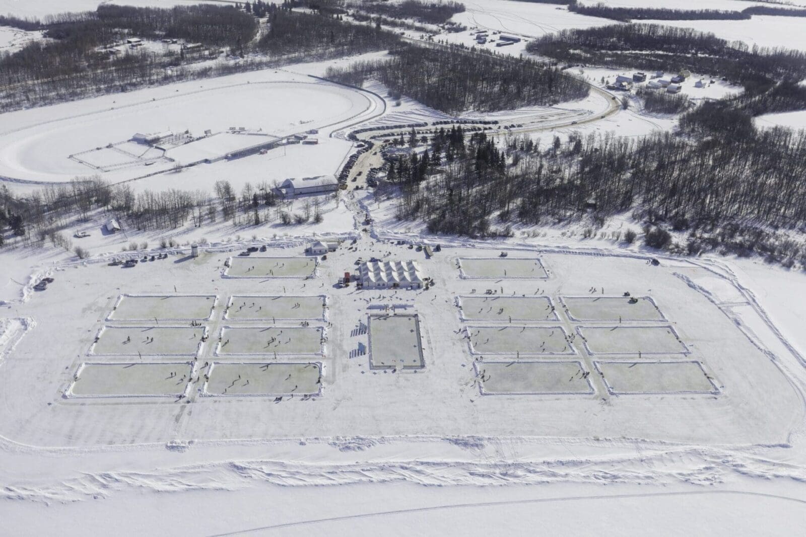
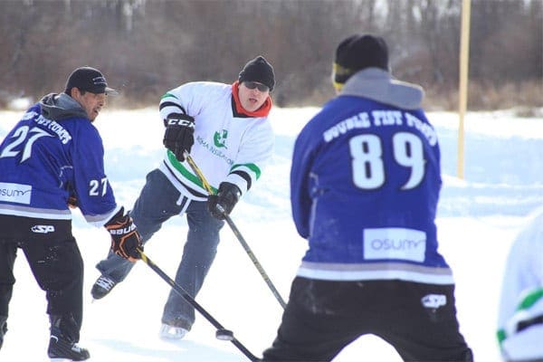
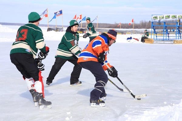
Organized by Alberta Pond Hockey AssociationThe Alberta Pond Hockey Championship is a thrilling three-day event that brings the spirit of Canada's favourite pastime to life on the frozen Lac Cardinal Lake. Held annually, this championship is a celebration of hockey in its purest form, played outdoors on natural ice across 15 rinks.
Teams from all over Canada gather to compete in a friendly and competitive atmosphere, embracing the beauty of winter in the Mighty Peace. With a backdrop of stunning snow-covered ice and trees, this event features multiple divisions, Competitive, Recreational, Old Timers, Women’s, and Juniors, and provides a true sense of community and camaraderie.
With multiple events happening at once, participants and spectators alike can enjoy the many games of hockey, as well as stick curling, ringette, dog sledding, ice skating on the family rinks. There’s also plenty of things to do at the Provincial Park itself – bring your snowshoes and check out one of the many trails around the lake, catch a glimpse of local wildlife, or take the kids to one of the exciting playgrounds to burn off some steam.
During the entire weekend, you won’t have to worry about the cool temperatures while visiting. Staying warm is easy to do, as there is a large, heated tent on site equipped with a lively beer garden, freshly made food from Mr. Mikes Steak House Casual, and hot chocolate and coffee from Tim Hortons.
The fun doesn’t end off the ice though – the highly anticipated Gala happens Saturday evening with live entertainment, catering from local businesses, and a party that lasts into the night. Known for selling out quickly, people from near and far attend this larger-than-life event to let loose, have fun, and enjoy a great time with family and friends.
So, bundle up, clear your schedule, and see what the fuss is all about! As one of the biggest pond hockey events in Canada, the Alberta Pond Hockey Championship is a true winter spectacle that celebrates the joy of the season and good old fashioned hockey games.