No Records Found
Sorry, no records were found. Please adjust your search criteria and try again.
Google Map Not Loaded
Sorry, unable to load Google Maps API.
-
Save
GPS Coordinates: N56° 07.900’ W119° 54.683’
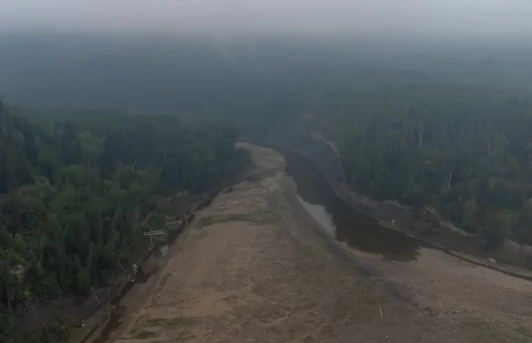
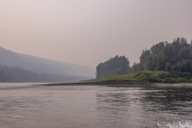
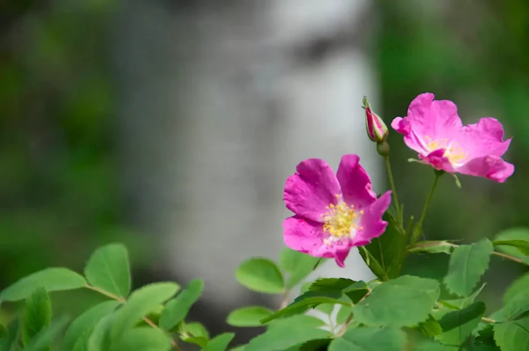
Directly across from Maxwell’s Landing is the Pouce Coupe River. There is no launch available here, and depending on the season, the river can be quite low. There is a lot of history surrounding this river, and it was previously known as the Bear River when Alexander Mackenzie passed it in 1793.Paddle Time
1 Hour, 20 Minutes
-
Save
GPS Coordinates: N56° 10.218’ W119° 47.153’
A glimpse of civilization can be seen during this section. A pipeline crossing is noticeable here and offers a quick change in scenery. In drier conditions, a sandbar can be seen jutting out from the left side of the river immediately after the two islands, so it is recommended to read the river and choose the best course of action once again.Paddle Time
65 Minutes
-
Save
GPS Coordinates: N56° 10.433’ W119° 42.467’
Clear River is an informal day use area that allows for visitors to swim, fish, and explore. With access from the river, you will be able to hike an undeveloped trail and enjoy this quiet and magical site. A small creek flows through the south side of this location and there are many lush trees. This place is definitely worth exploring!Paddle Time
1 Hour, 30 Minutes
-
Save
GPS Coordinates: N56° 10.267’ W119° 42.900’
After exploring the Clear River area, you can catch a glimpse of the natural spring that flows out of the rocks nearby. This is a beautiful spot with a rock wall with spiral textures that is sure to grab your interest.Paddle Time
1 Hour, 30 Minutes
-
Save
GPS Coordinates: N56° 09.933’ W119° 41.583’
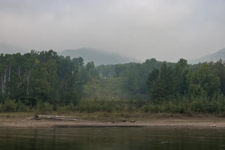
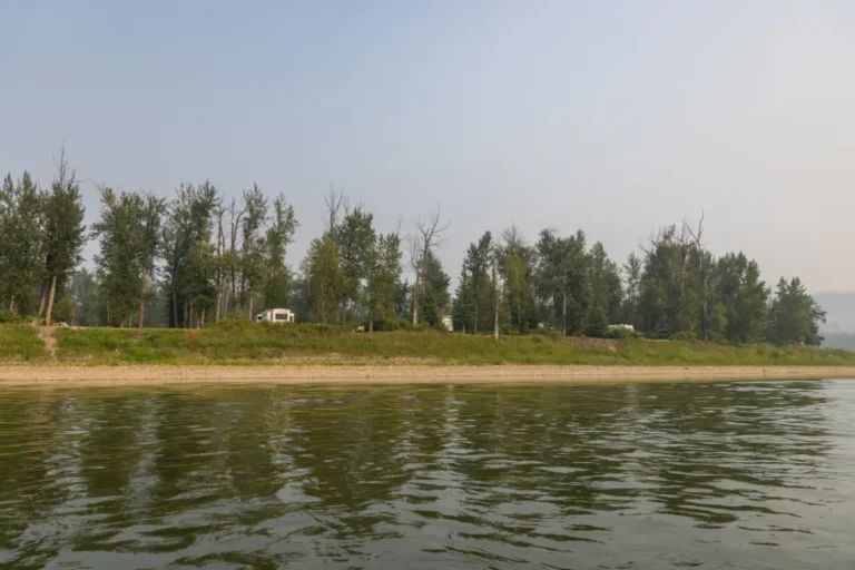
Across from the Clear River is Cotillion Park. This recreational site is hard to see from the river, but you may be able to see a tin shed from the shore. There is a walking trail and access to the park directly from the river, making it easy to stop at. This area has serviced and unserviced RV and tent sites, firepits, firewood, picnic tables, washrooms, a shower house, picnic areas, hiking trails, and a playground. There is also vehicle access to the river if needed. You can enjoy incredible views of the river and valley from this park, and it also provides the opportunity to camp, whether it’s for one night or multiple.Paddle Time
7.5 Minutes
-
Save
GPS Coordinates: N56° 09.983’ W119° 41.333’
Sneddon Creek splits the Cotillion Park area in half. You will be able to explore both sides of the creek and will get a great glimpse of the hoodoos across from the park here. This area holds a lot of interesting sights and things to do and is a spot worth stopping at.Paddle Time
7.5 Minutes
-
Save
GPS Coordinates: N56° 10.117’ W119° 40.683’
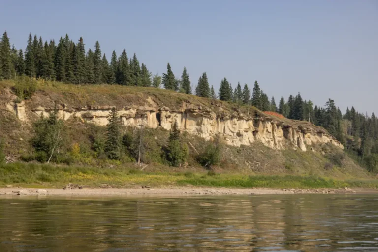
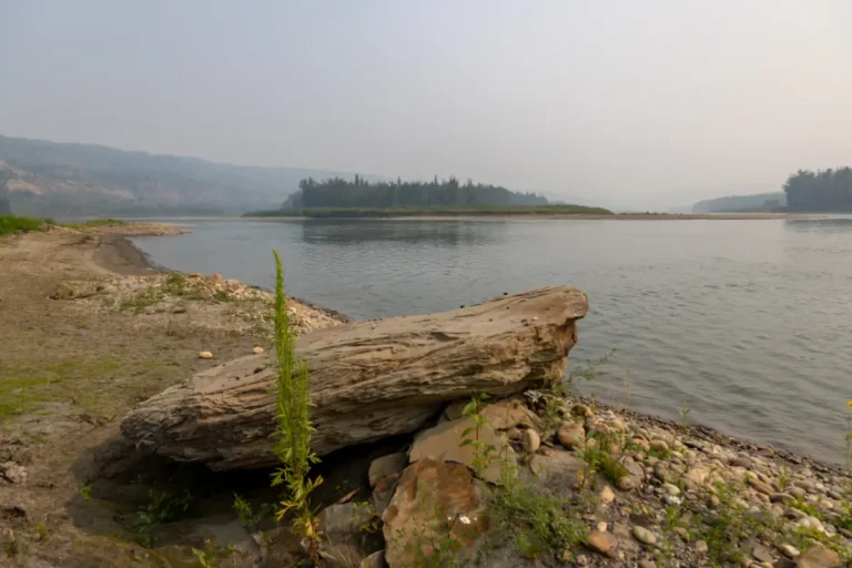
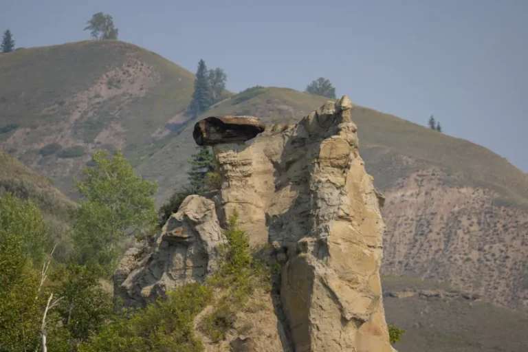
A few minutes downstream from Cotillion Park on the north cliffs of the river are the unique rock formations commonly known as hoodoos. Formed by thousands of years of erosion, these interesting rock creations are always exciting to see. You will almost feel like you’ve gone back in time when you come across them – make sure you have your camera ready!Paddle Time
7.5 Minutes
-
Save
GPS Coordinates: N56° 13.155′ W119° 29.424′
Located on the right-hand side is Silver Valley. Legislated as an Ecological Reserve by the Alberta Government, it represents a special natural landscape in the province and is protected as an example of a functioning ecosystem for research and education. Fires and camping are prohibited, and foot traffic is only permitted. There are lots of interesting sights to see here if you feel like stopping and exploring.Paddle Time
15 Minutes
-
Save
GPS Coordinates: N56° 14.767’ W119° 20.933’
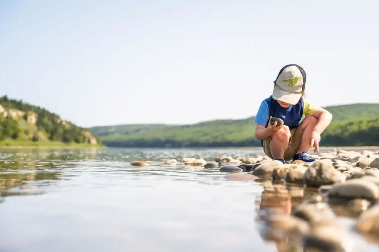
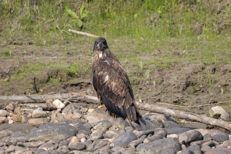
Beverly Island, or Deadman’s Island, is an island on the left side of the river that has thick brush, but also space for a quick stop if you need. There may still be remnants of a burnt cabin here, which was previously a privately owned building. Wildlife may be seen here, especially along the banks or soaring above. It’s not uncommon to see eagles, deer, or even bears in this area.Paddle Time
1 Hour, 30 Minutes
-
Save
GPS Coordinates – N56° 18.953’ W119° 08.853’
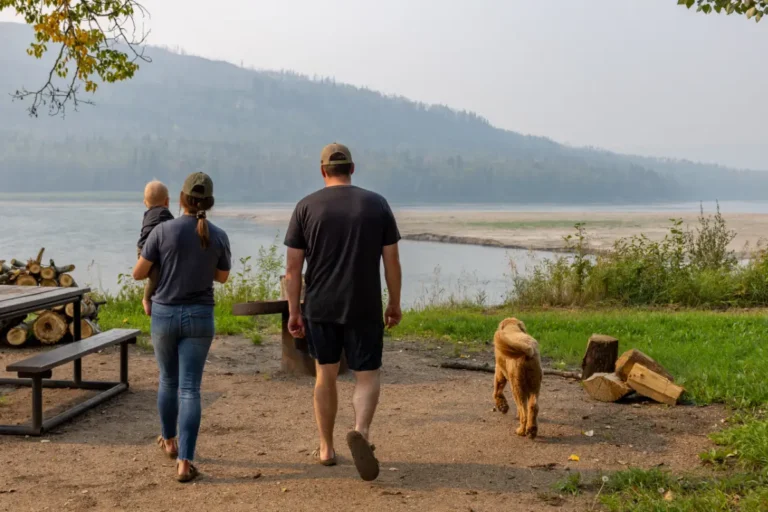
This beautiful location can be accessed from the river, as there is a boat launch for campers to use during their stay. There is plenty of room to dock your boat, but it is important to note that the river can change frequently, and water levels can fluctuate. The Many Islands Recreation Area offers camping sites with fire pits, picnic tables, outhouses, hiking trails, a playground, and even horseshoe pits. This campground offers some stunning scenery of the river valley and plenty of opportunities to see the wildlife that call the area home. Always worth the stop, Many Islands will provide you with the chance to relax or play during your river trip.Paddle Time
2 Hours
-
Save
GPS Coordinates: N56° 16.646’ W118° 59.043’
At this point in your travels, you will see a group of islands known as the Montagneuse Islands. Noted as a historical area, Alexander Mackenzie and his voyageurs camped at one of these islands during the Northwest Passage. This is another great area to spot wildlife and take in the views of the riverbanks on either side.Paddle Time
1 Hour, 30 Minutes
-
Save
GPS Coordinates: N56° 14.581’ W118° 57.048’
Carter Camp is easily seen from the river and offers an ideal spot for overnight camping. Docking your boat is easy and there is a large area with lots of river rocks and gravel to explore before making your way up to the campsites. Equipped with bathrooms, picnic tables, fire pits, firewood, a picnic area, and a playground, there are many natural areas to hike and explore while you stay or visit here. Carter Camp was originally a homestead for a Peace River family in the early 1900’s that had a mill widely known for its products. This location offers boaters a chance to stretch their legs, see new sights, and add some more adventure to their travels.Paddle Time
35 Minutes
-
Save
GPS Coordinates: N56° 10.999’ W118° 57.160’
Located on private land, only use this cabin as a landmark. This cabin sits on the left shore and should not be disturbed or explored.Paddle Time
1 Hour
-
Save
GPS Coordinates: N56° 04.427’ W118° 55.501’
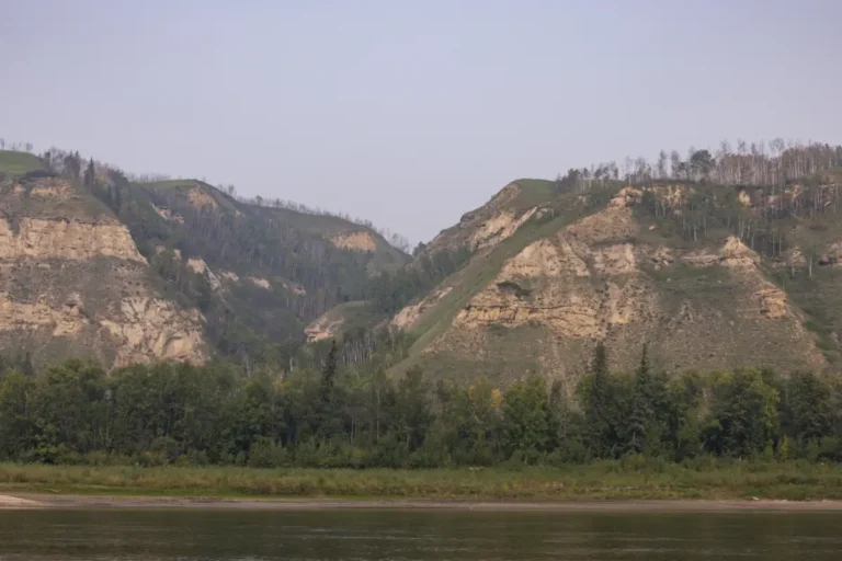
Almost looking out of place, Cathedral Rock is a large rock situated on top of a hill on the right side of the valley. Although part of it has fallen, this spot is still very interesting to see. The terrain changes a bit here and you will notice a cliff with rocky areas. The hills in this area are some of the most beautiful you will see during your travels.Paddle Time
1 hour, 50 Minutes
-
Save
GPS Coordinates: N56° 03.933’ W118° 56.017’
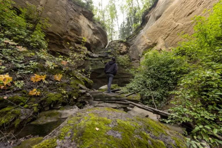
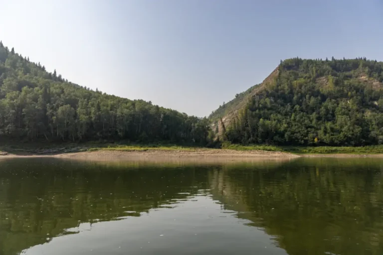
Extremely scenic, Fourth Creek is only accessible by river and has carved a canyon that’s filled with diverse wildlife, trees, hoodoos, and caves. Hiking is encouraged if you decide to stop for a while, but camping and building fires is not permitted. This one-of-a-kind location is a must see and will provide you with some epic photos to share after your adventures.Paddle Time
7 Minutes
-
Save
GPS Coordinates: N56° 03.300’ W118° 55.917’
A short distance away from Fourth Creek is a small waterfall surrounded by large, moss-covered rocks, fallen trees, and different layers of vegetation. Best seen in the spring, it’s common for the waterfall to be dry during the summer months, however the area can still be enjoyed and appreciated during the warmer months. This spot is one that everyone should explore and see at least once, as it is truly a fascinating area.Paddle Time
3 Minutes