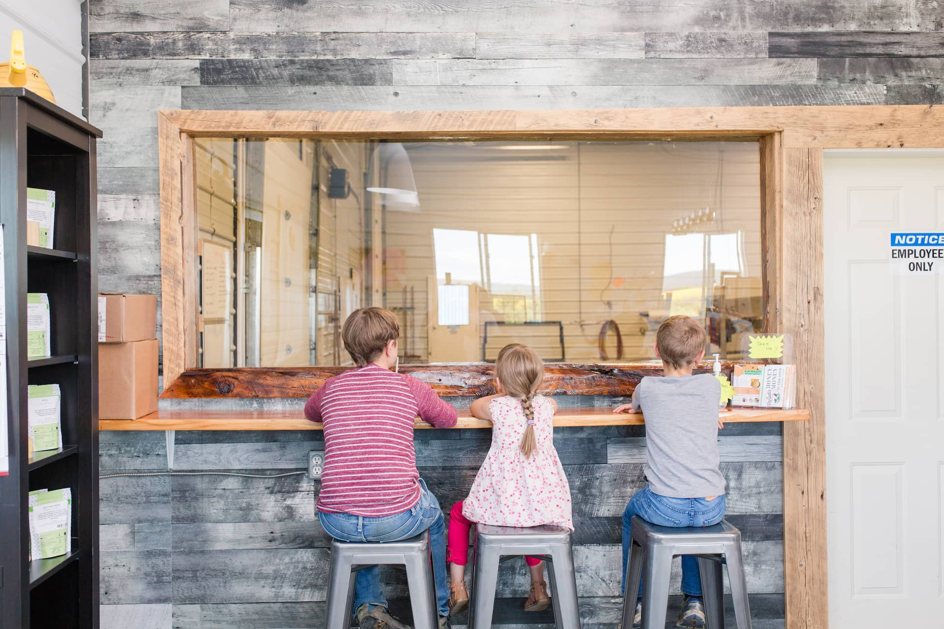
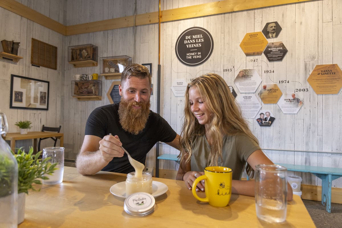
Q & A With Hive Hero and the Valley Bee Café
Hive Hero's (formerly Paradis Valley Honey) Valley Bee Café is a “sweet” place to visit; it boasts an observation window into the honey extraction room, an observation hive, a larger than...


New to Geocaching?
Geocaching is a fun outdoor activity that involves using a GPS device or smartphone to find hidden containers, called geocaches, that are hidden in various locations around the world. To get started with geocaching, follow these steps:
Need a Little More Help Getting Started?
If you want to practice or get more involved with geocaching, you may want to consider using a dedicated geocaching app or website, such as the official Geocaching app or website. These resources will provide you with detailed information about geocaches in your area, as well as tools for logging your finds and connecting with other geocachers.
The Fairview Community Centre is home to a beautiful indoor, salt-water pool, a well-equipped fitness centre, and an amazing theatre venue. After you locate this geocache go ahead and enjoy a dip in this pool which has multiple water features including river jets and fountain canes. Swimmers can try the Tarzan rope, Skywalker hanging monkey bar climber, and a rock climbing wall. Warm up and relax in the 20-person hot tub with a wheelchair access ramp. If there’s snow on the ground you might have to dig a bit to find the cache. Bring a writing utensil to write in this geocache’s log.
Interesting Fact: This pool facility also has a 150-foot water slide – the biggest in the Peace Country!
Hint: Bend down & tie your shoe, slightly off the sidewalk.
Once you’ve found this geocache go for a walk! This is the gateway to Cumming Lake Trail – 11 kms of trails invite you to explore the Cummings Lake area, the Fairview Golf Course, the Fairview Pioneer Museum and enjoy some beautiful Peace country views. This trail system is recommended for all skill levels. Wildlife is abundant in this area and with partially paved paths it’s perfect for both walkers, runners and bikers to enjoy. Bring a writing utensil to write in this geocache’s log.
Interesting Fact: This is also the trailhead for a beautiful Nordic ski track which is maintained throughout the winter months!
Hint: Cartographer's Craft
Hopefully you’ll find the geocache that is hidden along this beautiful path that connects the Town of Fairview to the Cummings Lake Recreation area. This camping and recreation area is a true hidden gem just north of the town. The area is quiet and cozy and features a small lake as well as group and individual camping spots tucked into a lush forested area. There is a variety of activities available in the area - canoe, kayak or paddleboard on the lake and watch for the many species of birds and creatures that also enjoy the water! Walk, jog, run or bike on these meandering and scenic trails. There are horseshoe pits and a playground available for visitors as well. During your stay take a stroll over to the Fairview Pioneer Museum that is adjacent to the campground and learn about the early settlers of the area. The area also features ball diamonds and soccer fields. After a busy day of geocaching, relax around a cozy campfire and enjoy a spectacular Peace Country sunset! Bring a writing utensil to write in this geocache’s log.
Interesting Fact: Over 75 species of birds and various wildlife can be viewed in this area!
Hint: Brace yourself, this find is pretty "grizzly"
This geocache is near the Fairview Fairplex Arena which is home to the WJHL Fairview Flyers, Fairview Minor Hockey Teams, and the Fairview Silver Blades Skating Program. Family and public skating hours are available inside and located directly south of the Fairplex is an outdoor ice surface that is perfect for a casual pick-up game of shinny, or an afternoon skate with the family. The Fairplex is located just one block off Fairview’s Main Street. This is a great place to start exploring this friendly little town! Bring a writing utensil to write in this geocache’s log.
Interesting Fact: Fairview is proud to be recognized as the “Heart of the Peace”, not only because of its location at the centre of this vast region, but also because of the progressive support the community contributes to the development of business, industry, education, and recreation.
Hint: South Side might be slippery!
This recently renovated inn and suites is conveniently located on Highway 2 in Fairview. Rooms include free Wi-Fi, and complimentary use of the local swimming pool just a short walk away. Daily dry-cleaning and on-site laundry facilities will make your stay more comfortable. Try out breakfast or lunch at The Café (open 6 am to 9 pm) or maybe you want to try your luck at Fairview’s largest and most comfortable VLT room at the Aurora Sports Bar (11 am to 12 pm-kitchen service till 10 pm)! Don’t need a bed to sleep? Dunvegan Inn & Suites is not just a place to stay – they accommodate meetings and conferences, as well as weddings and social events. Give them a call today! Bring a writing utensil to write in this geocache’s log.
Interesting Fact: The Dunvegan Inn & Suites has welcomed a world of travellers to Fairview since 1982. With 67 well-appointed guest rooms and 13 luxurious two-storey executive suites, there’s the perfect accommodation for everyone!
Hint: Relax on the bench and enjoy the view!
No Trespassing here, please obey all signs.
Enjoy this interesting story: The Fairview Aircraft Restoration Society (FARS) is a non-profit organization that is passionate about preserving history. FARS took on the incredible feat of restoring the Canso, a Canadian-built aircraft of World War II, and they successfully brought it back to life for the community to appreciate and enjoy. Their mission is to include all ages in the rich history that the Canso encompasses and to showcase a glimpse in time that should never be forgotten. Demonstrations in the sky are now available to watch, which are guaranteed to invoke curiosity into the historical past that the Canso represents. Viewers on the ground can watch in awe as the big, red machine moves gracefully through the air and they can imagine what it must feel like to be at the controls. FARS has allowed history to come alive again and they are motivated to educate school-aged children, adults and community members about Canada’s past in aviation. Bring a writing utensil to write in this geocache’s log.
Interesting Fact: A Father’s Day Fly-In Breakfast is hosted here each year. Visitors are welcome to explore safely during this event.
Hint: You'll have to step off the roadway a bit to find this geocache, when you find it you'll have a great view of the Canso!
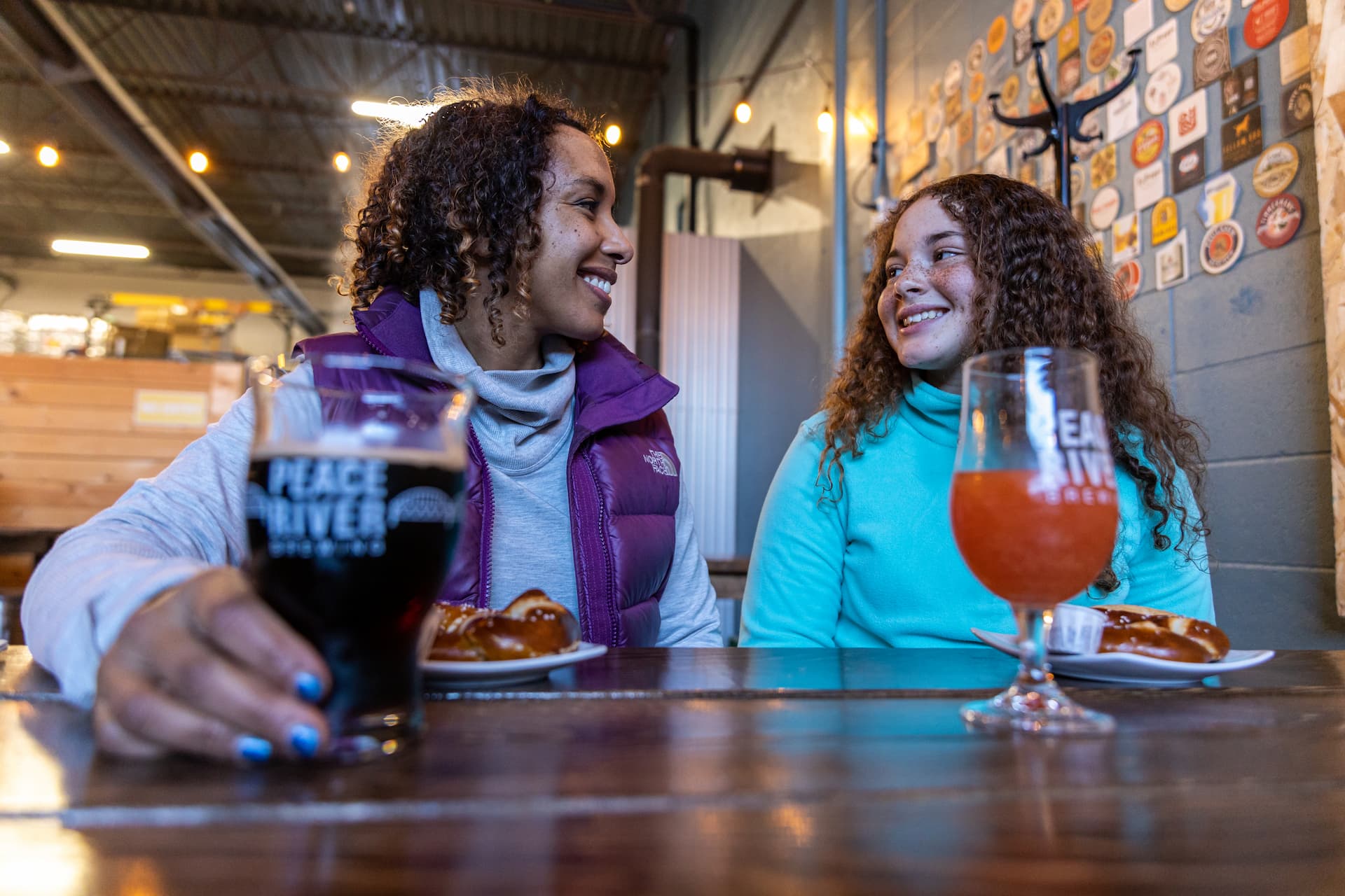
After you find this geocache, visit the Heilan Beer House that was built from the ground up by a small crew alongside the owners, and opened in 2019. When entering the brewery you will notice features such as the hop lighting, beer taps, and table tops that are unique only to this brewery. A seasonal greenhouse and garden centre connects to the brewery through the taproom and is able to provide fresh herbs and vegetables to the menu. If you love pizza, their wood-fired oven is sure to impress and with constant rotating taps, one visit will not be enough to satisfy your cravings. Bring a writing utensil to write in this geocache’s log.
Interesting Fact: Each week Open Mic Thursdays feature local talent. This popular event is not to be missed.
Hint: What the highlander calls his coos!
Take a short drive southwest of Fairview to find this geocache and discover a local treasure! The Fairview Ski Hill with its beautiful views of the Hines Creek coulee is a great place to spend the day. Fairview Ski Hill is the perfect place to bring your family to play this winter. With 20,000 feet of groomed runs, 4 lifts (beginner to expert) and a diverse terrain park, there is plenty of skiing and snowboarding for everyone to enjoy. The Fairview ski hill is equipped with the best rental selection in the region, a full concession and a great view of the hill from the comfort of the chalet. This area also has some great hiking in the summer! Bring a writing utensil to write in this geocache’s log.
Interesting Fact: The MD of Fairview offers amazing dark sky views for gazing up and taking in the Aurora Borealis, fondly known as the “Northern Lights,” this is an experience that most people can only dream about.
Hint: Skiers and hikers will be the lucky ones to find this geocache. Sit down, rest awhile and enjoy the view!
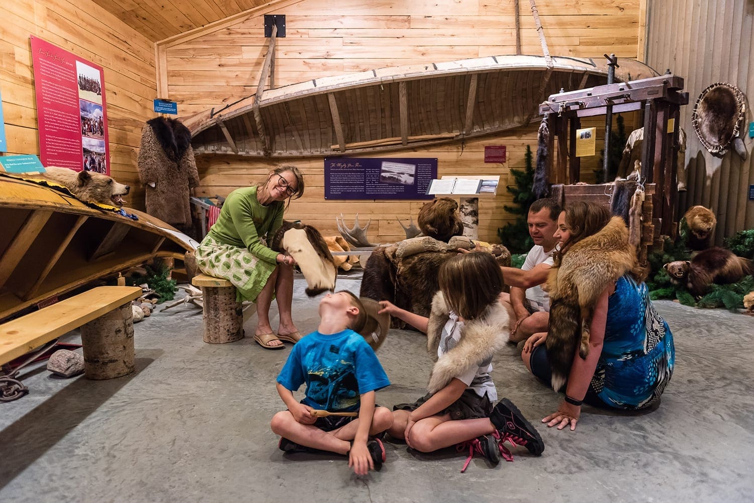
After finding this geocache be sure to continue on down the highway to explore the history of Indigenous people, the fur trade and missionaries in the Peace Region by touring Historic Dunvegan! This National Historic Site of Canada is located alongside the Peace River with a breathtaking view of Dunvegan Bridge. This bridge is Alberta’s longest vehicle suspension bridge. There is a visitors’ centre located near the entrance which offers information as well as guided tours of the historic buildings. Guided tours are available from mid-May until Labor Day. Four original authentically restored and furnished buildings are located in the same places they were over a century ago. There is a wide variety of cultural and nature-based activities available. Day-use camp areas with fire pits and horseshoe pitches are available to visitors. A playground and extensive hiking/biking trails will entertain visitors of all ages. Canada Day celebrations are held here annually as well as a fresh air market, children’s programs and amphitheatre presentations. Stroll down to the near by market gardens for ice cream, shopping and mini golf! Dunvegan Provincial Park is located adjacent to this historic site for visitors wishing to stay overnight or longer. Historic Dunvegan is open mid May through to the beginning of September, 10am – 5pm Monday through Sunday. It is located 26km south of Fairview on highway #2. Bring a writing utensil to write in this geocache’s log.
Interesting Fact: The area now known as Dunvegan has been a gathering place for Indigenous peoples for thousands of years and is located on the traditional lands of the Dunne-Za (Beaver) people.
Hint: Read the huge sign and learn some interesting information about the Peace Region.
This is the staging area for sledders to access the Peace Valley Snow Riders Hines Creek trail. Lots of parking is available here if you want to explore this friendly little village after you’ve found this geocache. Be sure to visit Last Spike Park, where you’ll see the world’s largest railroad spike. Bring a writing utensil to write in this geocache’s log.
Interesting Fact: The 13-foot high, 15-inch wide spike was erected in the village in 1992. The spike represents the furthest point north and west that the Canadian National Railway extended to across the prairies.
Hint: Check with the person who can be seen sitting on their sled all year long!
Hines Creek is the perfect place to bask in nature, so it’s no surprise that they have one of the most beautifully made walking trails in the area! Located on the western edge of the Village of Hines Creek, this scenic 1 km walking path will make you feel like you are miles away from civilization. The trail is nestled among beautiful, lush trees and dense bush and leads you across a walking bridge stretching over a cattail-lined marsh. Thanks to the Village of Hines Creek Public Works staff, this trail is regularly maintained and can be enjoyed all year round. Enjoying the outdoors has never been easier! Bring a writing utensil to write in this geocache’s log.
Interesting Fact: The Hines Creek Hotel, which can be seen east of this cache, has been a landmark in the little Village of Hines Creek since 1931. The hotel has many stories to tell and the locals and staff are always willing to give you a good story.
Hint: Explore this beautiful walking trail - it's a SIGN of the times!
This cache hiding spot can be seen from the Dave Shaw Memorial Arena. Before you enter the parking area, take the time to look around! The Dave Shaw Memorial Complex is a very important part of life in the Village of Hines Creek and the surrounding Clear Hills County. Friends and neighbors gather here for all sorts of events such as Christmas dances, craft shows, trade fairs, weddings and even funerals. The complex is named for Dave Shaw, an early pioneer of the Worsley District who was a business man as well as one of the former mayors of Hines Creek. This arena has several activity areas to keep everyone busy and entertained. Enjoy a skate or a game of shinny on the arena’s indoor rink from October to March. Concession available. Workout at the Rodney Bjornson fitness centre which offers a walking/running track, cardio equipment and a wide variety of free weights and weight machines. Bring a writing utensil to write in this geocache’s log.
Interesting Fact: The Village of Hines Creek was named after a local fur trader who lived here many years ago by the name of Jack Hines. This is also how nearby Jack Creek and Hines Creek were named.
Hint: Before you arrive at the arena - get low - ROCK & roll!
Traveling north through the friendly village of Hines Creek don't miss this recreational area. After you have found this geocache be sure to explore this friendly community that offers plenty of activities. Walk through history at the End of Steel Museum (so-called because the community used to lie at the northern extent of the railroad). Cool off on hot days at the spray park or take the kids to the playground. Fish or boat at any of the nearby lakes or rivers. Get a photo with the giant grain elevator—one of the few remaining in Alberta. Bring a writing utensil to write in this geocache’s log.
Interesting Fact: Hines Creek was a major transportation hub in 1930 with the arrival of the first Canadian National Railway train and at one point there were five grain elevators along the tracks.
Hint: May be open or may be shut.
The Sand Lake Natural Area is a hidden gem for year-round fun in the Peace Region. This 7,028 acre natural area is made up of boreal and dry mixed wood forest. The area includes sand dunes and is a mosaic of forested ridges and wetlands. Many diverse habitats make this area home to a wide variety of plants and animals. Visitors enjoy the many kilometres of trails by hiking, horseback riding and OHV riding. Visitors have lots of fun here all year round! Wintertime is no exception as this area offers a beautiful cross-country ski trail! This natural area can be found northwest of the town of Fairview. Bring a writing utensil to write in this geocache’s log.
Interesting Fact: This 7,028 acre area lies within both the MD Fairview and Clear Hills County.
Hint: Don't go POSTal if you can't find me at first!
After you find this geocache continue north up this road to find Running Lake Provincial Recreation Area. The Peace country is one of the few places on earth that you can find locations like this to enjoy a truly dark sky experience. Many of our provincial parks, natural areas, and green zones are completely free of artificial light. Bundle up and enjoy a long, magical winter night, the vast star-filled skies of the Mighty Peace will astonish. Bring a writing utensil to write in this geocache’s log.
Interesting Fact: A night sky without artificial light is vital to the proper functioning of natural ecosystems. Artificial lighting affects species migration patterns, predator-prey relationships, and the circadian rhythms of many organisms.
Hint: STOP & enjoy the sights
After finding this geocache in the friendly village of Worsley, located 630 kms north of Edmonton in the beautiful Peace Region of northwestern Alberta, be sure to explore this beautiful region! The mighty Peace River, forming part of the southern boundary, and the Clear Hills to the north, are natural features that contribute to the charm and appeal of Clear Hills County. Hiking, camping, golfing, fishing, museums, hunting, snowmobiling, canoeing, and downhill skiing…there is fun and challenge for everyone of any age. Two popular campsites are Carter Camp, west of Hines Creek, and Many Islands Campsite south of Worsley. Both are nestled on the banks of the Peace River, and have excellent boat launch areas, camping stalls, picnic tables, and playgrounds. Among the many other recreational facilities are the Cleardale Agricultural Society campground at the Clear River, the Whispering Pines Ski Hill and Chalet, located in the Clear Hills just minutes from Worsley, the George Lake Campground and Hines Creek Golf Course just south of Hines Creek, and the Cleardale Golf and Country Club. As well, there are four lakes stocked with trout located throughout the County: Ole’s Lake, Running Lake, Stoney Lake and Sulphur Lake. The hamlet of Worsley also offers an R.V. park. The campgrounds of Clear Hills County are among the most natural and relaxing in the Peace region as they are rarely full, providing visitors the chance to enjoy not only the sights but also the sounds of nature.
Interesting Fact: Driving through the County on Highway 64 is a beautiful alternative route to Alaska and British Columbia, providing the opportunity to pass through two stunning river crossings; the Clear River and the Beaton River crossings.
Hint: This is open in the summer and closed in the winter - please don't climb over me.
Visit this location in the beautiful Montagneuse Valley of Clear Hills County to find this geocache. This hall is maintained by the Eureka River Agricultural Society which is a non-profit organization dedicated to providing facilities for people in the community to use as well as hosting events for people to enjoy. The Eureka River Hall and grounds are available for rent year-round. Bring a writing utensil to write in this geocache’s log.
Interesting Fact: Clear Hills County is also home to some amazing riverside camping areas. Carter’s Camp and Many Islands Campground both offer amazing Peace River views.
Hint: "Step" up to this job, bend down and tie your shoe and you'll do "grate"!
Enjoy an affordable and relaxing golf experience on the beautifully treed Hines Creek Golf Course in the spectacular Clear Hills County. Designed for maximum enjoyment regardless of your golfing abilities, this course welcomes beginners and also offers a challenge for the low handicapper. The Hines Creek meanders through the course coming into play on five holes offering visitors some stunning views and challenging shots! Eleven well-placed holes, grass greens and a full irrigation system ensure a quality experience every time. Relax with a beverage on the back patio of the new clubhouse and watch the putting action on the ninth green! The clubhouse restaurant offers a full menu and licensed bar. Cart rentals and public camping are available. OHV enthusiasts can access the Sand Lake trail system in this area offering more activities for visitors of all ages. Bring a writing utensil to write in this geocache’s log.
Interesting Fact: This is the second oldest course in Northern Alberta and a wagon wheel monument on the course commemorates the Fort Saint John Wagon Trail which ran through the area many years ago.
Hint: You'll know just where to slow & turn when you see this.
Whispering Pines Ski Hill is considered one of Northern Alberta’s premier hills —for good reason. A short, scenic 200-kilometre drive from Grande Prairie, this ski hill offers exceptional hospitality, impeccable maintained runs and dramatic scenery. There are 17 runs, 3 chair lifts, conveyer, a terrain park, rental shop and ski school. The wide variety of terrain provides excellent skiing and snowboarding for all skill levels. Take a break in-between riding and warm up in their day lodge and enjoy a delicious hot meal. Or sit in the upper chalet and enjoy a picturesque view of the ski hill. Whatever you do make sure you get your hands on one of their epic cinnamon buns. Visitors travel far and wide to get their hands on these cinnamon buns. Keep an eye out while on the hill for local wildlife friends crossing the coniferous tree-bordered runs. It’s not unusual to come across a deer, moose or even a fox. Bring a writing utensil to write in this geocache’s log.
Interesting Fact: Whispering Pines Ski Hill has an abundance of cross-country ski trails which are free for visitors to use, leading from the ski hill.
Hint: A couple of steps through some deep snow will help you find me. This is how you know where you are.
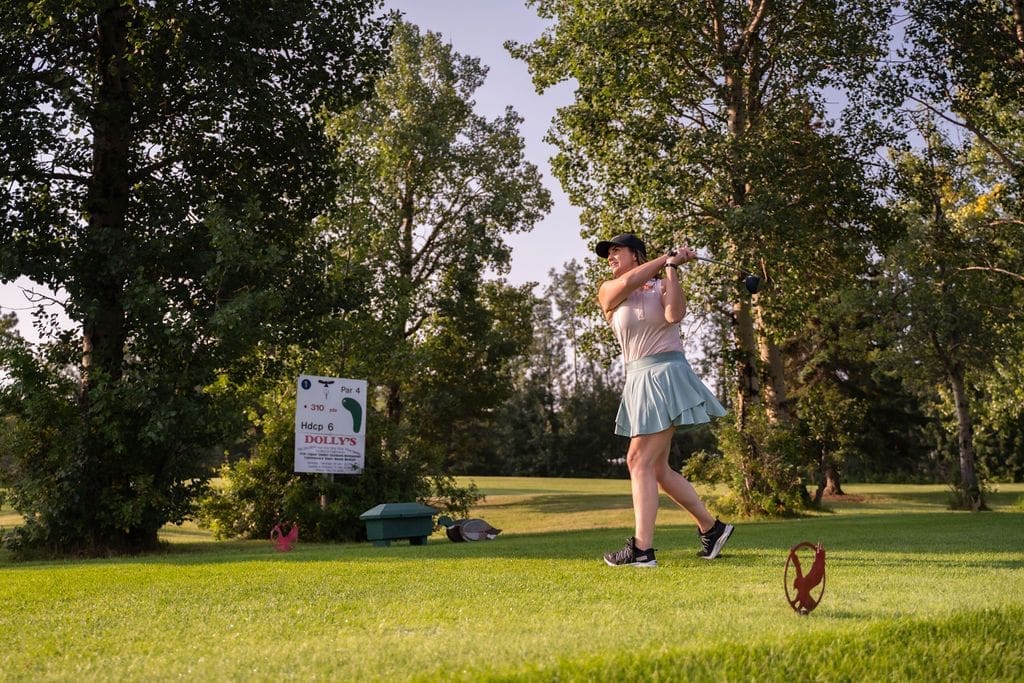
Mighty Peace Golf Club gives the golfer a feeling that is not found anywhere else in the country. Mighty Peace Golf Club is a golf facility that lies between Grimshaw and Peace River in North West Alberta. Our 18-hole championship golf course features all the hallmarks of Northern Alberta golf, including lush fairways, undulating greens, various tee decks that will challenge novice to expert golfers alike and spectacular views. Bring a writing utensil to write in this geocache’s log.
Interesting Fact: Mighty Peace Golf Club is the only 18 hole course in our region!
Hint: Golf course campgrounds are great! Come stay and golf all weekend!
After you find this geocache feel free to explore this beautiful spot. In the Griffin Creek area, south of present-day Brownvale, Mrs. Bessie Eaton was one of the first pioneer women to live north of the Peace River. Bessie settled in the Griffin Creek area in 1903 and was everyone’s friend. Lots of friendly people can still be found in this area which is part of the Municipal District of Peace. The communities of Brownvale, Berwyn and Grimshaw are located here and the M.D. of Peace is also home to Queen Elizabeth Provincial Park (Lac Cardinal), the Shaftesbury Trail, and two outstanding museums. Bring a writing utensil to write in this geocache’s log.
Interesting Fact: This beautiful municipality is bordered on the south and east by the mighty Peace River, making it a great place for visitors to view and enjoy this scenic waterway.
Hint: Direct your attention here.
When you’re finished geocaching you’ll find that Strong Creek Park has a little something for everyone. Strong Creek Park is a municipal park located on the Peace River mouth of Strong Creek, 8 km south of the Town of Peace River, on Shaftesbury Trail. Set up camp or spend the day - camping spots are rustic and free to the public. There are washrooms, water, and a sheltered kitchen for campers. The park is a short stroll from the Peace River where you can spend the day sunbathing, paddling, or fishing. There are picnic tables set up for day use, a fantastic park for the kiddos, and scenic hiking trails throughout the park. This is the perfect place to unwind and escape reality. Bring a writing utensil to write in this geocache’s log.
Interesting Fact: If you continue to explore south and west along the Shaftesbury trail you will find the Shaftesbury Ferry, which carries passenger vehicles across the Peace River during the summer months. It is one of only six ferries that operate in the province. There’s something fun about sitting in the car and watching the river flow by on either side. It’s a great reminder of the ferry systems the early settlers used at multiple points along the river before bridges were built. Plus, it’s free!
Hint: I hope this one doesn't STUMP you!
This is a really great location to enjoy many activities! After you locate the geocache you can enjoy endless hours of activity – paddle boarding, canoeing and kayaking to name a few! There is a nearby boat launch for those wishing to enjoy tubing or water skiing. The Lac Cardinal Pioneer Village Museum as well as the rodeo grounds can easily be accessed on foot from the campground. Snowshoers will find a spacious unmaintained area along the shore of Lac Cardinal to explore and enjoy. The sun-filled winter days of the Peace region offer spectacular experiences for outdoor enthusiasts. Bring a writing utensil to write in this geocache’s log.
Interesting Fact: The North Peace Pro Stampede has been held at the nearby rodeo grounds each summer since 1956!
Hint: A great view of the lake.
Searching for a geocache and a back-to-nature experience? Head out to Wilderness Park located approximately 11km west of Peace River; the path into the area is as beautiful as the park itself! This day-use area has picnic tables, fire pits, outhouses, and man-made ponds to enjoy! Swimming is not allowed but fishing enthusiasts bring your fishing rods as the ponds are stocked with rainbow trout and grayling! There are docks to fish from and to launch your canoe, kayak or paddle board. Hiking trails abound in the area for walkers, joggers and runners. Bring your binoculars and enjoy some bird watching, this area is abundant with wildlife. A crackling campfire is a perfect end to a day of fun at Wilderness Park! Visit in the winter months as well and explore the unmaintained Nordic ski and snowshoe trails. Bring a writing utensil to write in this geocache’s log.
Interesting Fact: The trail here is actually part of the Trans Canada Trail which is the longest trail of its kind in the world. Spanning approximately 16,000 km, the trail winds its way through every province and territory and connects Canadians from coast to coast to coast.
Hint: Left or right? Check both!
With small-town friendliness, great local businesses and mouth-watering food, Grimshaw should be on your list of places to visit this year! Whether you’re looking for ways to get active or a place to simply enjoy, this town is the perfect pit stop. Bring a writing utensil to write in this geocache’s log.
Interesting Fact: Grimshaw is home to FIVE parks and playgrounds! Kids have a great selection of fun play equipment and wide open spaces to run and enjoy. Explore the Diebert Memorial Park, the Grimshaw SK8 and Bike Park, the Kinsmen Park, the Veidt Community Park, the Mile Zero Multiplex Playground and end off a day of play at the Town of Grimshaw Park!
Hint: Get ready, get set...go! Explore all there is to see between the Peace region and the NWT!
Grimshaw has so much to offer during the summer months but there’s no shortage of ways to enjoy the winter magic in this friendly community. This bustling little town, famous for being the Mile Zero of the Mackenzie Highway, has plenty to offer residents and guests. So, tie up your laces and head out to the outdoor skating rink, check out the great shopping on Mainstreet, or cozy up with a book at the municipal library. If you feel like getting your heart rate up with a walk, skate, shinny, or your favourite sport, there’s tons of space and options at the Mile Zero Regional Multiplex. Bring a writing utensil to write in this geocache’s log.
Interesting Fact: The Mile Zero Regional Multiplex has a 175.3 metre elevated walking track that is perfect for use on a cold, snowy winter day. This multiplex is truly the hub of this great community and the place where all ages play sports, work out, go for a walk, or cheer on the athletes in their lives. Inside this incredible facility is a fieldhouse, an ice rink, a fitness center and weight room, and a concession booth with lots of tasty food and snacks. Thanks to the community’s support, there are many options to participate in free-sponsored public skating or time on the walking track. In addition, shinny, pickleball, figure skating, hockey games, and social events like concerts, dances and trade fairs on the weekend keep this fantastic facility hopping.
Hint: This is a very welcoming little community!
Grimshaw is a friendly, progressive community. We have a long history of innovation in agricultural and the oil industry. Our main focus is on economic development. Imagine a place with hills wrapped in majestic lakes and rivers. A place where the sound of nature freely resonates. It's a lot like an adventure and just enough like home. You've just arrived in Grimshaw, Alberta. We want everyone who visits to have an extraordinary experience. Grimshaw offers an amazing assortment of wilderness activities. Get away from it all with some backpacking and camping. Just make sure you bring binoculars so you can get a close-up of the moose, elk, deer, wolves, black bears and other creatures inhabiting the area. Or if you're looking for something less intense you can try your hand at fishing. Our lakes offer a variety of fish including Arctic Grayling, Burbot, Goldeye, Mountain Whitefish, Northern Pike and Walleye. Bring a writing utensil to write in this geocache’s log.
Interesting Fact: Grimshaw is home to several really great events throughout the year! The Harvest Moon festival, the Christmas Market and Canada Day events to name just a few.
Hint: Prepare to feel welcomed!
The Sagitawa Lookout is located just south of the Town of Peace River on Hwy 744 in Northern Sunrise County. The Lookout has a spectacular view of the Town of Peace River and the confluence of the Peace, Smoky and Heart rivers. The Lookout is complete with picnic area and historical information. Bring a writing utensil to write in this geocache’s log.
Interesting Fact: Sagitawa is a Cree word meaning “Where the rivers meet”.
Hint: Be open to noticing all the helpful "signs" around you. Sometimes you see things in places they just don't belong!
A breathtaking lookout over the Town of Peace River in honor of Henry Fuller Davis, a trader on the Peace River who struck gold on his claim in the 1860s. The park features include pathways, landscaping, interpretive panels, picnic benches and parking. This is a great viewpoint and photography spot. Bring a writing utensil to write in this geocache’s log.
Interesting Fact: Henry Fuller Davis struck it rich on a 12 Foot gold claim in northern British Columbia, earning him around $12,000 as well as the “12 Foot Davis” nickname. Spending much of his life as a fur trader on the Peace River, he left his mark on many places in the region and was known for his good business sense and friendliness.
Harmon Valley Park offers an incredible night sky with virtually no light pollution. If you are a star gazer this is an amazing campground with the possibility of experiencing the northern lights. This campground features 17 unserviced campsites, free firewood, pump water, pit toilets, hiking trails, children’s playground, picnic shelter, a cook shack, and horseshoe pits. Enjoy a wintery sunshine-filled day on the maintained cross-country ski trails at Harmon Valley Park. Snowshoers are also welcome to explore alongside the groomed ski trails. The parking lot and a couple of the campsites are kept free from snow throughout the winter for the use of skiers and snowshoers to enjoy a campfire and an apres-ski snack. Bring a writing utensil to write in this geocache’s log.
Interesting Fact: This Geocache is located in the municipality of Northern Sunrise County. This area is abundant with oil and gas, forestry, agriculture and tourism. It encompasses a vast area of 21,000 square kilometers of unspoiled wilderness and agricultural land, including small hamlets and villages, providing endless adventure and economic potential.
The Hamlet of St. Isidore was established after WWII by ten francophone families from Québec, and the area is still home to a thriving francophone culture. The interactive St. Isidore Museum, Plein Soleil folkloric dance troupe, and St. Isidore Weavers arts and crafts group all contribute to the local culture. Bring a writing utensil to write in this geocache’s log.
Interesting Fact: Each year this friendly community hosts the Carnaval de St. Isidore. Every February, since 1982 this annual celebration gives people a taste of the vibrant francophone culture of Northern Alberta. The Carnaval showcases Francophone artists and family fun activities including sleigh rides, snow sculpting, shinny, friendly competitions and so much more. You can expect French-Canadian dishes, incredible set design, fun winter activities and warm moments between friends. The Carnaval attracts Francophones and Francophiles from all over Alberta, as well as from many Canadian provinces but don’t think you need to be one to enjoy the Carnaval. Don’t miss the Carnaval de St. Isidore, it’s an event to remember!
Leddy Lake is a quiet and peaceful camping area located 24km northwest of Peace River on Highway 743, near Weberville. Campers can expect very private sites with lots of fire wood available. Electrical hookups, kitchen shelters and water are available to campers. Launch your boat and enjoy beautiful sunsets and viewing the many birds and animals living in the area. While there is no fishing, visitors can enjoy horseshoes, hiking, canoeing and kayaking. Families visiting here can enjoy a great park for kids as well as a nice sandy area for hours of entertainment. Bring a writing utensil to write in this geocache’s log.
Interesting Fact: In the winter the fun doesn’t stop. Enjoy a sparkling and crisp winter’s day on a sled trail that starts with a scenic loop at Leddy Lake and runs 40km north to the area of Driftwood Lake near Deadwood.
Hint: Take a walk and keep your eyes open!
The County of Northern Lights is what “I am Canadian” is all about. Home to dense boreal forests, majestic rivers, and secret lakes, visitors can get closer to nature in the campgrounds, on the interpretive trails, or explore the communities of this pristine municipality. The many camping areas in this municipality offer beautiful natural spaces where wildlife such as bear, moose and deer can be viewed and enjoyed. Truly a place to get away from it all. Bring a writing utensil to write in this geocache’s log.
Interesting Fact: County of Northern Lights is home to the Notikewan Provincial Park. Situated at the confluence of the Peace and Notikewin Rivers, this campground offers amazing views. Notikewin is from the Cree word for battle! It is said that in the 1700’s, The Beaver Tribe and the invading Cree Tribe battled many times in this area.
Hint: The stars will show you the way.
The Manning and District Ski Club has been in operation since 1972 as a non-profit organization in the Notikewan River Valley, just east of the town of Manning. With some of the best scenery around, this hill is a favorite to many locals and out-of-town visitors. The hill itself has four main runs with a t-bar lift, making it easy to use for all ages. Whether you’re just started out on the slopes or are an experienced skier or snowboarder, this hill has something for everyone to enjoy. Relying solely on volunteers to maintain weekend operating hours, the Manning Ski Club is open throughout the winter months on Saturdays and Sundays from 11 am until 4 pm. Plus, with the recent installation of lights, they are now open late on Wednesdays from 6:30pm to 9:30pm for exhilarating night skiing and boarding. Bring a writing utensil to write in this geocache’s log.
Interesting Fact: The ski hill hosts the Moose on the Loose Fun Run at the ski hill in the fall to raise funds for its operations during the winter!
Hint: Be ready to search this beautiful area.
The Dixonville General Store is a one stop shop for just about anything. This unique, warm & welcoming business is located in the hamlet of Dixonville within the County of Northern Lights, just a short and scenic 40 minute drive northwest of Peace River. Need anything from the grocery section, hardware section or gift shop? They’ve got it. Campers can pick up supplies for the weekend, even fireworks and propane. Take a seat in the cafe and enjoy a daily lunch special and some fresh baking. Can’t stop? Grab a hot and delicious take-out pizza. Discounts offered to seniors every Tuesday. Follow their Facebook page for daily specials and other news. Bring a writing utensil to write in this geocache’s log.
Interesting Fact: The Dixonville General Store also has a liquor store for that perfect bottle of wine to go with supper!
This firehall is manned by volunteers that spend much of their time offering emergency services to the area whenever needed. Most small communities in this area have similar situations. All these volunteers really are “Hidden Heroes”! The friendly village of Nampa is just 30 km south of the Town of Peace River. The Nampa and District Pioneer Museum is open during the summer and serves as a tourist information centre. The museum was formed in 1978 to collect and preserve the area’s culture and artifacts. The Nampa Municipal Library offers internet services. The Nampa & District Agriculture Complex is home to an arena and curling rink. It is a centre for a variety of winter activities. Bring a writing utensil to write in this geocache’s log.
Interesting Fact: The Village of Nampa is known as “A place close to the Heart” because the Heart River flows near the village and Nampa is a Cree word meaning “the Place”.
Hint: The power of positive thinking.
Mill Brown Park is located in the Village of Nampa. This quaint little town is home to almost 400 of the friendliest Albertans. The park is walking distance to Farmers Restaurant. This restaurant offers a very unique dining experience with delicious Canadian-inspired food. While you’re here drop in at the Nampa & District Museum which is right beside Farmers Restaurant. At the Museum you can explore the history of the legendary Mighty Peace. Stay awhile and camp at Mill Brown Park which has 6 paved stalls, power hookups, water supply, playground, tennis court, ball diamonds, hiking trails to the Heart River and a RV Dump. Bring a writing utensil to write in this geocache’s log.
Interesting Fact: There are many parks and recreational areas in close proximity to the community of Nampa, including The Heart River Golf Course which is just north of the village. Also, Green Valley Provincial Park to the northeast in the Heart River valley extends from Nampa to the Town of Peace River providing an important corridor for wildlife.
Hint: Don't forget to pay if you're camping here.
The Town of Falher is a buzzing little community with tons to see, do and enjoy. Whether you come for a day trip or the weekend, you will have tons to see, do and enjoy. This welcoming town has great shopping, restaurants, a fitness center, a pool, and a recreation center, and in the heart of the community is the giant bee that represents Falher’s designation as the “Honey Capital of Canada.” Bring a writing utensil to write in this geocache’s log.
Interesting Fact: Did you know that Falher’s bee statue is the largest in the world? This stunning structure was created in 1990 by a local welder, Richard Ethier and sits proudly on display 20 feet in the air in the heart of downtown Falher. Be sure to take a selfie with the bee and read up on the historical information displayed on site.
Hint: Flags fly high.
Reconnect with nature this summer, kick back and relax at the Falher Municipal Campground. This cozy campground offers 30 powered sites as well as washrooms with showers for visitors traveling in the beautiful Smoky River region. Enjoy the convenience of town water for RV refills and a sanitary disposal system. Larger groups may book the powered shelter building complete with a wood stove. There’s something for everyone to enjoy, take a stroll, discover the campground’s play area or relax with a good book. Explore some of the attractions in the Town of Falher as well, the campground is within walking distance of the regional outdoor pool, the Splash Park, and the Honey Capital Park! End the day with an evening of stargazing and great conversation around the campfire (firewood is free!) Strap on the snowshoes and explore this area all winter long! Bring a writing utensil to write in this geocache’s log.
Interesting Fact: A Honey Festival is held annually to celebrate the bee industry in the Town of Falher. Visitors are welcome to come and celebrate the beginning of summer in Falher. All sorts of fun and activities like a BEE beard demonstration, vendors market, art exhibition, car show & shine, ball tournament, children’s games, local talent, BEEr garden, dance and much more!
Hint: Enjoy a nice warm campfire.
If you have been looking for a charming town that provides outdoor activities and historical sites to enjoy, then McLennan is for you. Known as the “Bird Capital of Canada”, McLennan is a nature lover’s dream. With the Kimiwan Lake Campground, Interpretive Centre and Bird Walk nearby, visitors can hit up the walking trails, do some bird watching or cast their lines and catch some trout. Golf enthusiasts can try out the Smoky River Regional Golf Course which offers scenic views and glimpses of wildlife over nine holes. Bring a writing utensil to write in this geocache’s log.
Interesting Fact: You can experience skating in the great outdoors on natural ice! Strap on your skates and enjoy an authentic Canadian skating experience on McLennan’s beautiful natural outdoor pond. Located straight down from Centre Street by the covered bridge.
Hint: Brace yourself and get down low!
Engaging indoor and outdoor exhibits beckon visitors to explore this museum located on the northwest side of McLennan on Hwy 2. This carefully curated collection of artifacts from the pioneer days of northern Alberta are artfully displayed within historic buildings such as a NAR station, hospital, a store as well as a church, school and a library. Visitors are sure to discover one-of-a kind displays that will educate and inspire! Bring a writing utensil to write in this geocache’s log.
Interesting Fact: On a cold, snowy day in early January 1915, the steel (railway track) reached McLennan and the first train station was built.
Hint: Check the deck.
Explore the lakeshore of Lake Kimiwan and all of its many species of wildlife along the paved walking trails established by the McLennan Recreation and Leisure Society. Discover the new covered bridge as well as the many ponds and trees along the trail that the wild waterfowl enjoy throughout the season. Run, walk or bike these trails, it’s a great way to get out with family, friends and pets to enjoy the natural beauty of the area. Memorial benches can be found along the trail to take a break and let nature rejuvenate and inspire you. The trails have been built wide and smooth enough to encourage everyone from tiny walkers to those requiring the assistance of a wheelchair to participate in some great outdoor activity. Bring a writing utensil to write in this geocache’s log.
Interesting Fact: Explore the lakeshore of Lake Kimiwan in all of its winter glory! This area offers a great space for snowshoers or winter hikers to enjoy a beautiful winter day in the Smoky River region.
Hint: Enjoy this beautiful spot, it's pretty easy!
The Town of McLennan is adjacent to Kimiwan Lake. This lake is a prairie wetland. It is home to a vast variety of waterfowl and other wildlife. These areas can be found across the prairies of western Canada and very important to this area’s ecological health. Prairie wetlands act as natural water filters, reduce flooding, minimize drought as well as offering beautiful recreation areas for everyone to enjoy! Bring a writing utensil to write in this geocache’s log. Bring a writing utensil to write in this geocache’s log.
Interesting Fact: Wetlands draw in hunters, fishers, birdwatchers and photographers all of which help to boost rural economies.
Hint: You'll know you've arrived!
Peace River's NEWEST (2021) bridge has a beautiful pedestrian walkway built underneath it. It spans the entire majestic Peace River and walking on it gives you views of the river, town and valley not otherwise seen from land. Walk it end to end and back (about 45 minutes) or walk part way. Great for all seasons. Picture huge jagged ice chunks several feet thick in the winter! Gorgeous! The east side of the walkway connects to a paved walking trail along the dyke and into downtown (past River Front Park and the 12 Foot Davis statue). The west side connects to a paved walking trail up the west hill. It's well-lit for evening or late-night walks as well. The open-air bridge walkway is suspended underneath the traffic bridge, how cool is that for kids to experience?? Don't worry, this is NOT a rope suspension bridge, it's part of the design and engineering. Bring a writing utensil to write in this geocache’s log.
Interesting Fact: The cost of building this bridge was $180 million and took four years to complete.
Hint: Check before you start or after you finish.
The Misery Mountain Trails offer natural trails to elevations that offer a wonderful view of the Peace River Valley and the west side of the community. This area is amazing
for hiking and mountain biking. The views are worth the elevation gain! In the winter Misery Mountain is also a ski hill! Visitors flock here to enjoy the best downhill sports
and to experience one of Alberta’s sunniest regions. Misery Mountain Ski Area offers the most vertical descent in northern Alberta. With two T-bars, quad chairlift, 26 runs, snowshoe trails, a terrain park and the Mighty Peace’s most extensive snowmaking system. Misery Mountain Ski Area is the Mighty Peace’s playground, right here in your backyard. Misery Mountain Ski Area offers a picturesque view of the Peace River Valley. They offer a family-friendly atmosphere with a cozy chalet with a concession. Make sure you try their iconic poutine because it doesn’t get more Canadian than that! Located right in the town of Peace River – making it easy to enjoy the other amenities that Peace River has to offer when you are done riding for the day. Bring a writing utensil to write in this geocache’s log.
Interesting Fact: The Miserable Miles Obstacle Race takes place here annually in September. Athletes push themselves to the limits of their endurance against the breathtaking background of the Peace River valley while competing in this fun and challenging 5.5km obstacle race that takes contestants over a 212 meter vertical ascent through the stunning vistas of Misery Mountain. Finishing is the prize and the bragging rights are priceless. Compete for fun or for the chance to win the prestigious Miserable Miles.
The fun doesn’t stop at the end of the challenge. Enjoy the picturesque Peace River Valley at the base of Misery Mountain in the beer gardens! Or bring the kiddos and enjoy a BBQ while cheering on your favourite team.
Hint: Big rocks may mock you!
When shopping downtown, you will notice bright and elaborate paintings that showcase the history and nature of the area. They are perfect backdrops for Instagram worthy photos and deserve to be appreciated by all. When it comes to shopping, Peace River literally has something for everyone. With many local makers in the area, you can find hand crafted goods in all shapes and sizes, health food stores, sports and clothing stores, a mall with multiple businesses inside, jewellery stores, flower shops and salons that have plenty of high-end accessories and supplies available. Take your time and check out the artistic efforts that are in between each shopping experience. Spending a day downtown is definitely worth it! Bring a writing utensil to write in this geocache’s log.
Hint: Before you start or finish, make sure your shoes are tied.
Tucked away downtown, along the shores of the Heart River is one of the best outdoor concert venues in Peace River. Originally a ball diamond, the 12 Foot Davis Events Park has changed over the last few years becoming both a place to spend an afternoon and have a picnic or host a large event. The shape of the hill surrounding the park makes a natural amphitheatre which has made this location a prime choice for large events.
The park has developed into a popular venue for photo shoots; family, weddings and informal selfies along the river or on the pedestrian bridge. Summer or winter the site is a serene location to enjoy a walk, sit by the river, or set some track for cross country skiing. Bring a writing utensil to write in this geocache’s log.
Hint: Be aware of the sign.
The west side of the Peace River boasts a much loved river access point, to the Peace River, for jet boaters, kayakers, and all water enthusiasts. The boat launch is maintained in partnership with the Peace River Boating Association and the Town of Peace River.
The site can be accessed by pedestrians via the paved trail that follows the top of the dyke, with a set of stairs leading down to the boat launch area. The location is enjoyed by dog walkers, families and individuals throughout the seasons. The easy access and natural sand area along this stretch of the river, makes it a popular spot to cool off on a hot summers day.
Plan a trip down the river with family and friends and end your excursion at Lower West Peace, or join the annual Paddle the Peace Event to experience the river in a group setting. Bring a writing utensil to write in this geocache’s log.
Hint: Take a few steps down - but don't hit your head.
Spring Lake is one of the most popular sites in Saddle Hills County, attracting visitors from all over North America. It is the number one stop for fishing in the county, as the lake is stocked with rainbow and brook trout seasonally. It’s the perfect spot to enjoy paddle boarding, kayaking, hiking, and cross country skiing in the winter.
Hint: Don’t give up, keep looking!
Interesting Fact: Rainbow Trout can live about 6 years in the wild, although the oldest caught fish was estimated to be around 11 years old.
Bay Tree is a small community on the BC/Alberta border with a general store, gas station and recreation activities, including the rim rocks. The cache container is made by a local artisan to fit in with the natural scenery, with a hole in the bottom housing a container. The container includes instructions for finders, a log book and pencil and a Geocache tracking bug.
Hint: The Geocache is hidden near animals and plants.
Interesting Fact: A quarter of homestead land in the Bay Tree area cost only $10 in 1914.
Hilltop Lake is located within Saddle Hills County borders and provides hiking, fishing, camping etc. for residents and visitors. The cache container is made by a local artisan to fit in with the natural scenery, with a hole in the bottom housing a container. The container includes instructions for finders, a log book and pencil and a Geocache tracking bug.
Hint: The Geocache is hidden within a forested, trail area near the day use area.
Interesting Fact: Saddle Hill County is 5837 km2 and has many great campgrounds and lakes to explore.
otillion Park is located in Saddle Hills County on the banks of the Peace River and provides camping, hiking, boating etc. to residents and visitors. The cache container is made by a local artisan to fit in with the natural scenery, with a hole in the bottom housing a container. The container includes instructions for finders, a log book and pencil and a Geocache tracking bug.
Hint: The Geocache is hidden within a forested, trail area near the day use area.
Interesting Fact: The Cotillion Park area along the Peace River is only 26km downriver from Clayhurst and the Doe River Bridge in British Columbia.
Munro Presbyterian Church (Blueberry Mountain): “Blueberry Mountain” draws up exotic images that everyone seems to remember – it is remarkable how many people province wide have already heard the name with interest and a question of how it was named. The reality is there are no blueberries and no mountain – but one must realize that if it were treed over its crest, as it once may have been, it would stand a lot higher on the horizon. Saskatoon berries grow, which may have been the reason the local Indigenous people may have given it that name.
Hint: Say a prayer to help you find this one.
Interesting Fact: Many Indigenous artifacts have been found here indicating that this area may have been used as a lookout.
Savanna is a small community in Northern Saddle Hills County, with a school, recreation complex, and splash park. The cache container is made by a local artisan to fit in with the natural scenery, with space to house a container. The container includes instructions for finders, a log book and pencil, gifts, and a Geocache tracking bug.
Hint: Can you afford the price of admittance?
Interesting Fact: Savanna hosts an annual fair every summer! Come visit and enjoy a rodeo, fair, tractor pull, family dance and much more.
Fourth Creek is a small community in Northern Saddle Hills County, adjacent to Savanna, and is home to the Fourth Creek Community Association Hall, housing a community garden, playground, basketball courts, and campsites. The cache container is made by a local artisan to fit in with the natural scenery, with space to house a container. The container includes instructions for finders, a log book and pencil, gifts, and a Geocache tracking bug.
Hint: Head to the “outback” and explore.
Interesting Fact: Fourth Creek is a friendly community; the hall hosts many events throughout the year. Many dances, soup and sandwich suppers, games days and there’s even a community garden here!
Saddle Hills County Slopes is a toboggan hill located behind the Savanna Water Treatment Plant, between the communities of Fourth Creek and Savanna, in Saddle Hills County, Alberta. The cache container is made by a local artisan to fit in with the natural scenery, with a swinging door with latch housing a container. The container includes instructions for finders, a log book and pencil, gifts, and a Geocache tracking bug.
Hint: Watch for things that look like they are naturally part of the landscape.
Interesting Fact: “Toboggan” is from the Mi'kmaq word tobakun, which means sled. In fact, the Inuit made the first toboggans out of whale bone and used them to transport people and belongings across the snowy tundra.
This scenic bridge that is definitely blue in color, crosses the Little Smoky River which originates in the foothills of the Canadian Rockies and flows in a north-east direction throughout the foothills. Upon reaching the open prairie, it meanders northwards into the MD Smoky River and merges into the Smoky River itself south of the hamlet of Watino. Great camping spots, trails and wildlife viewing areas can be found along this peaceful northern river. This waterway can be enjoyed by boaters, paddlers and anyone looking for great fishing spots. Bring a writing utensil to write in this geocache’s log.
Interesting Fact: Walleye, burbot, whitefish, northern pike and trout are said to call this river home.
Hint: A great place to stop and take in the view!
Be sure to stay awhile and enjoy this scenic area along side the Smoky River. This beautiful river can be enjoyed by river boaters, paddlers and anyone looking for great fishing spots. Walleye, burbot, whitefish, northern pike and trout are said to call this river home. Many trails and wildlife viewing areas can be found along this picturesque northern river. Bring a writing utensil to write in this geocache’s log.
Interesting Fact: The wild and picturesque Smoky River is said to be named many years ago, for the smouldering coal beds that the Indigenous Cree people who lived in the area, observed along it’s banks.
Hint: Nothing is set in stone.
The Hamlet of Jean Cote is part of the MD of Smoky River. This vibrant region spans nearly 712,404 acres in the Peace County and also includes the communities of Falher, McLennan, Girouxville, Guy, and Donnelly. This scenic region is home to the Smoky River and Lake Kimiwan near the friendly Town of McLennan. There’s so much to see and do here regardless of the season, and you can be sure to expect to see some beautiful landscapes and wildlife wherever your travels take you. Bring a writing utensil to write in this geocache’s log.
Interesting Fact: The area has strong Francophone and agricultural roots, with French pioneer settlers opening the land in the early 1900’s.
Hint: Bring a hound to sniff the ground.
The Municipal District of Smoky River is home to some fascinating and beautiful rock formations known as hoodoos. These formations tower high in the sky, and provide fantastic photo opportunities. The geological explanation for hoodoos is that they are the product of millions of years of erosion—in which a lower layer of soft rock wears away, leaving a top-heavy layer of harder rock protruding above the surrounding landscape. However, Alberta’s hoodoo legends are somewhat more entertaining, telling of ancient travellers witnessing the hoodoos reveal themselves to be wizards, offering a helping hand to lost explorers by pointing them in the right direction. Bring a writing utensil to write in this geocache’s log.
Interesting Fact: These amazing wonders of nature are very remote and can be accessed only by helicopter or viewed from the Smoky River by river boat.
Hint: Bright ideas bring success.
Looking for a great space to enjoy a getaway? Kakut Lake is the perfect spot for friends and family to get together and make some amazing memories. This calm and beautiful lake is ideal for kayakers, canoers, and paddle boarders to enjoy some fun on the water. The lake is stocked with rainbow trout each spring providing some great year-round fishing. This is also a great spot to visit in the winter months to enjoy some ice fishing. Firepits are available near the lake to warm up and cook a tasty campfire snack! Bring a writing utensil to write in this geocache’s log.
Interesting Fact: Kakut Lake is 382 hectares in size!
Hint: Rocks remember when they were mountains.
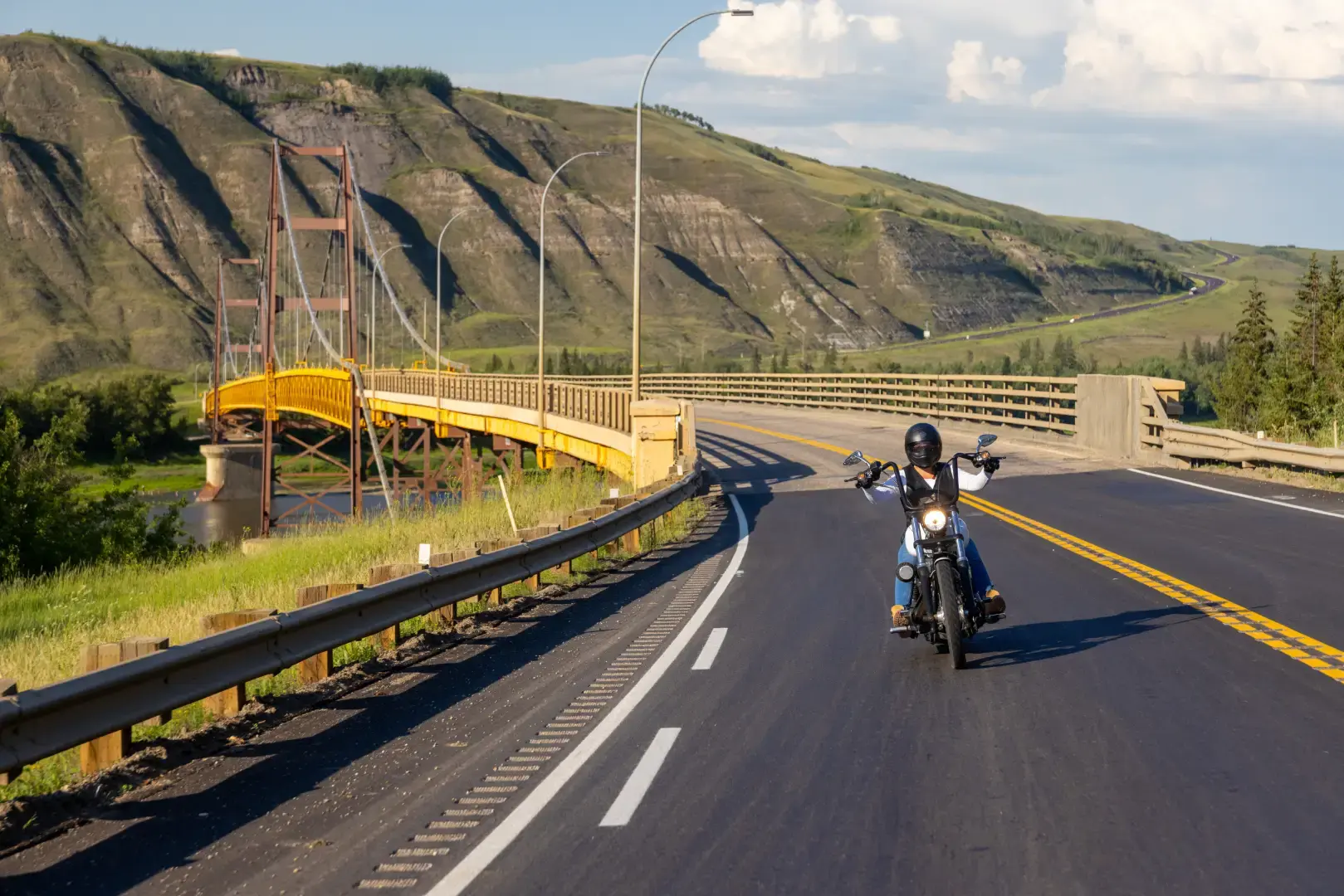
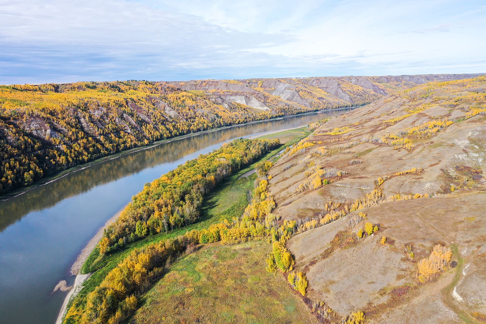
Continue North down the road to the beautiful Dunvegan Bridge. The length of this bridge built in 1960 is approximately 1,800 feet. The north and south anchorages of cellular construction extend 25 feet below ground level and weigh 18,400 and 14,000 tons respectively. The main cables consist of twenty 2 1/2 inch strands, each strand having 90 wires. Cable and fittings totaled 509 tons, 3,300 tons of structural steel was used, 750 tons of reinforcing steel in the concrete. 26,000 cubic yards of concrete and 140,000 bags of cement were used. Be sure to get some photos of this iconic landmark of the Peace Country. Bring a writing utensil to write in this geocache’s log.
Interesting Fact: The topography of the Peace River crossing at Dunvegan is very rugged, consisting of steep banks some 700 feet in height.
Hint: You light up my life!
Birch Hills’ very own ghost town – Belloy, was once a thriving little community around the 1950s, when it had a United Grain Growers elevator, a railway station, a blacksmith shop, several cafes, stores and residences. There was also a community hall, a church and a school. Now the townsite of Belloy has reverted to forest growth on both sides of the railway and there is no evidence of the community except for a few old, decayed buildings. Bring a writing utensil to write in this geocache’s log.
Interesting Fact: The Belloy area was named for Octavie Belloy an opera singer.
Hint: Inspections of intersections can offer inspirations.
The Village of Girouxville – a strong community spirit, tradition and a friendly place to visit, live and work in. Located only two miles off Highway 49 on Secondary Hwy 744 heading north, 55 kms from Peace River, is a small quiet francophone community with young families- just the right place to raise children or to retire. Bring a writing utensil to write in this geocache’s log.
Interesting Fact: A five legged squirrel can be viewed at the Musée Girouxville Museum where over 6,000 articles are on display reflecting the lifestyle of pioneers in and out of the home.
Hint: Use the power of the wind to help you find this!

