No Records Found
Sorry, no records were found. Please adjust your search criteria and try again.
Google Map Not Loaded
Sorry, unable to load Google Maps API.
-
SavePlace Title: Dixonville Community Forest TrailPlace Description:
A magical gem of Boreal forest with easy access awaits you only 600 metres off of Highway 35. From highway 35, turn west onto highway 689 into the hamlet of Dixonville. Dixonville is approximately 57km northwest of the Town of Peace River. Once in Dixonville, watch carefully for 1st St. West and turn South on it. You will then come to a large truck parking lot on your right hand side. You have now arrived at your enchanted destination.
The entry to the forest trail is marked by a large sign with flags and is adjacent to a foot bridge. Cross over the bridge (beware of the old troll that may still be lurking) and you are onto the trail. The majority of the trail is a gravel surface and while not suited for a wheelchair, it is mostly flat and level. The trail is approximately 1.5km’s and offers a great way to stretch your legs while taking in the sights, sounds and smells of a typical boreal forest.
Along the trail you will find informative signs highlighting various aspects of the flora and fauna. A variety of bird houses and even bat houses have been installed throughout the forest to encourage nesting. For the young or very young at heart, look for a tiny enchanted forest but be very quiet as you never know what or who you may see in there. A side trail will have you bounding on soft moss and encompassed by some large White Spruce trees.
In the wintertime, the trails are still very much so accessible. The main portion of the trail is packed and groomed for easier walking or cross country skiing. The side loop is intentionally not groomed as it lends itself well to snowshoeing and off trail exploration.
A 50 metre section of the trail lovingly referred to as “Chickadee Alley”, features several large bird feeders complete with bins of seeds. Feel free to fill the feeders while you watch and listen. It is not unusual to feed over 600 pounds of seeds here each winter not to mention suet and other treats! These feeders are primarily stocked in winter months only. From spring months until late fall months our small forest critters are able to forage just fine within the vast hearty taiga.
Toilet facilities are not provided and campfires are only permitted in the Shady Lane campground located south of the Community Forest.
No OHVs permitted
Category: Circle Tour, Dark Sky Adventures, County of Northern Lights, Outdoors, Trails, and Winter ActivitiesAddress: 1 Street West, Dixonville
Dixonville
Alberta
CanadaTelephone Number: 780-836-3348A magical gem of Boreal forest with easy access awaits you only 600 metres off of Highway 35. From highway 35, turn west onto highway 689 into the hamlet of Dixonville. Dixonville is approximately 57km northwest of the Town of Peace River. Once in Dixonville, watch carefully for 1st St. West and turn South on it. You will then come to a large truck parking lot on your right hand side. You have now arrived at your enchanted destination.
The entry to the forest trail is marked by a large sign with flags and is adjacent to a foot bridge. Cross over the bridge (beware of the old troll that may still be lurking) and you are onto the trail. The majority of the trail is a gravel surface and while not suited for a wheelchair, it is mostly flat and level. The trail is approximately 1.5km’s and offers a great way to stretch your legs while taking in the sights, sounds and smells of a typical boreal forest.
Along the trail you will find informative signs highlighting various aspects of the flora and fauna. A variety of bird houses and even bat houses have been installed throughout the forest to encourage nesting. For the young or very young at heart, look for a tiny enchanted forest but be very quiet as you never know what or who you may see in there. A side trail will have you bounding on soft moss and encompassed by some large White Spruce trees.
In the wintertime, the trails are still very much so accessible. The main portion of the trail is packed and groomed for easier walking or cross country skiing. The side loop is intentionally not groomed as it lends itself well to snowshoeing and off trail exploration.
A 50 metre section of the trail lovingly referred to as “Chickadee Alley”, features several large bird feeders complete with bins of seeds. Feel free to fill the feeders while you watch and listen. It is not unusual to feed over 600 pounds of seeds here each winter not to mention suet and other treats! These feeders are primarily stocked in winter months only. From spring months until late fall months our small forest critters are able to forage just fine within the vast hearty taiga.
Toilet facilities are not provided and campfires are only permitted in the Shady Lane campground located south of the Community Forest.
No OHVs permitted
-
SavePlace Title: Pat’s Creek Interpretive TrailPlace Description:
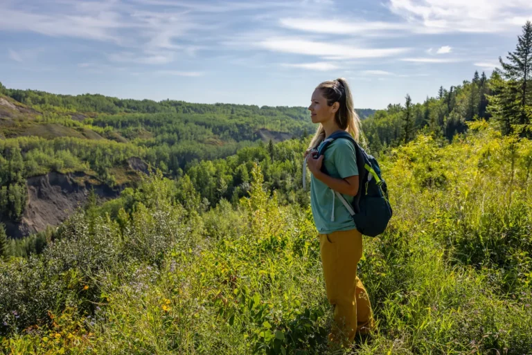
Enjoy a relaxing hike or hop on your mountain bike and explore Pat’s Creek Interpretive Trail. Fresh air, beautiful views and wide-open spaces await visitors exploring this easily accessible trail only a quick 5-minute drive from the Town of Peace River. The trail head can be located by driving through the Sunrise Gateway Business Park, then turning onto the Fairground Road and continuing on until you reach the end of the road. Pat’s Creek is a tributary of the Peace River. It is named after Patrick Wesley, a Métis man who lived in a cabin adjacent to the creek on his property. Pat’s Creek Valley consists of glacial deposits left over from the last ice age about 12,000 years ago. The full 7.6km hike takes about 2 hours or turn back at the metal stair landing for a shorter 10-minute walk. Bring a picnic and be ready to capture photos of the stunning landscape and abundant wildlife in this spectacular spot!
Tags: Sunrise WinterAddress: Pats Creek
St. Isidore
St. Isidore
T8S 1Z5
CanadaTelephone Number: (780) 624-0013Enjoy a relaxing hike or hop on your mountain bike and explore Pat’s Creek Interpretive Trail. Fresh air, beautiful views and wide-open spaces await visitors exploring this easily accessible trail only a quick 5-minute drive from the Town of Peace River. The trail head can be located by driving through the Sunrise Gateway Business Park, then turning onto the Fairground Road and continuing on until you reach the end of the road. Pat’s Creek is a tributary of the Peace River. It is named after Patrick Wesley, a Métis man who lived in a cabin adjacent to the creek on his property. Pat’s Creek Valley consists of glacial deposits left over from the last ice age about 12,000 years ago. The full 7.6km hike takes about 2 hours or turn back at the metal stair landing for a shorter 10-minute walk. Bring a picnic and be ready to capture photos of the stunning landscape and abundant wildlife in this spectacular spot!
-
SavePlace Title: Many Islands Boat LaunchPlace Description:
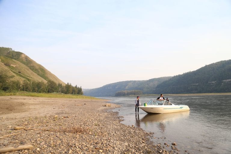
Launch a boat, canoe or kayak at this gravel boat launch on the Peace River at Many Islands Campground. Boating and paddling enthusiasts enjoying a Peace River adventure can launch here or stop in for a break at this beautiful riverside campground. This area, upriver from the Carter’s Camp boat launch, offers some stunning scenery of the river valley and the wildlife that call the area home. There are camp sites with fire pits, picnic tables, outhouses and camp kitchens for individuals or groups. The Many Islands Music Festival is held here every summer. A great weekend of music, dancing, wagon rides and much more. Many Islands Campground is 24km Southeast of Worsley off highway 64.
For information call –780-772-0243
Address: Clear Hills County
Clear Hills County
Alberta
T0H 3Y0
CanadaTelephone Number: 780-772-0243Launch a boat, canoe or kayak at this gravel boat launch on the Peace River at Many Islands Campground. Boating and paddling enthusiasts enjoying a Peace River adventure can launch here or stop in for a break at this beautiful riverside campground. This area, upriver from the Carter’s Camp boat launch, offers some stunning scenery of the river valley and the wildlife that call the area home. There are camp sites with fire pits, picnic tables, outhouses and camp kitchens for individuals or groups. The Many Islands Music Festival is held here every summer. A great weekend of music, dancing, wagon rides and much more. Many Islands Campground is 24km Southeast of Worsley off highway 64.
For information call –780-772-0243
-
SavePlace Title: Many Islands CampgroundPlace Description:
Enjoy sweeping views from the top of the riverbanks as you descend toward Many Islands Campground, a peaceful retreat nestled along the banks of the mighty Peace River. As you arrive, you may spot the cluster of small islands that give the campground its name.
There are few experiences more relaxing than sitting by a crackling campfire, watching the quiet power of the river flow past. This campground is a gem in the Peace River Valley, offering stunning natural scenery and a chance to spot local wildlife.
Campers can enjoy:
-
26 regular campsites and 44 seasonal sites
-
Two group camping areas
-
Well-maintained boat launch for river boating and fishing
-
Camp kitchens, picnic tables, fire pits, and outhouses
-
Three playgrounds, hiking trails, horseshoe pits, volleyball and basketball nets
-
A variety of games available for campers to borrow
August Long Weekend is packed with fun activities for the whole family, including:
-
Boat rally
-
Dance
-
Kids’ bike parade
-
Golf cart parade
-
Bouncy castle
-
Horseshoe tournament
Many Islands Campground is 24km Southeast of Worsley off highway 64.
Check out our River Guide to help you plan your trip.
Address: Unnamed Road
Bear Canyon
Alberta
T0H 0B0
CanadaTelephone Number: 780-772-0243Enjoy sweeping views from the top of the riverbanks as you descend toward Many Islands Campground, a peaceful retreat nestled along the banks of the mighty Peace River. As you arrive, you may spot the cluster of small islands that give the campground its name.
There are few experiences more relaxing than sitting by a crackling campfire, watching the quiet power of the river flow past. This campground is a gem in the Peace River Valley, offering stunning natural scenery and a chance to spot local wildlife.
Campers can enjoy:
-
26 regular campsites and 44 seasonal sites
-
Two group camping areas
-
Well-maintained boat launch for river boating and fishing
-
Camp kitchens, picnic tables, fire pits, and outhouses
-
Three playgrounds, hiking trails, horseshoe pits, volleyball and basketball nets
-
A variety of games available for campers to borrow
August Long Weekend is packed with fun activities for the whole family, including:
-
Boat rally
-
Dance
-
Kids’ bike parade
-
Golf cart parade
-
Bouncy castle
-
Horseshoe tournament
Many Islands Campground is 24km Southeast of Worsley off highway 64.
Check out our River Guide to help you plan your trip.

-