No Records Found
Sorry, no records were found. Please adjust your search criteria and try again.
Google Map Not Loaded
Sorry, unable to load Google Maps API.
-
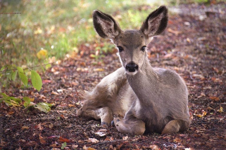
SavePlace Title: Dixonville Community Forest TrailPlace Description:
A magical gem of Boreal forest with easy access awaits you only 600 metres off of Highway 35. From highway 35, turn west onto highway 689 into the hamlet of Dixonville. Dixonville is approximately 57km northwest of the Town of Peace River. Once in Dixonville, watch carefully for 1st St. West and turn South on it. You will then come to a large truck parking lot on your right hand side. You have now arrived at your enchanted destination.
The entry to the forest trail is marked by a large sign with flags and is adjacent to a foot bridge. Cross over the bridge (beware of the old troll that may still be lurking) and you are onto the trail. The majority of the trail is a gravel surface and while not suited for a wheelchair, it is mostly flat and level. The trail is approximately 1.5km’s and offers a great way to stretch your legs while taking in the sights, sounds and smells of a typical boreal forest.
Along the trail you will find informative signs highlighting various aspects of the flora and fauna. A variety of bird houses and even bat houses have been installed throughout the forest to encourage nesting. For the young or very young at heart, look for a tiny enchanted forest but be very quiet as you never know what or who you may see in there. A side trail will have you bounding on soft moss and encompassed by some large White Spruce trees.
In the wintertime, the trails are still very much so accessible. The main portion of the trail is packed and groomed for easier walking or cross country skiing. The side loop is intentionally not groomed as it lends itself well to snowshoeing and off trail exploration.
A 50 metre section of the trail lovingly referred to as “Chickadee Alley”, features several large bird feeders complete with bins of seeds. Feel free to fill the feeders while you watch and listen. It is not unusual to feed over 600 pounds of seeds here each winter not to mention suet and other treats! These feeders are primarily stocked in winter months only. From spring months until late fall months our small forest critters are able to forage just fine within the vast hearty taiga.
Toilet facilities are not provided and campfires are only permitted in the Shady Lane campground located south of the Community Forest.
No OHVs permitted
Category: Circle Tour, Dark Sky Adventures, County of Northern Lights, Outdoors, Trails, and Winter ActivitiesAddress: 1 Street West, Dixonville
Dixonville
Alberta
CanadaTelephone Number: 780-836-3348A magical gem of Boreal forest with easy access awaits you only 600 metres off of Highway 35. From highway 35, turn west onto highway 689 into the hamlet of Dixonville. Dixonville is approximately 57km northwest of the Town of Peace River. Once in Dixonville, watch carefully for 1st St. West and turn South on it. You will then come to a large truck parking lot on your right hand side. You have now arrived at your enchanted destination.
The entry to the forest trail is marked by a large sign with flags and is adjacent to a foot bridge. Cross over the bridge (beware of the old troll that may still be lurking) and you are onto the trail. The majority of the trail is a gravel surface and while not suited for a wheelchair, it is mostly flat and level. The trail is approximately 1.5km’s and offers a great way to stretch your legs while taking in the sights, sounds and smells of a typical boreal forest.
Along the trail you will find informative signs highlighting various aspects of the flora and fauna. A variety of bird houses and even bat houses have been installed throughout the forest to encourage nesting. For the young or very young at heart, look for a tiny enchanted forest but be very quiet as you never know what or who you may see in there. A side trail will have you bounding on soft moss and encompassed by some large White Spruce trees.
In the wintertime, the trails are still very much so accessible. The main portion of the trail is packed and groomed for easier walking or cross country skiing. The side loop is intentionally not groomed as it lends itself well to snowshoeing and off trail exploration.
A 50 metre section of the trail lovingly referred to as “Chickadee Alley”, features several large bird feeders complete with bins of seeds. Feel free to fill the feeders while you watch and listen. It is not unusual to feed over 600 pounds of seeds here each winter not to mention suet and other treats! These feeders are primarily stocked in winter months only. From spring months until late fall months our small forest critters are able to forage just fine within the vast hearty taiga.
Toilet facilities are not provided and campfires are only permitted in the Shady Lane campground located south of the Community Forest.
No OHVs permitted
-
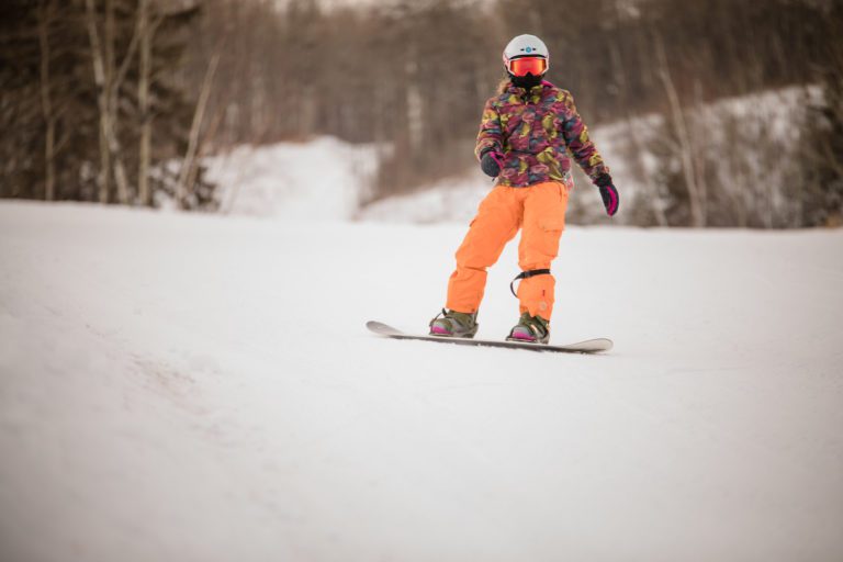
SavePlace Title: Manning Ski HillPlace Description:
If you’re looking for affordable winter fun that the whole family can enjoy, then you MUST experience what the Manning Ski Hill has to offer!
The Manning and District Ski Club has been in operation since 1972 as a non-profit organization in the Notikewan River Valley, just east of the town of Manning. With some of the best scenery around, this hill is a favourite to many locals and out of town visitors. The hill itself has four main runs with a t-bar lift, making it easy to use for all ages. Whether you’re just started out on the slopes or are an experienced skier or snowboarder, this hill has something for everyone to enjoy.
Staying active during the winter season is important and the Manning Ski Club is committed to helping users do just that. Although they don’t offer lessons at this time, they do have a chalet with pre-packaged snacks to help visitors refuel after a long day hitting the slopes.
Northern Alberta Small Ski Area (NASSA) Passport
New! With the purchase of a season pass.
This passport entitles the season pass holder to 1 complimentary lift pass at each of the participating skills. The ski area will stamp your passport to indicate redemption. Return your completed passport, with stamps from all six ski areas to be entered into a draw at the end of the season. The passport is valid only during the season of purchase. A complimentary pass exclusion of liability waiver must be signed by an adult for each ski area at the time of redemption.Hours:
Monday – Friday (6pm -9pm)Saturday & Sunday (11am -4pm)Tags: Northern Lights WinterAddress: Range Road 224
Northern Lights No. 22
Alberta
CanadaEmail: skiclubmanning@gmail.comIf you’re looking for affordable winter fun that the whole family can enjoy, then you MUST experience what the Manning Ski Hill has to offer!
The Manning and District Ski Club has been in operation since 1972 as a non-profit organization in the Notikewan River Valley, just east of the town of Manning. With some of the best scenery around, this hill is a favourite to many locals and out of town visitors. The hill itself has four main runs with a t-bar lift, making it easy to use for all ages. Whether you’re just started out on the slopes or are an experienced skier or snowboarder, this hill has something for everyone to enjoy.
Staying active during the winter season is important and the Manning Ski Club is committed to helping users do just that. Although they don’t offer lessons at this time, they do have a chalet with pre-packaged snacks to help visitors refuel after a long day hitting the slopes.
Northern Alberta Small Ski Area (NASSA) Passport
New! With the purchase of a season pass.
This passport entitles the season pass holder to 1 complimentary lift pass at each of the participating skills. The ski area will stamp your passport to indicate redemption. Return your completed passport, with stamps from all six ski areas to be entered into a draw at the end of the season. The passport is valid only during the season of purchase. A complimentary pass exclusion of liability waiver must be signed by an adult for each ski area at the time of redemption.Hours:
Monday – Friday (6pm -9pm)Saturday & Sunday (11am -4pm) -
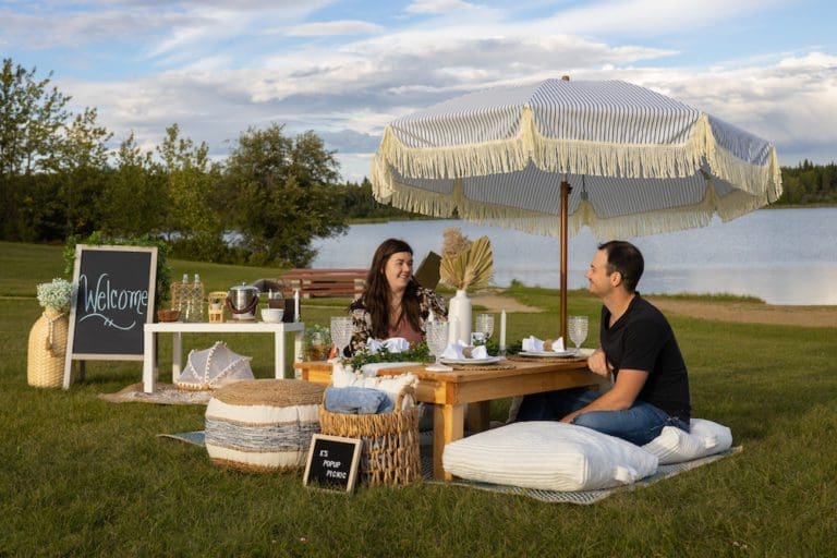
SavePlace Title: Figure Eight LakePlace Description:
Figure Eight Lake Provincial Recreation Area is located 40 kilometers northwest of Peace River on Highway 737 in the County of Northern Lights. Figure Eight Lake takes its name from the shape it had before 1970 when the water level was low, in these earlier days the lake had two basins and resembled a figure eight.
Get There: Figure 8 Lake is 45 km west of Peace River on Highway 737.
GPS Lat/Long:
56.3007800, -117.909248
Category: Accommodations, Campgrounds, Circle Tour, Dark Sky Adventures, County of Northern Lights, and Parks & LakesAddress: Located 8 kilometers north of Grimshaw, then 20 km west on Highway 737.
MD of Peace
Alberta
T0H 1E0
CanadaTelephone Number: (780) 624-6486Figure Eight Lake Provincial Recreation Area is located 40 kilometers northwest of Peace River on Highway 737 in the County of Northern Lights. Figure Eight Lake takes its name from the shape it had before 1970 when the water level was low, in these earlier days the lake had two basins and resembled a figure eight.
Get There: Figure 8 Lake is 45 km west of Peace River on Highway 737.
GPS Lat/Long:
56.3007800, -117.909248
-
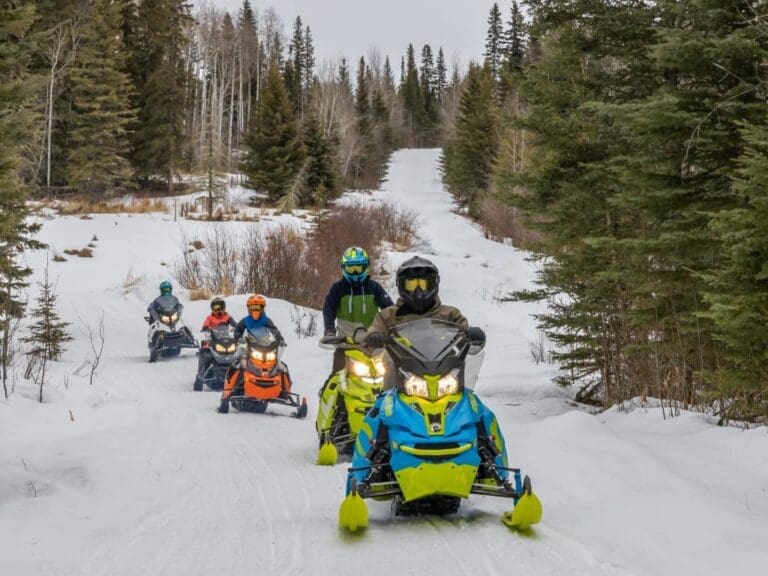
SavePlace Title: Peace Valley Snow RidersPlace Description:
The Peace Valley Snow Riders are a group dedicated to helping families and friends get out of the house and enjoy the Mighty Peace this winter. Their mission is to promote responsible snowmobiling in the Peace Region and develop trails that form a network on both the east and west side of Peace River. Each trail has rest stops with fire pits, picnic tables, outhouses and firewood.
With many sights and scenery to appreciate, riding their trails is a must this winter!
Events:
- Peace Valley Snow Riders Annual General Meeting
- Thursday October 23, 2025
- Grimshaw Legion Hall
- Happy hour and supper at 5:30 pm, meeting at 7 pm
- Supper is complimentary however it would be appreciated if you would RSVP to Wendell Whittleton at 780-618-6039 or whittleton12@yahoo.com so we know how many people to be prepared for.
- Peace Valley Snow Riders 25/26 Poker Rally
- Sunday February 15, 2026
- Baytex Wesley Creek Trail
- Registration 9 am to 11 am
Memberships & Trail Passes
Memberships and trail passes can be purchased online at albertasnowmobile.ca.
Category: Attractions, Dark Sky Adventures, Town of Grimshaw, Village of Hines Creek, Mighty Peace Essentials, Outdoors, Parks & Lakes, Town of Peace River, M.D. of Peace, Sights & Experiences, Town of Saint Isidore, and Winter ActivitiesAddress: Leddy Lake Staging Area
Dixonville
Alberta
T0H 1E0
CanadaThe Peace Valley Snow Riders are a group dedicated to helping families and friends get out of the house and enjoy the Mighty Peace this winter. Their mission is to promote responsible snowmobiling in the Peace Region and develop trails that form a network on both the east and west side of Peace River. Each trail has rest stops with fire pits, picnic tables, outhouses and firewood.
With many sights and scenery to appreciate, riding their trails is a must this winter!
Events:
- Peace Valley Snow Riders Annual General Meeting
- Thursday October 23, 2025
- Grimshaw Legion Hall
- Happy hour and supper at 5:30 pm, meeting at 7 pm
- Supper is complimentary however it would be appreciated if you would RSVP to Wendell Whittleton at 780-618-6039 or whittleton12@yahoo.com so we know how many people to be prepared for.
- Peace Valley Snow Riders 25/26 Poker Rally
- Sunday February 15, 2026
- Baytex Wesley Creek Trail
- Registration 9 am to 11 am
Memberships & Trail Passes
Memberships and trail passes can be purchased online at albertasnowmobile.ca.
-
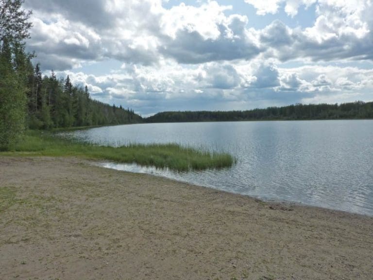
SavePlace Title: Twin Lakes Provincial ParkPlace Description:
This cozy, private, 49 site camp ground in the Twin Lakes Provincial Park is located 65 km north of Manning. Twin Lakes Provincial Park is named for the two lakes neighboring one another within the park. A smaller lake where the camp ground is located and a larger one accessible to visitors on foot. Campers arriving at the park will see a modern playground located in the central part of the park as well as the self registration area and washrooms nearby. After settling into a private well treed site, fishing enthusiasts can launch an electric motor boat on to the lake or cast their line from the dock and enjoy fishing for trout! A modern fish cleaning station makes it easy to prep the day’s catch! Canoeing, kayaking, paddle boarding as well as swimming will provide hours of enjoyment for campers of all ages! A small sandy beach on the lake shore offers even more fun! After a day of exciting activities, absorb the serenity of this beautiful area and the abundant wildlife that make their home here while hiking the walking trail around the first lake to the second lake. This scenic trail was constructed by a Junior Forest Ranger Crew in 1997 and is approximately 3km in length. Enjoy all the seasons in this area and experience a beautiful northern winter day in the park while ice fishing!
Address: 65 kilometers north of Manning on Highway 35
Manning
Alberta
T0H
CanadaTelephone Number: 780-274-0345This cozy, private, 49 site camp ground in the Twin Lakes Provincial Park is located 65 km north of Manning. Twin Lakes Provincial Park is named for the two lakes neighboring one another within the park. A smaller lake where the camp ground is located and a larger one accessible to visitors on foot. Campers arriving at the park will see a modern playground located in the central part of the park as well as the self registration area and washrooms nearby. After settling into a private well treed site, fishing enthusiasts can launch an electric motor boat on to the lake or cast their line from the dock and enjoy fishing for trout! A modern fish cleaning station makes it easy to prep the day’s catch! Canoeing, kayaking, paddle boarding as well as swimming will provide hours of enjoyment for campers of all ages! A small sandy beach on the lake shore offers even more fun! After a day of exciting activities, absorb the serenity of this beautiful area and the abundant wildlife that make their home here while hiking the walking trail around the first lake to the second lake. This scenic trail was constructed by a Junior Forest Ranger Crew in 1997 and is approximately 3km in length. Enjoy all the seasons in this area and experience a beautiful northern winter day in the park while ice fishing!