No Records Found
Sorry, no records were found. Please adjust your search criteria and try again.
Google Map Not Loaded
Sorry, unable to load Google Maps API.
-
Save
GPS Coordinates: N56° 15.007’ W117° 18.202’
Just across from Bewley Island is the North End Boat Launch. Just off 84th Avenue, it’s made up of gravel and has some parking on site. This launch is maintained by the Peace River Boating Association.Paddle Time
7 Minutes
-
Save
GPS Coordinates: N56° 15.567’ W117° 18.367’
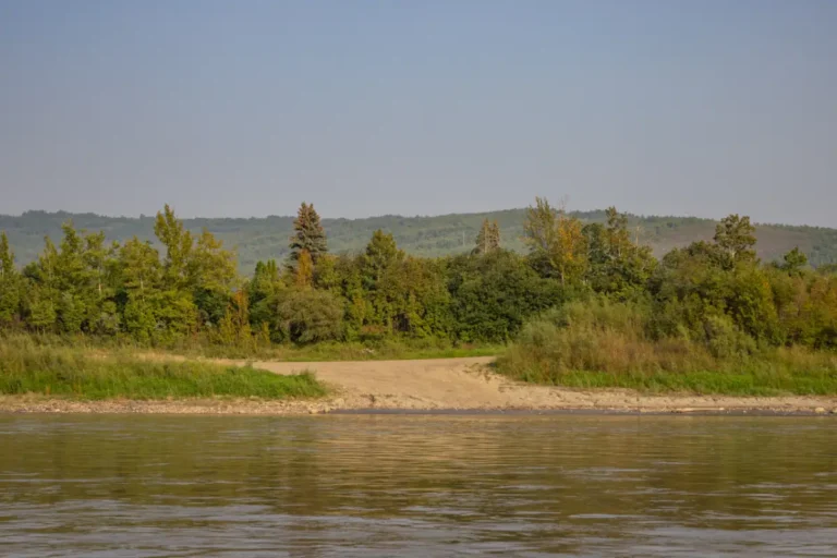
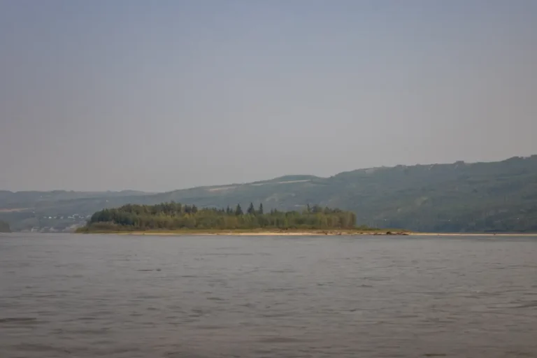
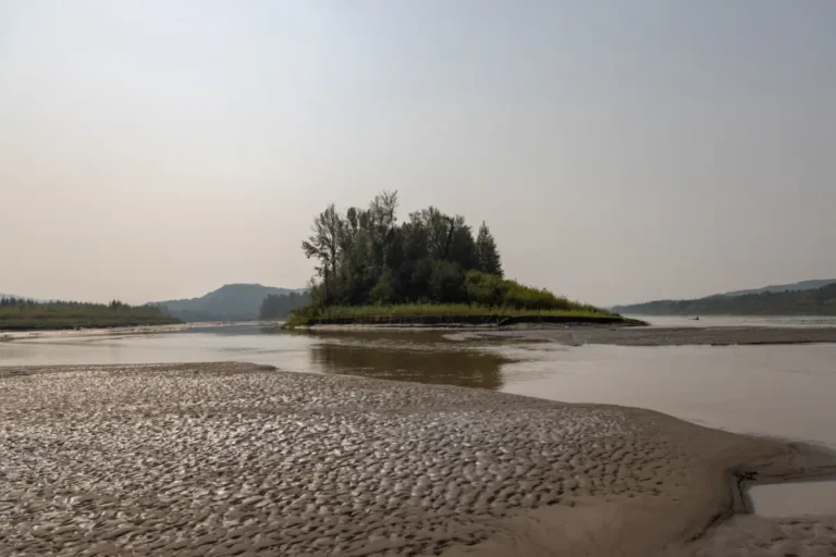
After passing under the bridges in Peace River, you will come to Bewley Island. Although it’s unknown who the island was named after, it’s a prominent part of the landscape within the town. You can travel on either side of this island, but the deeper channel is to the left. There are many gravel bars in this section of the river, so it’s important to be mindful while you travel downstream. You’ll also be able to see some incredible cliffs with vertical sandstone to the left of the island, plus, Cliff Swallow nests all along the side, which are always fascinating to see.Paddle Time
7 Minutes
-
Save
GPS Coordinates: N56° 14.369′ W117° 18.271′
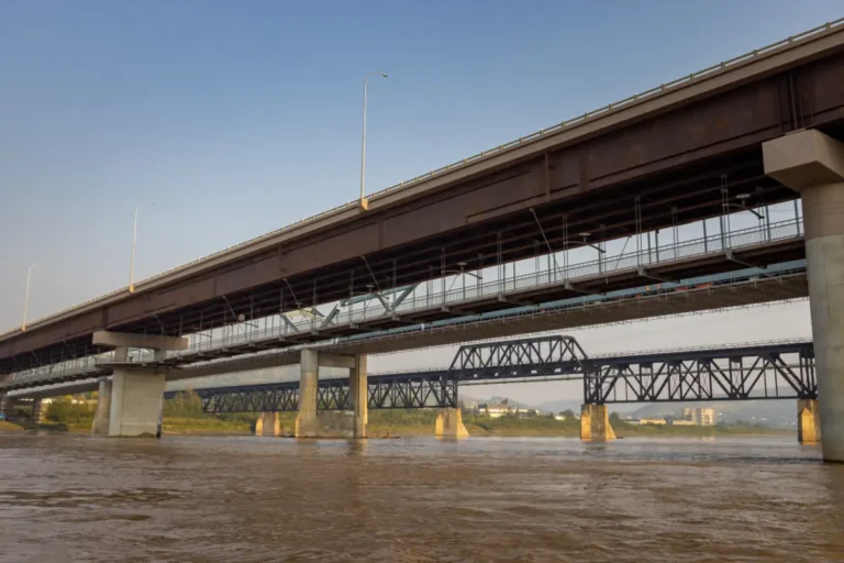
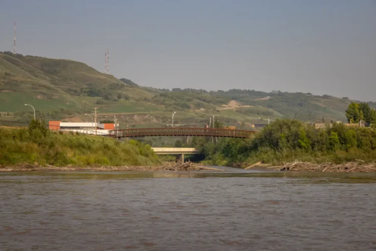
Boating under Peace River’s well-known bridges is always exciting. First you will go under the rail bridge that was built by the Canadian Bridge Company of Walkervile, Ontario, by 250 men in 1918. It’s 529 meters long and was an essential key for the Peace region after completion. Next is the blue highway bridge which was built in 1968 and is known for it’s arches along each side. Previously, people had to share the rail bridge to cross the river, which often caused some havoc when they had to give train locomotives the right of way. Next is the latest, and newest highway bridge that is currently being used while construction takes place on the blue bridge. Eventually there will be bridge twinning in place that will allow traffic to flow west on the new bridge and east on the blue bridge once it is completed.Paddle Time
3 Minutes
-
Save
GPS Coordinates: N56° 14.066′ W117° 17.790′
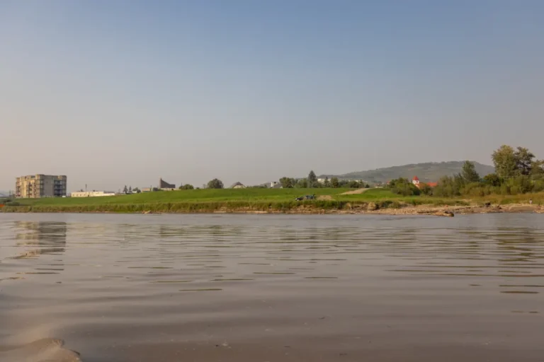
Dock your boat and check out what Peace River has to offer here. There is a short walk up and a gravel vehicle turnaround here, making it easy access for getting to and from the river. River Front Park is usually bustling with activity and is a favourite place among locals. This beautiful spot has a gazebo, access to walking trails along the river, a park, plus many businesses, hotels, and restaurants nearby.Paddle Time
3 Minutes
-
Save
GPS Coordinates: N56° 13.958′ W117° 17.772′
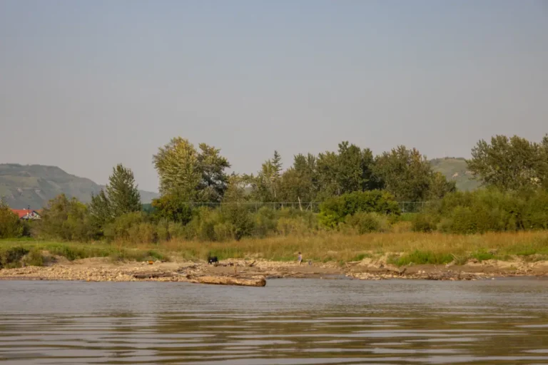
Named after Pat Wesley, a Métis man who lived in a cabin along the creek, Pat’s Creek used to flow right through the Town of Peace River. It often caused flooding and overall havoc, so in 1980 it was redirected through a culvert, which you can see if you look carefully along the right bank.Paddle Time
7 Minutes
-
Save
GPS Coordinates: N56° 13.820’ W117° 17.634’
The mouth of the Heart River opens onto the Peace River on the right-hand side here. It flows through a beautiful valley southeast of the Town of Peace River and is frequented by locals in all seasons. There is also a small walking bridge that runs over the Heart River that is visible from the river.Paddle Time
7 Minutes
-
Save
GPS Coordinates: N56° 13.619’ W117° 17.721’
With access to Shaftesbury Trail (Secondary Highway #684), this boat launch typically has porta potties, a large floating dock with benches and ample room to dock your boat and park vehicles. It’s common for many locals to be visiting this area throughout the summer and enjoying the scenery that comes with it. This boat launch is maintained by the Peace River Boating Association.Paddle Time
20 Minutes
-
Save
GPS Coordinates: N56° 12.167’ W117° 18.183’
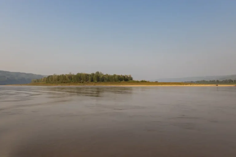
Living up to its name, Deer Island is known to have a lot of deer grazing on it throughout the year. This island is almost in the middle of the river, and you will be able to travel on either side of it. Going to the right is recommended as the left side is quite narrow and can have many gravel bars showing.Paddle Time
20 Minutes
-
Save
GPS Coordinates: N56° 11.194’ W117° 20.161’
This is where the Smoky River joins the Peace River. There are many gravel bars in this area, so it’s important to read the water as you pass through. You should be able to start to see the Peace River bridges from this point. This confluence was once one of the most important sites during the fur trade and acted as a major intersection for fur traders.Paddle Time
50 Minutes