No Records Found
Sorry, no records were found. Please adjust your search criteria and try again.
Google Map Not Loaded
Sorry, unable to load Google Maps API.
-
SavePlace Title: Historic Dunvegan Provincial ParkPlace Description:
Historic Dunvegan is a provincially and nationally designated historic resource. Experience history through 4 original, authentically restored and furnished buildings and the stories of Indigenous, fur trade, and mission life that our historic interpreters are waiting to share with you. Located alongside the Peace River with a breathtaking view of Alberta’s longest vehicle suspension bridge, there are activities for the whole family! A visitors’ centre located near the entrance offers information as well as guided tours of the historic buildings. The Visitor Centre and historic buildings are open from May 18 through Labour Day, 10am-5pm Wednesday through Sunday and holiday Mondays. Admission fees apply.
2024 Special Events
Dunvegan Tsattine/Beaver Storytelling – June 22, 1pm
Canada Day – July 1, Noon-5pm
Fresh Air Market – August 4, 11-5pm
Sunday Funday – May 19 and June 30, 10am-5pm
Picnic in the Park – July 14 and August 11, 11am-3pmLocated 26km south of Fairview on Highway 2. For more information please visit www.historicdunvegan.ca or find us on Facebook by searching @historicdunvegan!
Other nearby amenities include a day use area and campground operated by Alberta Parks. A playground, fire pits, cook shelters, and horseshoe pitches are all available. The Maples Day use area is just down the road, and offers a picnic shelter, fire pits, and a playground. You can also stroll down to the neighbouring Dunvegan Market Gardens for ice cream, food, shopping, and mini golf!
Category: Arts & Culture, Attractions, On the Peace River, Dark Sky Adventures, District of Fairview, Guided Adventure, Mighty Peace Essentials, Motorcycle Tours, Museums, Places To See, Sights & Experiences, and Things To DoAddress: Township Rd 801A
md of fairview
Alberta
T0H 0L0
CanadaTelephone Number: 780-835-7150Email: Historic.Dunvegan@gov.ab.caHistoric Dunvegan is a provincially and nationally designated historic resource. Experience history through 4 original, authentically restored and furnished buildings and the stories of Indigenous, fur trade, and mission life that our historic interpreters are waiting to share with you. Located alongside the Peace River with a breathtaking view of Alberta’s longest vehicle suspension bridge, there are activities for the whole family! A visitors’ centre located near the entrance offers information as well as guided tours of the historic buildings. The Visitor Centre and historic buildings are open from May 18 through Labour Day, 10am-5pm Wednesday through Sunday and holiday Mondays. Admission fees apply.
2024 Special Events
Dunvegan Tsattine/Beaver Storytelling – June 22, 1pm
Canada Day – July 1, Noon-5pm
Fresh Air Market – August 4, 11-5pm
Sunday Funday – May 19 and June 30, 10am-5pm
Picnic in the Park – July 14 and August 11, 11am-3pmLocated 26km south of Fairview on Highway 2. For more information please visit www.historicdunvegan.ca or find us on Facebook by searching @historicdunvegan!
Other nearby amenities include a day use area and campground operated by Alberta Parks. A playground, fire pits, cook shelters, and horseshoe pitches are all available. The Maples Day use area is just down the road, and offers a picnic shelter, fire pits, and a playground. You can also stroll down to the neighbouring Dunvegan Market Gardens for ice cream, food, shopping, and mini golf!
-
SavePlace Title: Shaftesbury Trail & FerryPlace Description:
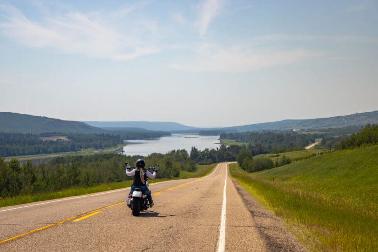
Enjoy the beauty of the Peace River and it’s valley by taking the short drive down the Shaftesbury Trail!
Running along side the Mighty Peace River for approximately 26km, the Shaftesbury Trail is one of the most scenic and interesting drives in the Peace region. Originally used by First Nations and Metis fur traders it is the location of several important historic sites. Start your tour on this paved and well maintained roadway either from Grimshaw going south on Highway 2, then taking secondary Highway 684 down into the valley or from Peace River, turn onto Highway 684, which can be accessed on the west side of the Peace River bridge. A relaxing and interesting adventure awaits! Along the way visit Fort Fork, MacKenzie Cairn as well as St. Augustine’s Mission. Stop for a picnic at Strong Creek Park and enjoy the stunning scenery and abundant wildlife! Continue on and visit the market gardens to see what’s in season! End your Shaftsbury Trail adventure with a ride on the Shaftesbury Ferry, the view of the river and surrounding hills is spectacular!
Getting There
From Grimshaw: go south on Highway 2, then take secondary Highway 684 down into the valley. From Peace River: turn onto Highway 684, which can be accessed on the west side of the Peace River bridge.
Mackenzie Cairn
It was 1793 when Sir Alexander Mackenzie, famed North American explorer, overwintered at Fort Fork before starting his transcontinental journey to the Pacific. The Mackenzie Cairn, built in 1929, honours both the Fort Fork trading post and the place where Mackenzie’s important journey began. This National Historic Site also provides a wonderful view of the Peace River, and an information kiosk offers detailed maps, drawings of the fort and early photos. Historic tours are available during the summer months.St. Augustine Mission Church
About 13 km southwest of the Town of Peace River, the St. Augustine Mission Church sits in a tranquil space in the valley. A Provincial Historic Site, St. Augustine Mission Church is the remains of the St. Augustine Mission, established in 1888. Tours of the church and grounds are available in the summer.Bridgeview Gardens
U-Pick berries and other vegetables. Call them at 780-624-1335.Fort McLeod
A historical site on the banks of the Peace River. Learn more about fur trade history with new interpretive signs, or visit the Peace River Museum, Archives and Mackenzie Centre for a more in-depth history.Strong Creek Park
Free camping, kitchen shelter, water, fishing, hiking trails and playground, including a backstop and field for baseball/softball.Brick’s Hill
When driving from Hwy 2 near Grimshaw, take Brick’s Hill to take in the beauty of the valley floor. Named after original families owning river lots in the area, Brick’s Hill boasts an abundant landscape of agriculture and gardens. The hills are layered with history and evidence of the Cree and Beaver First Nations.Shaftesbury Ferry
A unique experience awaits at the Shaftesbury Ferry!This is one of only 6 ferries operated by Alberta Transportation in the entire province! The ferry is part of highway 740 and crosses the mighty Peace River linking the Shaftesbury Trail with the Tangent Park area. The length of the crossing is 325 metres and takes about 5 minutes. Enjoy spectacular river valley scenery during the crossing and keep your eyes open for the abundant wildlife that frequent this area. This experience is available May through the end of October, 7am to 11pm daily. The ferry is free of charge and can accommodate everything from foot traffic to large RV’s and motorcycles. Visit 511 Alberta for the most recent information about ferry operations.
Tangent Park
Tangent Park campground is located on the east bank of the river, just a ferry ride across from the Shaftesbury Trail. It offers full service sites, showers, group camping and horseback riding/hiking trails.Category: Circle Tour, Getting Here, Mighty Peace Essentials, Town of Peace River, M.D. of Peace, Sights & Experiences, and Things To DoAddress: 11510 Shaftesbury Trail
Peace River
Alberta
T8S 1P7
CanadaEnjoy the beauty of the Peace River and it’s valley by taking the short drive down the Shaftesbury Trail!
Running along side the Mighty Peace River for approximately 26km, the Shaftesbury Trail is one of the most scenic and interesting drives in the Peace region. Originally used by First Nations and Metis fur traders it is the location of several important historic sites. Start your tour on this paved and well maintained roadway either from Grimshaw going south on Highway 2, then taking secondary Highway 684 down into the valley or from Peace River, turn onto Highway 684, which can be accessed on the west side of the Peace River bridge. A relaxing and interesting adventure awaits! Along the way visit Fort Fork, MacKenzie Cairn as well as St. Augustine’s Mission. Stop for a picnic at Strong Creek Park and enjoy the stunning scenery and abundant wildlife! Continue on and visit the market gardens to see what’s in season! End your Shaftsbury Trail adventure with a ride on the Shaftesbury Ferry, the view of the river and surrounding hills is spectacular!
Getting There
From Grimshaw: go south on Highway 2, then take secondary Highway 684 down into the valley. From Peace River: turn onto Highway 684, which can be accessed on the west side of the Peace River bridge.
Mackenzie Cairn
It was 1793 when Sir Alexander Mackenzie, famed North American explorer, overwintered at Fort Fork before starting his transcontinental journey to the Pacific. The Mackenzie Cairn, built in 1929, honours both the Fort Fork trading post and the place where Mackenzie’s important journey began. This National Historic Site also provides a wonderful view of the Peace River, and an information kiosk offers detailed maps, drawings of the fort and early photos. Historic tours are available during the summer months.St. Augustine Mission Church
About 13 km southwest of the Town of Peace River, the St. Augustine Mission Church sits in a tranquil space in the valley. A Provincial Historic Site, St. Augustine Mission Church is the remains of the St. Augustine Mission, established in 1888. Tours of the church and grounds are available in the summer.Bridgeview Gardens
U-Pick berries and other vegetables. Call them at 780-624-1335.Fort McLeod
A historical site on the banks of the Peace River. Learn more about fur trade history with new interpretive signs, or visit the Peace River Museum, Archives and Mackenzie Centre for a more in-depth history.Strong Creek Park
Free camping, kitchen shelter, water, fishing, hiking trails and playground, including a backstop and field for baseball/softball.Brick’s Hill
When driving from Hwy 2 near Grimshaw, take Brick’s Hill to take in the beauty of the valley floor. Named after original families owning river lots in the area, Brick’s Hill boasts an abundant landscape of agriculture and gardens. The hills are layered with history and evidence of the Cree and Beaver First Nations.Shaftesbury Ferry
A unique experience awaits at the Shaftesbury Ferry!This is one of only 6 ferries operated by Alberta Transportation in the entire province! The ferry is part of highway 740 and crosses the mighty Peace River linking the Shaftesbury Trail with the Tangent Park area. The length of the crossing is 325 metres and takes about 5 minutes. Enjoy spectacular river valley scenery during the crossing and keep your eyes open for the abundant wildlife that frequent this area. This experience is available May through the end of October, 7am to 11pm daily. The ferry is free of charge and can accommodate everything from foot traffic to large RV’s and motorcycles. Visit 511 Alberta for the most recent information about ferry operations.
Tangent Park
Tangent Park campground is located on the east bank of the river, just a ferry ride across from the Shaftesbury Trail. It offers full service sites, showers, group camping and horseback riding/hiking trails. -
SavePlace Title: Misery MountainPlace Description:
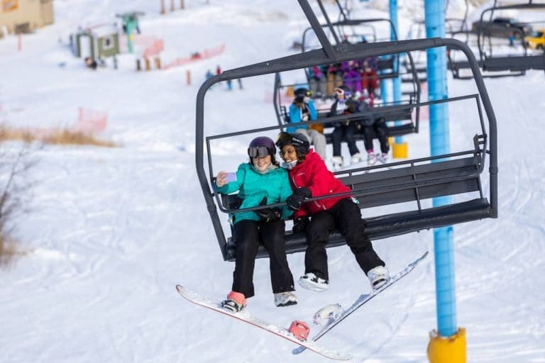
Misery Mountain In The Winter
Misery Mountain Ski Area is located in Peace River, Alberta. A short 486 km north-west of Edmonton and 195 km north-east of Grande Prairie. Visitors flock here to enjoy the best downhill sports and to experience one of Alberta’s sunniest regions. Misery Mountain Ski Area offers the most vertical descent in northern Alberta. With two t-bars, quad chairlift, 26 runs, snowshoe trails, a terrain park and the Mighty Peace’s most extensive snowmaking system. Misery Mountain Ski Area is the Mighty Peace’s playground, right here in your backyard.
Northern Alberta Small Ski Area (NASSA) Passport
New! With the purchase of a season pass.
This passport entitles the season pass holder to 1 complimentary lift pass at each of the participating skills. The ski area will stamp your passport to indicate redemption. Return your completed passport, with stamps from all six ski areas to be entered into a draw at the end of the season. The passport is valid only during the season of purchase. A complimentary pass exclusion of liability waiver must be signed by an adult for each ski area at the time of redemption.Misery Mountain In The Summer
Misery Mountain is one of Peace River’s best-loved outdoor destinations, offering scenic hiking and biking trails that wind through the hills overlooking the town. With dozens of paths to explore, adventurers can chase elevation or enjoy a peaceful nature walk while taking in panoramic views of the river valley, including the breathtaking confluence of the Peace and Smoky Rivers. Epic lookout points are scattered throughout the trail system, making it a must-visit for photographers and nature lovers alike. For those seeking a deeper connection to the land, guided hiking experiences are available through Peace River Adventures.
Recreation here goes beyond trails. Misery Mountain is also home to a disc golf course surrounded by stunning natural scenery.
-
Wednesday–Friday: 10am–5pm (no booking required)
-
Saturday–Sunday: Advance booking required
-
Rates: $20/person/hour (includes 3 discs)
Perfect for both casual players and groups, the course blends recreation with sweeping mountain views. To book, call 780-624-4881 or email skimiserymountain@gmail.com
Download the Trail Map .
Category: Dark Sky Adventures, Mighty Peace Essentials, Town of Peace River, Ski Hill, Things To Do, and Winter ActivitiesAddress: 10408 89 Street
Peace River
Alberta
T8S 1N9
CanadaTelephone Number: (780) 624-4881Email: skimiserymountain@gmail.comMisery Mountain In The Winter
Misery Mountain Ski Area is located in Peace River, Alberta. A short 486 km north-west of Edmonton and 195 km north-east of Grande Prairie. Visitors flock here to enjoy the best downhill sports and to experience one of Alberta’s sunniest regions. Misery Mountain Ski Area offers the most vertical descent in northern Alberta. With two t-bars, quad chairlift, 26 runs, snowshoe trails, a terrain park and the Mighty Peace’s most extensive snowmaking system. Misery Mountain Ski Area is the Mighty Peace’s playground, right here in your backyard.
Northern Alberta Small Ski Area (NASSA) Passport
New! With the purchase of a season pass.
This passport entitles the season pass holder to 1 complimentary lift pass at each of the participating skills. The ski area will stamp your passport to indicate redemption. Return your completed passport, with stamps from all six ski areas to be entered into a draw at the end of the season. The passport is valid only during the season of purchase. A complimentary pass exclusion of liability waiver must be signed by an adult for each ski area at the time of redemption.Misery Mountain In The Summer
Misery Mountain is one of Peace River’s best-loved outdoor destinations, offering scenic hiking and biking trails that wind through the hills overlooking the town. With dozens of paths to explore, adventurers can chase elevation or enjoy a peaceful nature walk while taking in panoramic views of the river valley, including the breathtaking confluence of the Peace and Smoky Rivers. Epic lookout points are scattered throughout the trail system, making it a must-visit for photographers and nature lovers alike. For those seeking a deeper connection to the land, guided hiking experiences are available through Peace River Adventures.
Recreation here goes beyond trails. Misery Mountain is also home to a disc golf course surrounded by stunning natural scenery.
-
Wednesday–Friday: 10am–5pm (no booking required)
-
Saturday–Sunday: Advance booking required
-
Rates: $20/person/hour (includes 3 discs)
Perfect for both casual players and groups, the course blends recreation with sweeping mountain views. To book, call 780-624-4881 or email skimiserymountain@gmail.com
Download the Trail Map .
-
SavePlace Title: Peace Valley Snow RidersPlace Description:
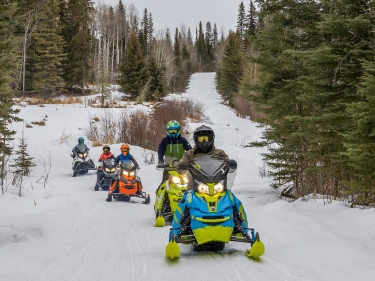
The Peace Valley Snow Riders are a group dedicated to helping families and friends get out of the house and enjoy the Mighty Peace this winter. Their mission is to promote responsible snowmobiling in the Peace Region and develop trails that form a network on both the east and west side of Peace River. Each trail has rest stops with fire pits, picnic tables, outhouses and firewood.
With many sights and scenery to appreciate, riding their trails is a must this winter!
Events:
- Peace Valley Snow Riders Annual General Meeting
- Thursday October 23, 2025
- Grimshaw Legion Hall
- Happy hour and supper at 5:30 pm, meeting at 7 pm
- Supper is complimentary however it would be appreciated if you would RSVP to Wendell Whittleton at 780-618-6039 or whittleton12@yahoo.com so we know how many people to be prepared for.
- Peace Valley Snow Riders 25/26 Poker Rally
- Sunday February 15, 2026
- Baytex Wesley Creek Trail
- Registration 9 am to 11 am
Memberships & Trail Passes
Memberships and trail passes can be purchased online at albertasnowmobile.ca.
Category: Attractions, Dark Sky Adventures, Town of Grimshaw, Village of Hines Creek, Mighty Peace Essentials, Outdoors, Parks & Lakes, Town of Peace River, M.D. of Peace, Sights & Experiences, Town of Saint Isidore, and Winter ActivitiesAddress: Leddy Lake Staging Area
Dixonville
Alberta
T0H 1E0
CanadaThe Peace Valley Snow Riders are a group dedicated to helping families and friends get out of the house and enjoy the Mighty Peace this winter. Their mission is to promote responsible snowmobiling in the Peace Region and develop trails that form a network on both the east and west side of Peace River. Each trail has rest stops with fire pits, picnic tables, outhouses and firewood.
With many sights and scenery to appreciate, riding their trails is a must this winter!
Events:
- Peace Valley Snow Riders Annual General Meeting
- Thursday October 23, 2025
- Grimshaw Legion Hall
- Happy hour and supper at 5:30 pm, meeting at 7 pm
- Supper is complimentary however it would be appreciated if you would RSVP to Wendell Whittleton at 780-618-6039 or whittleton12@yahoo.com so we know how many people to be prepared for.
- Peace Valley Snow Riders 25/26 Poker Rally
- Sunday February 15, 2026
- Baytex Wesley Creek Trail
- Registration 9 am to 11 am
Memberships & Trail Passes
Memberships and trail passes can be purchased online at albertasnowmobile.ca.