No Records Found
Sorry, no records were found. Please adjust your search criteria and try again.
Google Map Not Loaded
Sorry, unable to load Google Maps API.
-
Save
GPS Coordinates: N55° 54.080′ W117° 30.305’
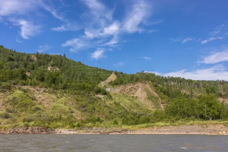
Here you will encounter another stunning set of hoodoos rising dramatically on the west side of the river in Birch Hills County. These natural sandstone pillars, shaped over centuries by wind and water, create a striking, otherworldly landscape that’s a highlight of the river journey. On the east side, you will notice a creek in Northern Sunrise County that can be accessed from the river, offering a quiet spot to explore or take a break.
-
Save
GPS Coordinates: N55° 54.906′ W117° 30.564’
Here you will reach your fourth set of rapids. Along this stretch, you will find another sandy beach, perfect for a rest stop or even an overnight camp. As with all rapids on the river, be mindful of the many rocks in the water, which require careful navigation.
-
Save
GPS Coordinates: N55° 55.478′ W117° 30.527’
Here is where you will encounter another stretch of whitewater.
-
Save
GPS Coordinates: N55° 55.938′ W117° 30.727’
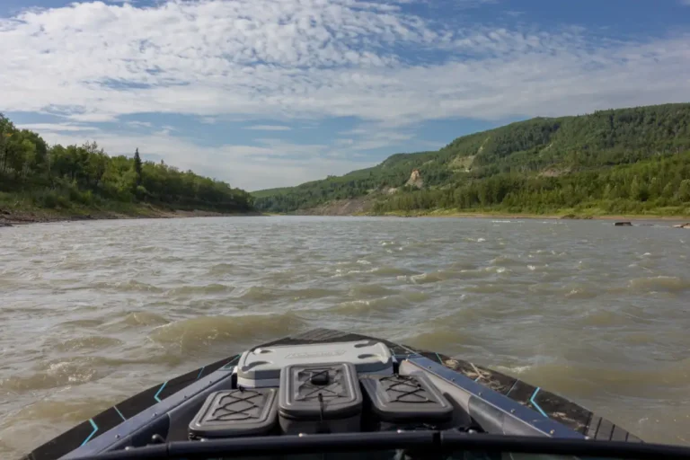
Here you will encounter yet another set of rapids, known locally as the Escalator Rapids due to the elevation drop in this section of the river. The current picks up speed as the water navigates around numerous large rocks, creating a dynamic stretch of river to navigate. It should be noted that these rapids are not always on the river depending on river flow. As with all rapids on the river, be mindful of the many rocks in the water, which require careful navigation.
-
Save
GPS Coordinates: N55° 56.095′ W117° 30.797’
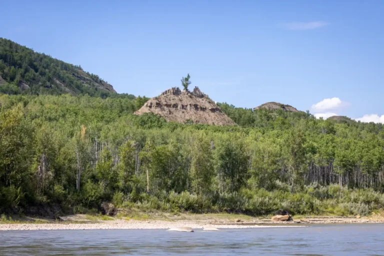
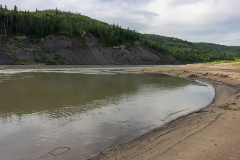
Locals call this spot Hoodoo Beach, named for the beautiful hoodoos that rise across the river in the MD of Smoky River. The beach itself is pristine, stretching wide with soft sand and offering a perfect spot to relax or take a swim. The current near the shore is gentle, making it a safer spot to swim. Large rocks frame both ends of the beach, while a backdrop of trees provides natural shelter and shade, creating a peaceful spot along the river.
-
Save
GPS Coordinates: N55° 56.499′ W117° 31.364’
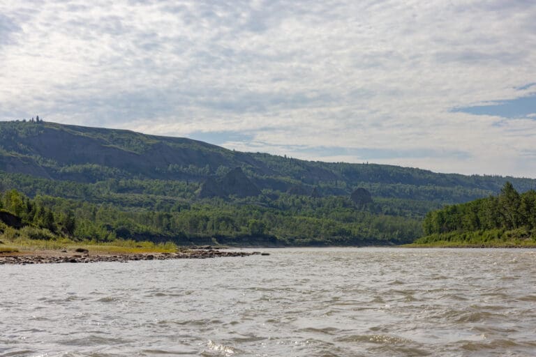
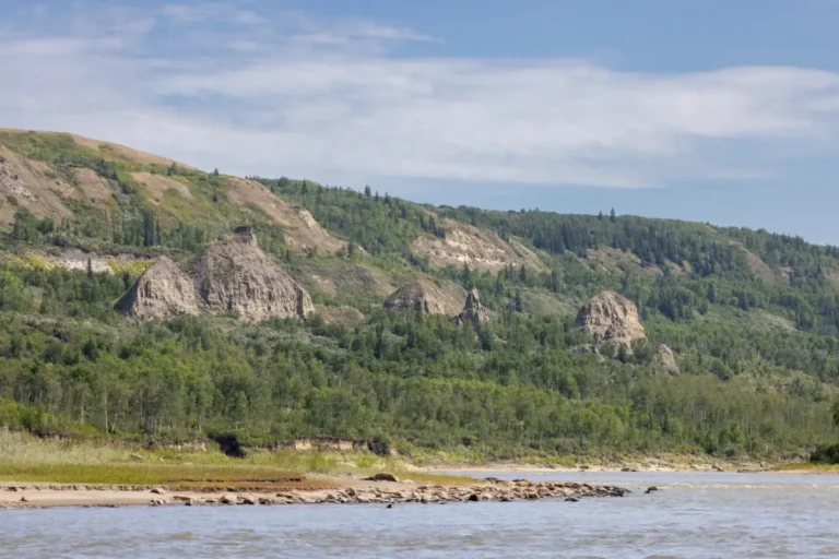
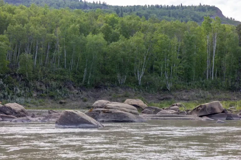
Here is where you will hit your third set of rapids—an exciting stretch of the Smoky that also opens up to some of the river’s most stunning hoodoos. As with all rapids on the river, be mindful of the many rocks in the water, which require careful navigation. Towering above both sides of the valley, these ancient sandstone formations have been shaped by centuries of wind and water, creating a rugged, otherworldly skyline along the cliffs.
Keep an eye on the east side: perched proudly on top of one of the tallest hoodoos is a Canadian flag. It was placed there by a local helicopter company known for their search-and-rescue work and wildfire support in the region. It is a striking reminder of the incredible beauty and spirit of this country. -
Save
GPS Coordinates: N55° 57.058′ W117° 31.501’
This is where you will hit a stretch of whitewater.
-
Save
GPS Coordinates: N55° 58.521′ W117° 31.791’
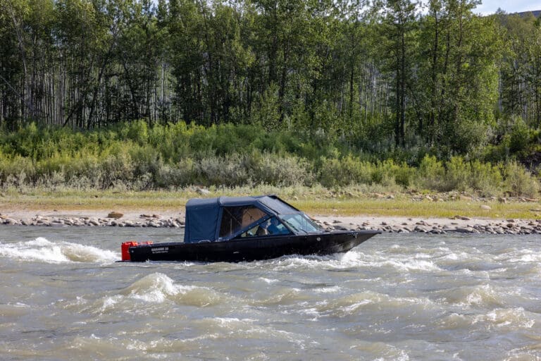
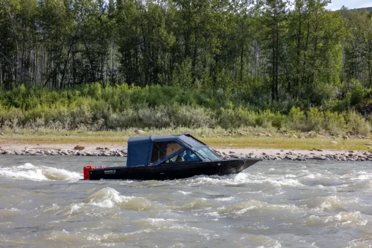
This is where you’ll encounter the second set of rapids on the Smoky River. Their difficulty can vary throughout the year, as water levels and seasonal conditions can change the classification of all rapids along the Smoky. Before heading out, it’s a good idea to check current conditions with local organizations such as the Peace River Boating Association or Peace River Adventures. As with all rapids on the river, be mindful of the many rocks in the water, which require careful navigation. ATV trails lead down to the river here, and there are beaches on both sides, making it a convenient spot to stop, explore, or prepare for the next stretch of paddling or boating.
-
Save
GPS Coordinates: N55° 59.868′ W117° 31.310’
This site marks the first set of rapids as you move upstream on the Smoky River, with both sides of the river known as Crazy Rays, featuring nice beaches on each side. It is accessible via ATV trails and makes for a good spot for paddlers and boaters to stop and explore.
This stretch of river – named after a local boater who sank his jet boat here years ago—has a bit of a reputation. It also claimed a race boat from a Mexican team during the 2007 World Jet Boat Championships. Neither vessel was ever recovered.
That said, don’t let these stories discourage you. Many paddlers and boaters travel through this area safely every year. It simply serves as a reminder of the importance of being well-prepared and informed about the river conditions before you head out.
Just north of this site is a location of paleontological significance. Local paddlers discovered Plesiosaur fossils nearby, which were later recovered by the Royal Tyrrell Museum with assistance from Peace River Adventures for river transportation.
Plesiosaurs were marine reptiles that lived from roughly 125 million years ago and found in the Shaftsbury formation. Fossils found in the Peace and Smoky River area, including vertebrae, ribs, and other bones preserved in marine sedimentary rocks, reveal that much of northwestern Alberta was once covered by a shallow sea, part of the great inland seaway that stretched across North America. Today, the riverbanks and rock outcrops in this area are rich in geological layers formed in those ancient seas, making this a fascinating spot for both geology lovers and fossil enthusiasts.
-
Save
GPS Coordinates: N56° 00.439′ W117° 30.812’
This beach is named for the incredibly large rocks across the beach, creating a dramatic and scenic landscape. It features a sandy beach with massive rock formations, making it a great spot to stop, explore, or camp while enjoying views of the iconic Three Sisters in the river.
The rocks in this area tell a fascinating geological story. Many are shale, siltstone, or sandstone from the Smoky Group, which, when more resistant or cemented, form large angular blocks and ledges. Others are ironstone concretions or ooidal ironstone from the Bad Heart Formation—dense, iron-rich, and often reddish, giving parts of the shoreline a striking “rusty” appearance.
This beach displays post glacial boulders that can sometimes include quartzite, chert, and sandstone, transported and deposited by ancient rivers or glaciers. Making it a fascinating spot for paddlers, boaters, and rock hounding enthusiasts alike.
-
Save
GPS Coordinates: N56° 02.070′ W117° 29.394′
The Three Sisters are named for three large rocks that rise from the river. Depending on water levels, they may be partially hidden or stand out prominently. While they make a striking sight, boaters and paddlers should give them a wide berth, as the current can be very strong in this area and there are multiple other rocks surrounding them.
-
Save
GPS Coordinates: N56° 04.390′ W117° 27.555’
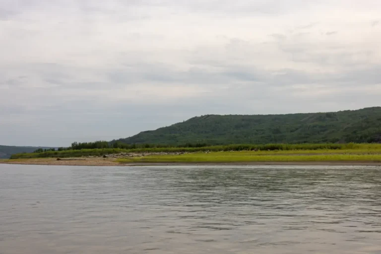
Murphy Flats is a rare spot where docking your boat is possible, but it’s not recommended for jet boats. It’s an excellent starting point for a paddle adventure to the Town of Peace River, allowing you to bypass all the rapids from the outset. It’s also a great stopping point for those paddling the Smoky River. Depending on your pace and style, the paddle can take 4–7 hours. This day use recreation area in Northern Sunrise County offers trails, picnic tables, free firewood, and washrooms, with convenient road access for visitors.
-
Save
GPS Coordinates: N56° 05.023′ W117° 27.099’
This island features a beautiful sandy beach and can be fully walked around when water levels allow. A large rocky section makes it a perfect spot for rock hounding. From here, you can enjoy views of Murphy Flats Recreation Area in Northern Sunrise County, which is accessible by road. Some areas of the island are shaded by clusters of trees, providing natural shelter and resting spots for paddlers and boaters.
-
Save
GPS Coordinates: N56° 05.057′ W117° 26.678′
At times, this back channel is navigable by boat or paddle, though opportunities are rare and dependent on water levels.
-
Save
GPS Coordinates: N56° 06.768′ W117° 23.239’
Locally known as Gord’s Beach, named for a gentleman who owns a trapline and cabin on the opposite riverbank, this spot offers a mix of sandy and rocky beach areas and plenty of space to stretch your legs. While there are few trees for shade or shelter, the beach provides striking views, including a large red iron deposit on the riverbank. This vivid red coloration comes from iron-rich sandstone. As the river erodes the layers, oxygen from the air and water reacts with the iron minerals, creating the bright red and rusty hues visible today.
In the distance, you can spot a Wildland Provincial Park lookout, accessible via mixed-use trails. Visitors can reach it by crossing the Peace River using the Shaftesbury Ferry and following the trails through Peace River Wildland Provincial Park. -
Save
GPS Coordinates: N56° 08.073′ W117° 22.382’
Locally known as Slide Beach—named for a natural land slide visible across the river. This spot is perfect for camping or taking a break to stretch your legs. Depending on water levels, it offers sandy areas as well as rocky sections, and at times becomes a walkable island. It’s also a great place to find shelter from the wind, making it a comfortable stop for paddlers and boaters alike.
-
Save
GPS Coordinates: N56° 08.920′ W117° 22.111’
This riverside spot transforms with the water levels—sometimes a sandy beach, other times a walkable island you can explore end to end. It features both soft sand and rocky stretches, offering plenty of variety for paddlers and boaters looking to stretch their legs. With its open space and natural shelter, it’s also a great location for riverside camping and taking in the scenery.
-
Save
MD of Peace on West Bank of the Peace River, Birch Hills in the middle and Northern Sunrise County on the East Shore.
GPS Coordinates: N56° 11.379′ W117° 19.933’Sagitawa is the Cree word for “where the rivers meet,” a fitting name for this naturally beautiful confluence. This spot is also accessible through mixed-use trails within the Peace River Wildland Provincial Park, this spot opens up to a wide sandy beach that shifts with the seasons, sometimes revealing calm back channels perfect for wading or exploring. There is also rocky section here that is a great spot for rock hounding, with unique rocks exposed by changing water levels. It is a lovely spot to spend the day and very close to the Town of Peace River.