No Records Found
Sorry, no records were found. Please adjust your search criteria and try again.
Google Map Not Loaded
Sorry, unable to load Google Maps API.
-
SavePlace Title: Woodland Cree First Nation Recreation GroundsPlace Description:
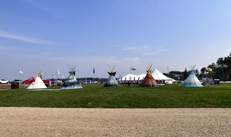
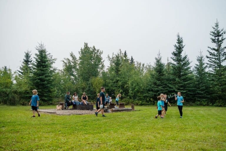
The Woodland Cree First Nation Recreation Grounds offer a perfect blend of natural beauty and modern amenities, making it an ideal location for events and sports activities. Situated in a serene woodland setting, the grounds boast well-maintained baseball diamonds that are perfect for friendly matches or competitive tournaments.
With lots of room for various activities and events, such as festivals and cultural gatherings, the recreation area provides a welcoming space for community members and visitors. The expansive grounds also offer plenty of parking space, ensuring convenience for those attending events or using the facilities.
There is also ample space for camping on site, allowing visitors to immerse themselves in the beauty of the surrounding nature. Whether you’re looking to enjoy a day of sports or one of their many events, the Woodland Cree First Nation Recreation Grounds offers the perfect retreat.
Category: Woodland Cree First NationAddress: Simon Lake
Simon Lake
Alberta
CanadaTelephone Number: (780) 629-3803The Woodland Cree First Nation Recreation Grounds offer a perfect blend of natural beauty and modern amenities, making it an ideal location for events and sports activities. Situated in a serene woodland setting, the grounds boast well-maintained baseball diamonds that are perfect for friendly matches or competitive tournaments.
With lots of room for various activities and events, such as festivals and cultural gatherings, the recreation area provides a welcoming space for community members and visitors. The expansive grounds also offer plenty of parking space, ensuring convenience for those attending events or using the facilities.
There is also ample space for camping on site, allowing visitors to immerse themselves in the beauty of the surrounding nature. Whether you’re looking to enjoy a day of sports or one of their many events, the Woodland Cree First Nation Recreation Grounds offers the perfect retreat.
-
SavePlace Title: Golden LakePlace Description:
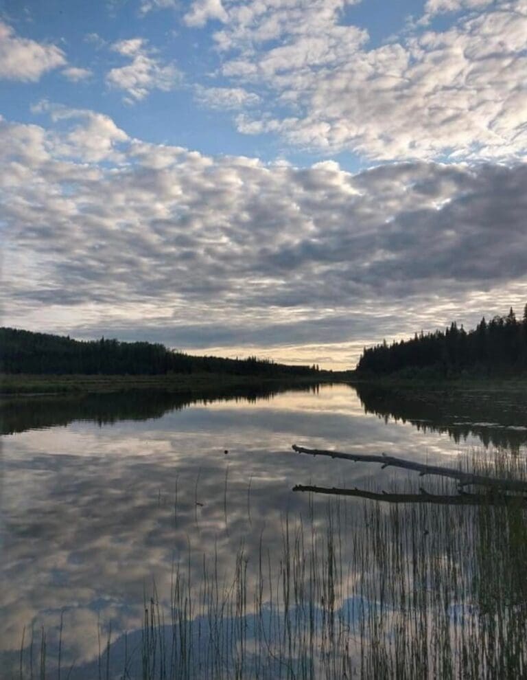
Located in between Simon Lake and Marten Lake, approximately 12km north of Cadotte Lake, Golden Lake is a beautiful area that is part of the Woodland Cree First Nation. Surrounded by lush forests and teeming with wildlife, Golden Lake is known as a haven for nature enthusiasts. With plenty of trails and sights to see, visitors will be able to immerse themselves in the outdoors and experience tranquility while they enjoy unlimited amounts of fresh air.
Category: Woodland Cree First NationAddress: Cadotte Lake
Northern Sunrise County
Alberta
CanadaTelephone Number: (780) 629-3803Located in between Simon Lake and Marten Lake, approximately 12km north of Cadotte Lake, Golden Lake is a beautiful area that is part of the Woodland Cree First Nation. Surrounded by lush forests and teeming with wildlife, Golden Lake is known as a haven for nature enthusiasts. With plenty of trails and sights to see, visitors will be able to immerse themselves in the outdoors and experience tranquility while they enjoy unlimited amounts of fresh air.
-
SavePlace Title: Peace ParaglidingPlace Description:
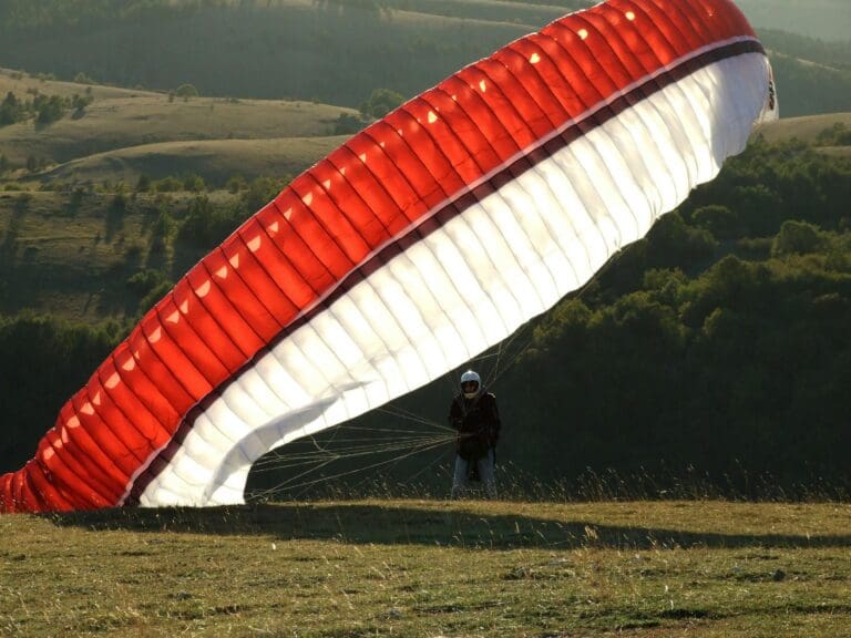
Embark on an exhilarating adventure with Peace Paragliding. Founded by seasoned instructor, Glenn Bitterman, Peace Paraglidinghas been offering thrilling adventures in the skies since 2000. Glenn, who has paraglided on six continents and has been an instructor since 2003, brings extensive experience to his clients. Whether you’re a beginner or seasoned thrill-seeker, Glenn offers a safe, unforgettable experience that will give you a lifetime of memories. Twenty plus jump locations throughout the Peace Country offer a truly unique and breathtaking perspective of this beautiful region. Discover the pure joy of flight with Peace Paragliding!
Tags: Fall-PhotoAddress: Peace River (town)
Peace River (town)
Alberta
T8S 1R8
CanadaTelephone Number: 780-605-0442Embark on an exhilarating adventure with Peace Paragliding. Founded by seasoned instructor, Glenn Bitterman, Peace Paraglidinghas been offering thrilling adventures in the skies since 2000. Glenn, who has paraglided on six continents and has been an instructor since 2003, brings extensive experience to his clients. Whether you’re a beginner or seasoned thrill-seeker, Glenn offers a safe, unforgettable experience that will give you a lifetime of memories. Twenty plus jump locations throughout the Peace Country offer a truly unique and breathtaking perspective of this beautiful region. Discover the pure joy of flight with Peace Paragliding!
-
SavePlace Title: Smoky River Historical and Genealogical SocietyPlace Description:
There’s a Story Behind Every Bend in the River:
Whether you are just passing by Donnelly or have come to visit with the goal of research in mind, the Smoky River Historical and Genealogical Society is an open book – really! You’ll find shelves upon shelves of organized material! Don`t be afraid to take a quick visit to satisfy your curiosities, or delve into an afternoon of research with the help of our passionate volunteers. The slogan “Our history is part of our future” reflects an over 40 year commitment to the meticulous preservation and dissemination of knowledge about all those who helped, and continue to help, shape our communities.
Founded in 1984, the Society has amassed the most robust, open archive in Northern Alberta, with a diverse inventory including hundreds of vital statistic (birth, marriage, baptism) indices, one of the largest collection of community history books, tens of thousands of historical photographs, obituary cards, and newspapers. Originally specializing in preserving Francophone contributions to the culture of our region, time has only expanded the Society’s horizons to include preserving the records of all pioneers and Indigenous peoples who call our vast province home.
Looking for something in particular? The Society welcomes everybody, and all sorts of inquiries. Feel free to get in touch and let them know!
Hours of Operation:
Summer Hours (May 1 – August 22): Open Monday through Friday, 10AM-4PM.
Winter Hours (August 26 – April 30): Tuesdays & WednesdaysEvery first Saturday of the month 10AM-4PM.
Always open by appointment.Directions:
At the junction of Highway 2 and 49, turn east towards the Village of Donnelly. The Smoky River Historical and Genealogical Society is located on the right, one block past the church, after turning north into the village.
Where to Find Us:
4923, 3rd St.
Donnelly, Alberta
T0H 1G0
shgsr@outlook.com
780-925-3801Tags: Francophone Circle TourAddress: Gravel Avenue, Village of Donnelly
Village of Donnelly
Alberta
CanadaTelephone Number: 780-925-3801Email: shgsr@outlook.comThere’s a Story Behind Every Bend in the River:
Whether you are just passing by Donnelly or have come to visit with the goal of research in mind, the Smoky River Historical and Genealogical Society is an open book – really! You’ll find shelves upon shelves of organized material! Don`t be afraid to take a quick visit to satisfy your curiosities, or delve into an afternoon of research with the help of our passionate volunteers. The slogan “Our history is part of our future” reflects an over 40 year commitment to the meticulous preservation and dissemination of knowledge about all those who helped, and continue to help, shape our communities.
Founded in 1984, the Society has amassed the most robust, open archive in Northern Alberta, with a diverse inventory including hundreds of vital statistic (birth, marriage, baptism) indices, one of the largest collection of community history books, tens of thousands of historical photographs, obituary cards, and newspapers. Originally specializing in preserving Francophone contributions to the culture of our region, time has only expanded the Society’s horizons to include preserving the records of all pioneers and Indigenous peoples who call our vast province home.
Looking for something in particular? The Society welcomes everybody, and all sorts of inquiries. Feel free to get in touch and let them know!
Hours of Operation:
Summer Hours (May 1 – August 22): Open Monday through Friday, 10AM-4PM.
Winter Hours (August 26 – April 30): Tuesdays & WednesdaysEvery first Saturday of the month 10AM-4PM.
Always open by appointment.Directions:
At the junction of Highway 2 and 49, turn east towards the Village of Donnelly. The Smoky River Historical and Genealogical Society is located on the right, one block past the church, after turning north into the village.
Where to Find Us:
4923, 3rd St.
Donnelly, Alberta
T0H 1G0
shgsr@outlook.com
780-925-3801 -
SavePlace Title: Cummings Lake CampgroundPlace Description:
Nestled near Fairview, Alberta, Cummings Lake Campground is a serene retreat offering a variety of amenities to ensure a comfortable and enjoyable stay. With 28 spacious camping stalls, the campground provides electrical hookups, firewood, and well-maintained outhouses for convenience. Families will appreciate the playground, tire park, and ball diamonds, while nature enthusiasts can explore the scenic walking trails and enjoy bird watching. Adventure awaits with canoe rentals and a dedicated canoe and kayak launch, making it easy to immerse yourself in the tranquil waters. Whether you’re seeking outdoor activities or simply looking to relax in nature, Cummings Lake Campground is the perfect destination for a memorable camping experience.
Located on Hwy 732 – Adjacent to Fairview
Tags: campingAddress: Highway 732
Division No. 19
Alberta
T0H 1L0
CanadaTelephone Number: 780-835-8651Email: Cummingslake1@gmail.comNestled near Fairview, Alberta, Cummings Lake Campground is a serene retreat offering a variety of amenities to ensure a comfortable and enjoyable stay. With 28 spacious camping stalls, the campground provides electrical hookups, firewood, and well-maintained outhouses for convenience. Families will appreciate the playground, tire park, and ball diamonds, while nature enthusiasts can explore the scenic walking trails and enjoy bird watching. Adventure awaits with canoe rentals and a dedicated canoe and kayak launch, making it easy to immerse yourself in the tranquil waters. Whether you’re seeking outdoor activities or simply looking to relax in nature, Cummings Lake Campground is the perfect destination for a memorable camping experience.
Located on Hwy 732 – Adjacent to Fairview
-
SavePlace Title: Peace Country Fish & Game AssociationPlace Description:
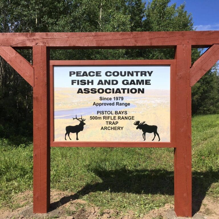
Discover the Peace Country Fish and Game Association (PCFGA), a community-oriented, non-profit club and gun range located near Peace River, Alberta. Since 1979, PCFGA has welcomed archers and shooters of all levels, offering a rifle range, pistol and smallbore bays, trapshooting, and archery.
Committed to safety and responsible shooting practices, the association provides a welcoming environment for outdoor enthusiasts. You can find information about memberships and rentals on the website, along with a calendar of upcoming activities. Join them for a variety of engaging events, family nights, and training sessions designed to help you develop your skills in a supportive community.
Category: Town of Peace RiverAddress: 843006A Range Road 225
County of Northern Lights
Alberta
CanadaEmail: PCFGA1979@gmail.comDiscover the Peace Country Fish and Game Association (PCFGA), a community-oriented, non-profit club and gun range located near Peace River, Alberta. Since 1979, PCFGA has welcomed archers and shooters of all levels, offering a rifle range, pistol and smallbore bays, trapshooting, and archery.
Committed to safety and responsible shooting practices, the association provides a welcoming environment for outdoor enthusiasts. You can find information about memberships and rentals on the website, along with a calendar of upcoming activities. Join them for a variety of engaging events, family nights, and training sessions designed to help you develop your skills in a supportive community.
-
SavePlace Title: Creekside Hat Co.Place Description:
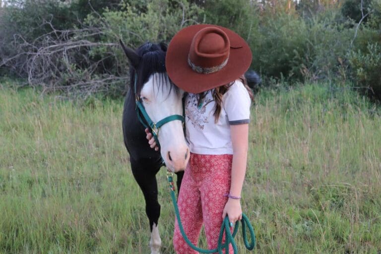
Creekside Hat Co. is where you create your own one-of-a-kind hat that reflects your personal style and creativity. Known for their custom fur hats, Creekside Hat Co. lets you select every detail—color, crown, brim, and hat band. They offer premium materials, including beaver and rabbit felt, each crafted by hand through an artisanal process involving steaming, blocking, ironing, sanding, and even fire finishing. You can even choose a hat with intricate custom detailing to match your vision.
Beyond fur hats, Creekside Hat Co. creates unique trucker hats featuring custom heat patches. They also offer permanent jewelry for a personal touch. With Creekside Hat Co., you design and wear a truly custom piece that tells your story, crafted with expertise and passion.
Category: ShoppingTags: FairviewAddress: 10209 110 Street
Fairview
Alberta
T0H 1L0
CanadaTelephone Number: (780) 772-8742Creekside Hat Co. is where you create your own one-of-a-kind hat that reflects your personal style and creativity. Known for their custom fur hats, Creekside Hat Co. lets you select every detail—color, crown, brim, and hat band. They offer premium materials, including beaver and rabbit felt, each crafted by hand through an artisanal process involving steaming, blocking, ironing, sanding, and even fire finishing. You can even choose a hat with intricate custom detailing to match your vision.
Beyond fur hats, Creekside Hat Co. creates unique trucker hats featuring custom heat patches. They also offer permanent jewelry for a personal touch. With Creekside Hat Co., you design and wear a truly custom piece that tells your story, crafted with expertise and passion.
-
SavePlace Title: Association canadienne-française de l'Alberta (ACFA) Peace RiverPlace Description:
The Association canadienne-française de l’Alberta (ACFA) Peace River is the heartbeat of Francophone culture in the Mighty Peace! As the largest organization of its kind in the region, ACFA brings Francophones together to amplify their voices and celebrate their vibrant heritage. Through their advocacy, French-language media, and cultural events, ACFA supports Francophone businesses, promotes unity, and creates spaces where everyone—French-speaking or not—can experience the rich traditions and lively spirit of the Francophone community. From festivals and performances to gatherings that blend history with modern flair, ACFA’s events are an open invitation to join in and embrace Alberta’s Francophone culture.
Address: Town of Falher
Town of Falher
Alberta
T0H 1M0
CanadaTelephone Number: (780) 837-2296The Association canadienne-française de l’Alberta (ACFA) Peace River is the heartbeat of Francophone culture in the Mighty Peace! As the largest organization of its kind in the region, ACFA brings Francophones together to amplify their voices and celebrate their vibrant heritage. Through their advocacy, French-language media, and cultural events, ACFA supports Francophone businesses, promotes unity, and creates spaces where everyone—French-speaking or not—can experience the rich traditions and lively spirit of the Francophone community. From festivals and performances to gatherings that blend history with modern flair, ACFA’s events are an open invitation to join in and embrace Alberta’s Francophone culture.
-
SavePlace Title: Rycroft Agricultural SocietyPlace Description:
The Rycroft Agricultural Society is the heart of Rycroft’s community spirit, hosting a diverse range of events in the Rycroft Ag Centre, conveniently located just off Hwy 49 in the Village of Rycroft. As a key gathering place for the Peace River Region, the Centre provides space for everything from meetings and conventions to weddings, dances, markets, and more.
One of the Society’s most exciting events is their annual Race the 8, a high-speed spectacle where teams of horses and drivers compete in an action-packed relay, showcasing agility, teamwork, and tradition. It’s a must-see event that draws participants and spectators alike, offering an exciting blend of sportsmanship and community camaraderie.
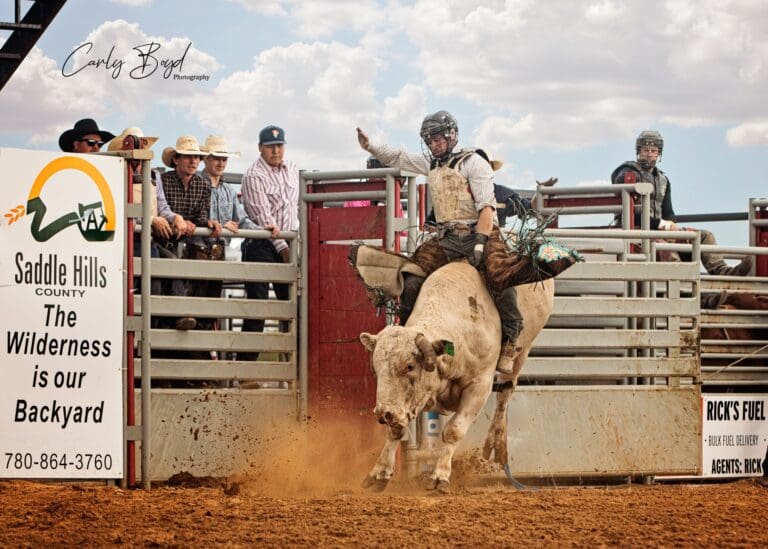
The newly constructed Rodeo Grounds are also available for rentals and annual memberships, making it an ideal venue for rodeos, jackpots, outdoor clinics, and more. Equipped with power, water, an announcer’s booth, and secure pens, the grounds are thoughtfully designed to provide a safe and enjoyable experience for both participants and attendees.
Category: AttractionsAddress: 11055 PTH
Rycroft
Alberta
T0H 3A0
CanadaEmail: admin@rycroftag.comThe Rycroft Agricultural Society is the heart of Rycroft’s community spirit, hosting a diverse range of events in the Rycroft Ag Centre, conveniently located just off Hwy 49 in the Village of Rycroft. As a key gathering place for the Peace River Region, the Centre provides space for everything from meetings and conventions to weddings, dances, markets, and more.
One of the Society’s most exciting events is their annual Race the 8, a high-speed spectacle where teams of horses and drivers compete in an action-packed relay, showcasing agility, teamwork, and tradition. It’s a must-see event that draws participants and spectators alike, offering an exciting blend of sportsmanship and community camaraderie.
The newly constructed Rodeo Grounds are also available for rentals and annual memberships, making it an ideal venue for rodeos, jackpots, outdoor clinics, and more. Equipped with power, water, an announcer’s booth, and secure pens, the grounds are thoughtfully designed to provide a safe and enjoyable experience for both participants and attendees.
-
SavePlace Title: Spring Lake Ski HillPlace Description:
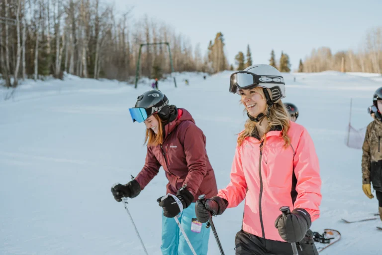
Located only 30 minutes away from Hythe, Beaverlodge, and La Glace, and one hour away from Grande Prairie, Spring Lake Ski Hill is a must visit this winter season! With newly renovated lifts, this family friendly ski hill offers beautiful views to both skiers and snowboarders, ski lessons, as well as a welcoming beginner hill for those just starting.
Equipped with a small rental shop, you’ll be able to get all the gear you need for a fun day outdoors in the fresh powder. Warm up in between runs at the cozy chalet and concession and make sure you refuel before heading up again.
Families can enjoy a full day of fun with activities that cater to all ages and experience levels here. Whether you’re gliding down the slopes or exploring the serene cross-country trails, Spring Lake Ski Hill delivers an unforgettable winter adventure in the Mighty Peace Region.
Address: Saddle Hills County
Saddle Hills County
Alberta
CanadaEmail: Info@springlakehill.comLocated only 30 minutes away from Hythe, Beaverlodge, and La Glace, and one hour away from Grande Prairie, Spring Lake Ski Hill is a must visit this winter season! With newly renovated lifts, this family friendly ski hill offers beautiful views to both skiers and snowboarders, ski lessons, as well as a welcoming beginner hill for those just starting.
Equipped with a small rental shop, you’ll be able to get all the gear you need for a fun day outdoors in the fresh powder. Warm up in between runs at the cozy chalet and concession and make sure you refuel before heading up again.
Families can enjoy a full day of fun with activities that cater to all ages and experience levels here. Whether you’re gliding down the slopes or exploring the serene cross-country trails, Spring Lake Ski Hill delivers an unforgettable winter adventure in the Mighty Peace Region.
-
SavePlace Title: The Tipsy BurroPlace Description:
Big Ears, Big Fun, Big Memories!
Looking to add a unique twist to your event? Let The Tipsy Burro bring the charm, laughter, and unforgettable moments to your special occasion!
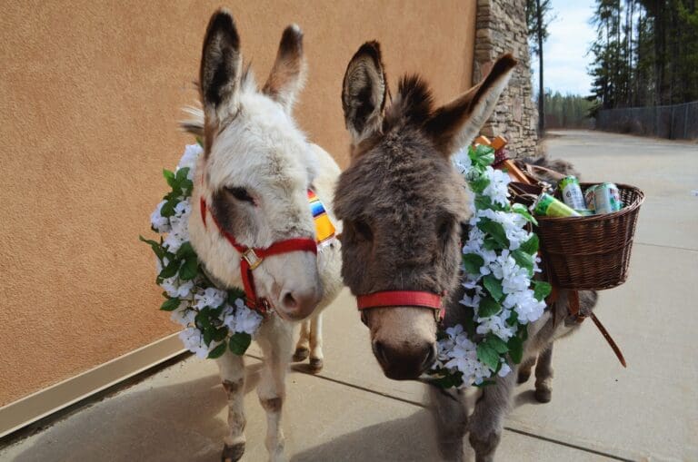
Their lovable donkeys are pros at spreading joy, mingling with guests, and posing for pictures. Whether your event is indoors or outdoors, they come fully prepared with donkey-doo diapers and squishy boots to ensure your venue stays pristine—no floor scratches, no worries.
From weddings and kids’ parties to golf tournaments, company picnics, tradeshows, birthdays, or any celebration you can dream up, The Tipsy Burro is ready to make it unforgettable.
Wrangle your crowd, and The Tipsy Burro will wrangle the drinks—book The Tipsy Burro for your next big bash.
Category: AttractionsAddress: Town of Peace River, 100 Avenue, Downtown
Peace River
Alberta
T8S 1P7
CanadaTelephone Number: (780) 618 6966Email: heehawtipsyburro@gmail.comBig Ears, Big Fun, Big Memories!
Looking to add a unique twist to your event? Let The Tipsy Burro bring the charm, laughter, and unforgettable moments to your special occasion!
Their lovable donkeys are pros at spreading joy, mingling with guests, and posing for pictures. Whether your event is indoors or outdoors, they come fully prepared with donkey-doo diapers and squishy boots to ensure your venue stays pristine—no floor scratches, no worries.
From weddings and kids’ parties to golf tournaments, company picnics, tradeshows, birthdays, or any celebration you can dream up, The Tipsy Burro is ready to make it unforgettable.
Wrangle your crowd, and The Tipsy Burro will wrangle the drinks—book The Tipsy Burro for your next big bash.
-
SavePlace Title: Barrel Wine 'n' SpiritsPlace Description:
Barrel Wine ‘n’ Spirits – A Unique Liquor Shopping Experience in The Town of Peace River
Discover a world of exceptional flavors at Barrel Wine ‘n’ Spirits! They pride themselves on offering a carefully curated selection of liquor and beer that you won’t find anywhere else in the region. From rare finds and premium spirits to craft brews and unique wines, their collection is designed to delight every palate.
Conveniently located right beside Board ‘n’ Barrel, you can enjoy a delicious dinner next door before stopping in to grab the perfect drinks for your evening. Whether you are planning a night in or hosting friends, Barrel Wine ‘n’ Spirits has everything you need to make it special.
Address: 9610 94 Street
Peace River
Alberta
T8S 1H8
CanadaTelephone Number: 587-479-1188Email: barrelwinenspirits@gmail.comBarrel Wine ‘n’ Spirits – A Unique Liquor Shopping Experience in The Town of Peace River
Discover a world of exceptional flavors at Barrel Wine ‘n’ Spirits! They pride themselves on offering a carefully curated selection of liquor and beer that you won’t find anywhere else in the region. From rare finds and premium spirits to craft brews and unique wines, their collection is designed to delight every palate.
Conveniently located right beside Board ‘n’ Barrel, you can enjoy a delicious dinner next door before stopping in to grab the perfect drinks for your evening. Whether you are planning a night in or hosting friends, Barrel Wine ‘n’ Spirits has everything you need to make it special.
-
SavePlace Title: Northern DoughPlace Description:
Northern Dough – Freshly Baked Delights in Grimshaw, Alberta
Welcome to Northern Dough, where the irresistible aroma of fresh baking fills the air every day. This local gem is your go-to spot for delicious homemade treats. From soft sandwich loaves and tangy sourdough bread to gooey cinnamon buns, perfectly baked cookies, cheesy sticks, cupcakes, and more, there’s something to satisfy every craving.
Enjoy a warm bowl of the daily feature soup paired with a fresh sandwich, or sip on a freshly brewed coffee or chilled beverage. Whether you choose to relax in the cozy bakery or take your goodies home, Northern Dough offers the perfect combination of comfort and flavor.
Planning an event? Northern Dough crafts stunning charcuterie boards and takes custom orders for parties, meetings, or casual get-togethers. Just send an email with your request, and they’ll take care of the rest.
Stop by Northern Dough for freshly baked perfection—made with care every single day!
Tags: Town of GrimshawAddress: 4411 51st Street
Town of Grimshaw
Alberta
T0H 1W0
CanadaTelephone Number: 780-332-0087Email: northerndough@outlook.comNorthern Dough – Freshly Baked Delights in Grimshaw, Alberta
Welcome to Northern Dough, where the irresistible aroma of fresh baking fills the air every day. This local gem is your go-to spot for delicious homemade treats. From soft sandwich loaves and tangy sourdough bread to gooey cinnamon buns, perfectly baked cookies, cheesy sticks, cupcakes, and more, there’s something to satisfy every craving.
Enjoy a warm bowl of the daily feature soup paired with a fresh sandwich, or sip on a freshly brewed coffee or chilled beverage. Whether you choose to relax in the cozy bakery or take your goodies home, Northern Dough offers the perfect combination of comfort and flavor.
Planning an event? Northern Dough crafts stunning charcuterie boards and takes custom orders for parties, meetings, or casual get-togethers. Just send an email with your request, and they’ll take care of the rest.
Stop by Northern Dough for freshly baked perfection—made with care every single day!
-
SavePlace Title: Mighty Peace Berries & BloomsPlace Description:
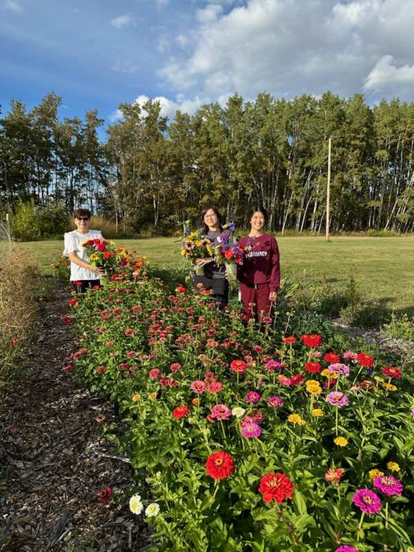
Enjoy a one-of-a-kind u-pick experience in the Mighty Peace! Stroll through vibrant flower gardens, pick fresh, juicy berries, and soak in the beauty of nature. Enhance your experience with bouquet subscriptions for fresh, seasonal blooms delivered weekly, or join one of their hands-on workshops to create stunning floral arrangements. Whether you’re gathering flowers, berries, or new skills, it’s the perfect place for a memorable day outdoors. Gardens are open by admission only and to book visit Mighty Peace Berries & Blooms social media pages and send a direct message or email to reserve your spot.
Please note berries will be ready to pick in 2026.
Address: 834038 RR231
Municipal District of Peace No. 135
Alberta
T0H 1W0
CanadaTelephone Number: 780- 618-1703Enjoy a one-of-a-kind u-pick experience in the Mighty Peace! Stroll through vibrant flower gardens, pick fresh, juicy berries, and soak in the beauty of nature. Enhance your experience with bouquet subscriptions for fresh, seasonal blooms delivered weekly, or join one of their hands-on workshops to create stunning floral arrangements. Whether you’re gathering flowers, berries, or new skills, it’s the perfect place for a memorable day outdoors. Gardens are open by admission only and to book visit Mighty Peace Berries & Blooms social media pages and send a direct message or email to reserve your spot.
Please note berries will be ready to pick in 2026.
-
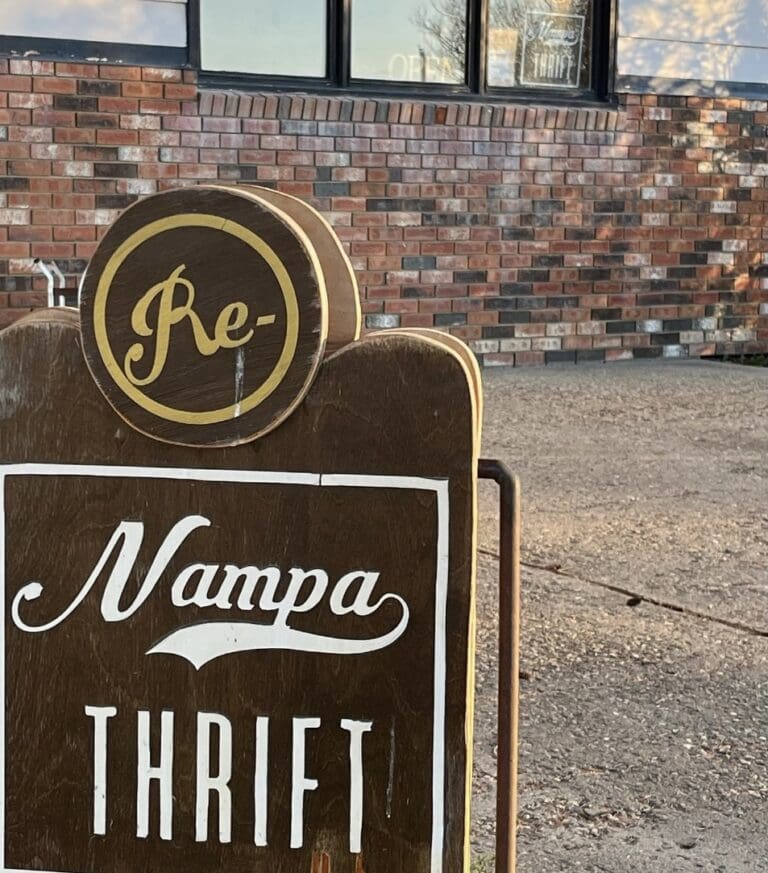
SavePlace Title: Nampa Thrift Second Hand BoutiquePlace Description:
At Second Hand Boutique in Nampa, they believe that every item has a story—and a second chance. Their boutique thrift shop is more than just a place to find great deals; it’s a community-driven space where sustainability, creativity, and affordability come together. Whether you’re hunting for vintage treasures, quality second-hand clothing, stylish home décor, or unique upcycled creations, you’ll find something special here.
Shopping second-hand isn’t just about saving money—it’s about making a difference. By choosing thrifted and upcycled items, you’re helping to reduce waste, support sustainable shopping, and give new life to pre-loved pieces.
Come see what makes Nampa Thrift special they welcome you to browse, shop, and be inspired.
Category: ShoppingAddress: 9810 100 Avenue
Nampa
Alberta
T0H 2R0
CanadaAt Second Hand Boutique in Nampa, they believe that every item has a story—and a second chance. Their boutique thrift shop is more than just a place to find great deals; it’s a community-driven space where sustainability, creativity, and affordability come together. Whether you’re hunting for vintage treasures, quality second-hand clothing, stylish home décor, or unique upcycled creations, you’ll find something special here.
Shopping second-hand isn’t just about saving money—it’s about making a difference. By choosing thrifted and upcycled items, you’re helping to reduce waste, support sustainable shopping, and give new life to pre-loved pieces.
Come see what makes Nampa Thrift special they welcome you to browse, shop, and be inspired.
-
SavePlace Title: Donnelly CampgroundPlace Description:
The Donnelly Campground is a charming and well-equipped retreat for travelers looking to enjoy the great outdoors with all the comforts of home. This fully serviced campground offers 15 power stalls, each with full hookups, including water, sewer, and power, making it the perfect place to set up camp. Whether you’re staying for a night or a week, the campground’s inviting atmosphere, complete with picnic tables and fire pits, creates a cozy and comfortable stay. With a first-come, first-served booking system, you can easily find a spot to unwind and relax. At just $30 per night or $160 for the week, or $580 per month the Donnelly Campground provides excellent value for a peaceful, convenient, and enjoyable camping experience. It’s the perfect place to rest and recharge while exploring the beautiful surroundings.
Category: CampgroundsAddress: Gravel Avenue, Village of Donnelly
Village of Donnelly
Alberta
CanadaTelephone Number: 780-925-3835Email: admin@donnelly.caThe Donnelly Campground is a charming and well-equipped retreat for travelers looking to enjoy the great outdoors with all the comforts of home. This fully serviced campground offers 15 power stalls, each with full hookups, including water, sewer, and power, making it the perfect place to set up camp. Whether you’re staying for a night or a week, the campground’s inviting atmosphere, complete with picnic tables and fire pits, creates a cozy and comfortable stay. With a first-come, first-served booking system, you can easily find a spot to unwind and relax. At just $30 per night or $160 for the week, or $580 per month the Donnelly Campground provides excellent value for a peaceful, convenient, and enjoyable camping experience. It’s the perfect place to rest and recharge while exploring the beautiful surroundings.
-
SavePlace Title: Dunvegan Overlook TrailPlace Description:
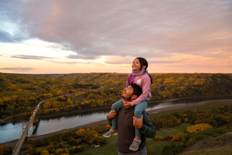
Located within the scenic Dunvegan Provincial Park, this trail offers a breathtaking 1.4 km out-and-back journey that rewards hikers with stunning panoramic views of the iconic Dunvegan Bridge, the surrounding rolling hills, and the mighty Peace River below. As you make your way along this easy-to-navigate trail, the natural beauty of the landscape unfolds, making it a perfect spot for photography and moments of tranquility. Whether you’re looking for a short but memorable hike or a peaceful place to appreciate the region’s stunning scenery, the Dunvegan Overlook Trail provides an unforgettable experience.
Directions: As you enter the provincial park, stay right and drive under the Dunvegan bridge. There is a well marked parking lot 200 meters after the bridge. There are also washrooms at the parking lot. The trail starts as you walk north towards the bluff, the 1st 300 M are flat till you reach the bluff.
Category: District of FairviewAddress: Historic Dunvegan
Fairview
Alberta
CanadaLocated within the scenic Dunvegan Provincial Park, this trail offers a breathtaking 1.4 km out-and-back journey that rewards hikers with stunning panoramic views of the iconic Dunvegan Bridge, the surrounding rolling hills, and the mighty Peace River below. As you make your way along this easy-to-navigate trail, the natural beauty of the landscape unfolds, making it a perfect spot for photography and moments of tranquility. Whether you’re looking for a short but memorable hike or a peaceful place to appreciate the region’s stunning scenery, the Dunvegan Overlook Trail provides an unforgettable experience.
Directions: As you enter the provincial park, stay right and drive under the Dunvegan bridge. There is a well marked parking lot 200 meters after the bridge. There are also washrooms at the parking lot. The trail starts as you walk north towards the bluff, the 1st 300 M are flat till you reach the bluff.
-
SavePlace Title: The Savanna Climbing WallPlace Description:
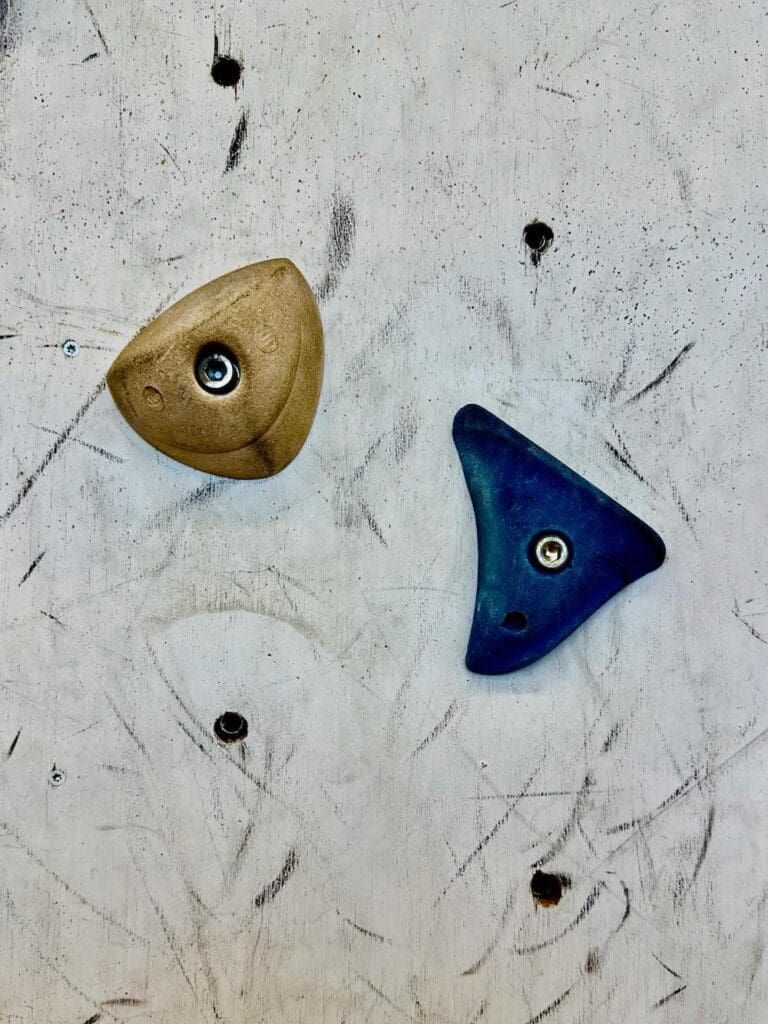
The Savanna Climbing Wall, located at the Savanna School gymnasium in Saddle Hills County, is an exciting indoor adventure for climbers of all ages! Situated at 10006 Highway 681, Silver Valley, AB, this facility offers a fantastic climbing experience with all the necessary equipment provided, including harnesses and shoes. Whether you’re a first-timer or an experienced climber, the wall is designed for everyone—just as long as climbers can communicate with their belayer and fit into the harnesses. It’s the perfect place to challenge yourself, have fun, and build strength, all while enjoying a safe and guided experience. Come enjoy this fantastic climbing opportunity in the heart of Silver Valley!
Tip: Make sure you call ahead to ensure the climbing wall is open before you visit.
Directions: Turn west off Highway 2 at Rycroft onto Highway 49, after 35km turn right onto Highway 725, after 23km turn left onto Highway 681, travel on this highway for 13km, then turn right, the school will be on your left.
Category: AttractionsTags: Village of RycroftAddress: 10006 Highway 681, Silver Valley
Silver Valley
Alberta
CanadaTelephone Number: 780-351-3771The Savanna Climbing Wall, located at the Savanna School gymnasium in Saddle Hills County, is an exciting indoor adventure for climbers of all ages! Situated at 10006 Highway 681, Silver Valley, AB, this facility offers a fantastic climbing experience with all the necessary equipment provided, including harnesses and shoes. Whether you’re a first-timer or an experienced climber, the wall is designed for everyone—just as long as climbers can communicate with their belayer and fit into the harnesses. It’s the perfect place to challenge yourself, have fun, and build strength, all while enjoying a safe and guided experience. Come enjoy this fantastic climbing opportunity in the heart of Silver Valley!
Tip: Make sure you call ahead to ensure the climbing wall is open before you visit.
Directions: Turn west off Highway 2 at Rycroft onto Highway 49, after 35km turn right onto Highway 725, after 23km turn left onto Highway 681, travel on this highway for 13km, then turn right, the school will be on your left.
-
SavePlace Title: New To You MarketPlace Description:
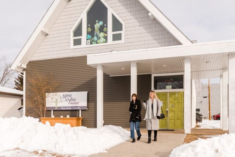
New to You Market is a beloved thrift store in the heart of Fairview, offering more than just great deals—it’s a place where every purchase makes a difference. All proceeds support the Crossroads Resource Centre, helping provide vital services to individuals and families in need.
Inside, you’ll find a clean, well-organized space filled with gently used clothing, bedding, dishware, furniture, books, movies, and home décor. With new treasures arriving regularly, there’s always something fresh to discover.
Whether you’re searching for unique vintage pieces, updating your wardrobe, or just browsing for budget-friendly household essentials, New to You Market is a must-visit community gem. Shop with purpose and uncover your next great find!
Category: ShoppingAddress: 10902 103 Avenue
Fairview
Alberta
T0H 1L0
CanadaTelephone Number: (780) 835-5591New to You Market is a beloved thrift store in the heart of Fairview, offering more than just great deals—it’s a place where every purchase makes a difference. All proceeds support the Crossroads Resource Centre, helping provide vital services to individuals and families in need.
Inside, you’ll find a clean, well-organized space filled with gently used clothing, bedding, dishware, furniture, books, movies, and home décor. With new treasures arriving regularly, there’s always something fresh to discover.
Whether you’re searching for unique vintage pieces, updating your wardrobe, or just browsing for budget-friendly household essentials, New to You Market is a must-visit community gem. Shop with purpose and uncover your next great find!
-
SavePlace Title: Yurt BeautifulPlace Description:
A Truly Authentic Mongolian Experience in the Heart of Northern Alberta
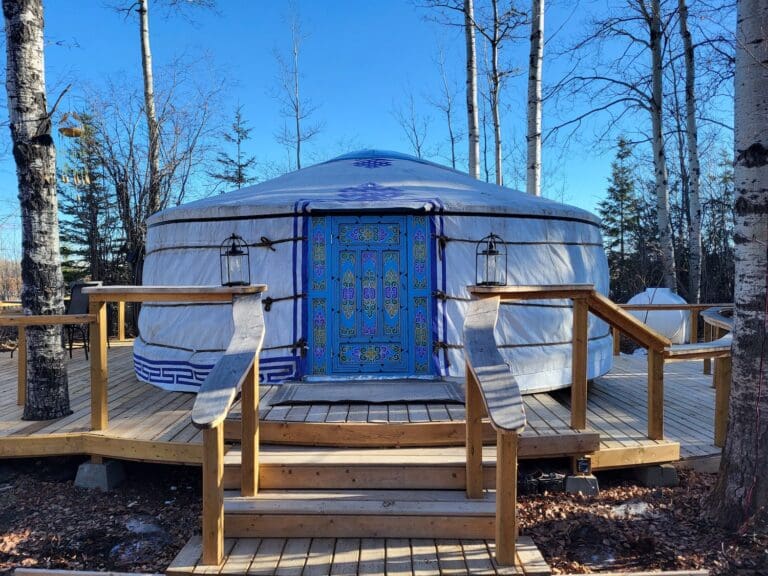
Step into a world where tradition meets tranquility at Yurt Beautiful, a handcrafted Mongolian yurt nestled in the peaceful boreal forest just 15 minutes north of Grimshaw, Alberta. This one-of-a-kind stay offers guests the rare opportunity to sleep in an authentic yurt built using centuries-old techniques by Mongolian nomadic tribes.
Every detail of Yurt Beautiful reflects this cultural heritage—camel hide connects the lattice walls, horsehair ropes hold the yurt’s shape, and wool from sheep insulates the cozy interior. The hand-painted woodwork, lovingly created by the women of the tribe, includes the toono (the crown of the yurt), the huns (roof poles), and the intricately designed doors.
This 20-foot yurt is both rustic and comfortable, equipped with a queen bed and a trundle daybed, perfect for up to four guests. Inside, you’ll find a dining table, solar-powered LED lighting, and a charging port for your phone. The yurt is perched on a forested platform with a wraparound deck and a private walkway to the washroom.
Wake up to a homemade breakfast, included for two guests with your stay. With advanced notice, you can also enjoy lunch and dinner, thoughtfully prepared to accommodate dietary preferences and allergies—including vegetarian options.
While there are no cooking facilities on-site, Yurt Beautiful invites you to relax, unplug, and connect with nature. Directly across the road is the Lac Cardinal Point Uplands Conservation Area, a 623-acre expanse of uplands, wetlands, and riparian zones teeming with wildlife—from moose and deer to black bears and waterfowl. If you’re lucky, you might even stumble upon a patch of wild strawberries in the summer months.
Season: Open from Victoria Day weekend through the end of September
Booking Availability: Tuesday through Sunday
Rate: $150.00 CAD per night (includes breakfast for two)
Evening Meals: Available by advance request; menu provided upon bookingIf you’re looking for a unique stay that blends cultural richness with serene wilderness, Yurt Beautiful is your perfect escape.
Address: 241060 Township Rd 842
County of Northern Lights
Alberta
T8S 0A5
CanadaTelephone Number: 780-819-9779Email: info@yurtbeautiful.caA Truly Authentic Mongolian Experience in the Heart of Northern Alberta
Step into a world where tradition meets tranquility at Yurt Beautiful, a handcrafted Mongolian yurt nestled in the peaceful boreal forest just 15 minutes north of Grimshaw, Alberta. This one-of-a-kind stay offers guests the rare opportunity to sleep in an authentic yurt built using centuries-old techniques by Mongolian nomadic tribes.
Every detail of Yurt Beautiful reflects this cultural heritage—camel hide connects the lattice walls, horsehair ropes hold the yurt’s shape, and wool from sheep insulates the cozy interior. The hand-painted woodwork, lovingly created by the women of the tribe, includes the toono (the crown of the yurt), the huns (roof poles), and the intricately designed doors.
This 20-foot yurt is both rustic and comfortable, equipped with a queen bed and a trundle daybed, perfect for up to four guests. Inside, you’ll find a dining table, solar-powered LED lighting, and a charging port for your phone. The yurt is perched on a forested platform with a wraparound deck and a private walkway to the washroom.
Wake up to a homemade breakfast, included for two guests with your stay. With advanced notice, you can also enjoy lunch and dinner, thoughtfully prepared to accommodate dietary preferences and allergies—including vegetarian options.
While there are no cooking facilities on-site, Yurt Beautiful invites you to relax, unplug, and connect with nature. Directly across the road is the Lac Cardinal Point Uplands Conservation Area, a 623-acre expanse of uplands, wetlands, and riparian zones teeming with wildlife—from moose and deer to black bears and waterfowl. If you’re lucky, you might even stumble upon a patch of wild strawberries in the summer months.
Season: Open from Victoria Day weekend through the end of September
Booking Availability: Tuesday through Sunday
Rate: $150.00 CAD per night (includes breakfast for two)
Evening Meals: Available by advance request; menu provided upon bookingIf you’re looking for a unique stay that blends cultural richness with serene wilderness, Yurt Beautiful is your perfect escape.
