No Records Found
Sorry, no records were found. Please adjust your search criteria and try again.
Google Map Not Loaded
Sorry, unable to load Google Maps API.
-
SavePlace Title: Historic Dunvegan Provincial ParkPlace Description:
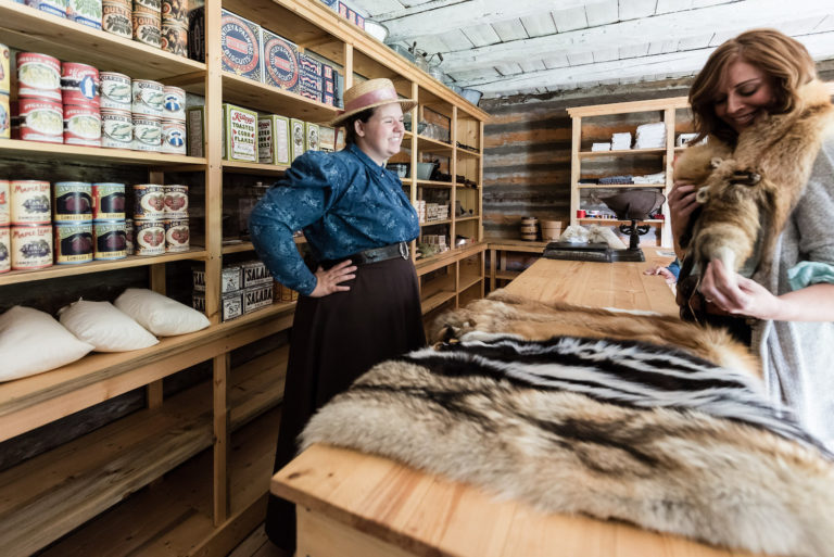
Historic Dunvegan is a provincially and nationally designated historic resource. Experience history through 4 original, authentically restored and furnished buildings and the stories of Indigenous, fur trade, and mission life that our historic interpreters are waiting to share with you. Located alongside the Peace River with a breathtaking view of Alberta’s longest vehicle suspension bridge, there are activities for the whole family! A visitors’ centre located near the entrance offers information as well as guided tours of the historic buildings. The Visitor Centre and historic buildings are open from May 18 through Labour Day, 10am-5pm Wednesday through Sunday and holiday Mondays. Admission fees apply.
2024 Special Events
Dunvegan Tsattine/Beaver Storytelling – June 22, 1pm
Canada Day – July 1, Noon-5pm
Fresh Air Market – August 4, 11-5pm
Sunday Funday – May 19 and June 30, 10am-5pm
Picnic in the Park – July 14 and August 11, 11am-3pmLocated 26km south of Fairview on Highway 2. For more information please visit www.historicdunvegan.ca or find us on Facebook by searching @historicdunvegan!
Other nearby amenities include a day use area and campground operated by Alberta Parks. A playground, fire pits, cook shelters, and horseshoe pitches are all available. The Maples Day use area is just down the road, and offers a picnic shelter, fire pits, and a playground. You can also stroll down to the neighbouring Dunvegan Market Gardens for ice cream, food, shopping, and mini golf!
Category: Arts & Culture, Attractions, On the Peace River, Dark Sky Adventures, District of Fairview, Guided Adventure, Mighty Peace Essentials, Motorcycle Tours, Museums, Places To See, Sights & Experiences, and Things To DoAddress: Township Rd 801A
md of fairview
Alberta
T0H 0L0
CanadaTelephone Number: 780-835-7150Email: Historic.Dunvegan@gov.ab.caHistoric Dunvegan is a provincially and nationally designated historic resource. Experience history through 4 original, authentically restored and furnished buildings and the stories of Indigenous, fur trade, and mission life that our historic interpreters are waiting to share with you. Located alongside the Peace River with a breathtaking view of Alberta’s longest vehicle suspension bridge, there are activities for the whole family! A visitors’ centre located near the entrance offers information as well as guided tours of the historic buildings. The Visitor Centre and historic buildings are open from May 18 through Labour Day, 10am-5pm Wednesday through Sunday and holiday Mondays. Admission fees apply.
2024 Special Events
Dunvegan Tsattine/Beaver Storytelling – June 22, 1pm
Canada Day – July 1, Noon-5pm
Fresh Air Market – August 4, 11-5pm
Sunday Funday – May 19 and June 30, 10am-5pm
Picnic in the Park – July 14 and August 11, 11am-3pmLocated 26km south of Fairview on Highway 2. For more information please visit www.historicdunvegan.ca or find us on Facebook by searching @historicdunvegan!
Other nearby amenities include a day use area and campground operated by Alberta Parks. A playground, fire pits, cook shelters, and horseshoe pitches are all available. The Maples Day use area is just down the road, and offers a picnic shelter, fire pits, and a playground. You can also stroll down to the neighbouring Dunvegan Market Gardens for ice cream, food, shopping, and mini golf!
-
SavePlace Title: Judah HillPlace Description:
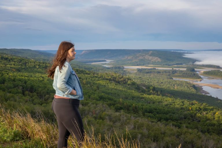
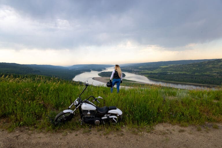
Judah Hill provides stunning views of the Land of the Mighty Peace and leads to one of Peace River’s most incredible and historical lookout points – Sagitawa Lookout.
Get There: Drive down Main Street (100 Street) to the bottom of Main, then turn left onto 102 Avenue. Follow this to 102 Avenue, turn right and cross the Heart River bridge. Turn left onto 104 Avenue and follow the Hwy 744 signs.
Address: Judah Hill Road, South End
Peace River
Peace River
T8S 1Y7
CanadaJudah Hill provides stunning views of the Land of the Mighty Peace and leads to one of Peace River’s most incredible and historical lookout points – Sagitawa Lookout.
Get There: Drive down Main Street (100 Street) to the bottom of Main, then turn left onto 102 Avenue. Follow this to 102 Avenue, turn right and cross the Heart River bridge. Turn left onto 104 Avenue and follow the Hwy 744 signs.
-
SavePlace Title: Nampa and District Museum and Tourist Information CenterPlace Description:
Explore the legendary Mighty Peace, from the fur trade to modern times, through the exhibits at our museum. Discover Nampa and Northern Sunrise County’s historic multicultural roots by following the steps of those who ventured to Canada’s northern-most homesteading area, across the Grouard Trail and onto the railways that took people from all over the world through muskeg to the Mighty Peace Country. Learn about local industries, about farming, about traditional ways as we guide you through the indoor and outdoor exhibits and buildings. With displays on two floors open year round and outdoor exhibits accessible from May to September, the Nampa and District Museum is more than worth a gander.
Major attractions include:
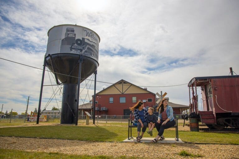
- The original water tank built by the Central Canada Railway to which Nampa owes its very own existence;
- Our old-time boardwalk of shops and businesses from the early to mid 1900’s;
- Our taxidermy exhibits, showing off local wildlife in the area
- The Rucka settlement house (circa 1937)
- Reno’s Ukrainian Catholic Church (circa 1946)
And so much more.
Hours of Operation
- June 1st to August 31st – 10 am to 5 pm / 7 days a week
- September 1st to May 31st – 10 am to 5 pm / Monday to Friday
- Admission: Seniors 65+ $3, Family $15, Adults $7, Students/children attending school $3, Children under 6 Free
Category: Agricultural, Arts & Culture, Circle Tour, Gift Shops & Other, Motorcycle Tours, Museums, Northern Sunrise County, Places To See, Shopping, Things To Do, and Village of NampaAddress: 9902 102 Avenue
Nampa
Alberta
T0H 2R0
CanadaTelephone Number: (780) 322-2777Email: nampamuseum@gmail.comExplore the legendary Mighty Peace, from the fur trade to modern times, through the exhibits at our museum. Discover Nampa and Northern Sunrise County’s historic multicultural roots by following the steps of those who ventured to Canada’s northern-most homesteading area, across the Grouard Trail and onto the railways that took people from all over the world through muskeg to the Mighty Peace Country. Learn about local industries, about farming, about traditional ways as we guide you through the indoor and outdoor exhibits and buildings. With displays on two floors open year round and outdoor exhibits accessible from May to September, the Nampa and District Museum is more than worth a gander.
Major attractions include:
- The original water tank built by the Central Canada Railway to which Nampa owes its very own existence;
- Our old-time boardwalk of shops and businesses from the early to mid 1900’s;
- Our taxidermy exhibits, showing off local wildlife in the area
- The Rucka settlement house (circa 1937)
- Reno’s Ukrainian Catholic Church (circa 1946)
And so much more.
Hours of Operation
- June 1st to August 31st – 10 am to 5 pm / 7 days a week
- September 1st to May 31st – 10 am to 5 pm / Monday to Friday
- Admission: Seniors 65+ $3, Family $15, Adults $7, Students/children attending school $3, Children under 6 Free
-
SavePlace Title: St. Isidore Museum & Cultural CentrePlace Description:
St. Isidore Museum & Cultural Centre – English
Situated in the quaint hamlet of St-Isidore, is a museum that depicts the storied heritage of the francophone community that left Quebec to establish itself in the Mighty Peace. In the museum, you’ll find costumes, pictures and artefacts that tell the story of hardships and victories. Also, theres a train car replica inside of the museum to help visualize the trek that the families had to make with their enormous families as well as with their livestock.
St. Isidore Museum & Cultural Centre – French
Situé dans le pittoresque hameau de St-Isidore, ce musée présente l’héritage historique de la communauté francophone qui a permis au gens du Québec de s’établir au sein de la région de Rivière-de-la-Paix. Dans le musée, vous trouverez des costumes, des images et des artefacts qui racontent l’histoire des épreuves et des victoires. De plus, il y a une réplique d’un wagon de train à l’intérieur du musée pour aider à visualiser le trek que les familles devaient faire avec leur famille et avec leur bétail. Nous accueillons tout le monde, même si vous ne parlez pas français.
Tisserandes De St. Isidore (St. Isidore Weavers)
Weaving is an ancient art!
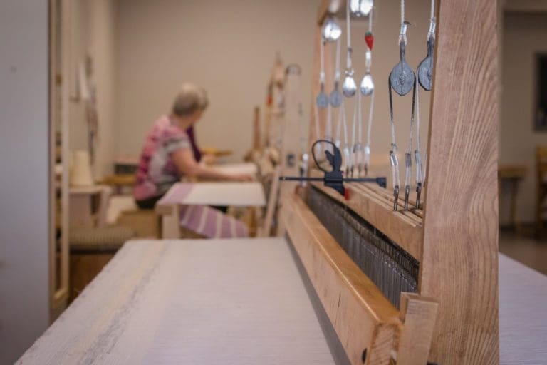
At the Centre Culturel de St-Isidore the St. Isidore Weavers share their talents and perpetuates the traditional arts and crafts of their ancestors. Stop by and admire or take home a piece of their work.
Hours Of Operation:
- Monday – Thursday, 9:00am -4:30pm
- Fridays – Call (780)624-8481
Category: Agricultural, Arts & Culture, Attractions, Library, Museums, Places To See, Shopping, and Town of Saint IsidoreTags: Circle Tour Contest, Edu-vacation, Francophone Circle Tour, and Northern Sunrise County DestinationAddress: Bouchard Road
Saint Isidore
Alberta
T0H 3B0
CanadaTelephone Number: (780) 624-8481Email: explorestisidore@gmail.comSt. Isidore Museum & Cultural Centre – English
Situated in the quaint hamlet of St-Isidore, is a museum that depicts the storied heritage of the francophone community that left Quebec to establish itself in the Mighty Peace. In the museum, you’ll find costumes, pictures and artefacts that tell the story of hardships and victories. Also, theres a train car replica inside of the museum to help visualize the trek that the families had to make with their enormous families as well as with their livestock.
St. Isidore Museum & Cultural Centre – French
Situé dans le pittoresque hameau de St-Isidore, ce musée présente l’héritage historique de la communauté francophone qui a permis au gens du Québec de s’établir au sein de la région de Rivière-de-la-Paix. Dans le musée, vous trouverez des costumes, des images et des artefacts qui racontent l’histoire des épreuves et des victoires. De plus, il y a une réplique d’un wagon de train à l’intérieur du musée pour aider à visualiser le trek que les familles devaient faire avec leur famille et avec leur bétail. Nous accueillons tout le monde, même si vous ne parlez pas français.
Tisserandes De St. Isidore (St. Isidore Weavers)
Weaving is an ancient art!
At the Centre Culturel de St-Isidore the St. Isidore Weavers share their talents and perpetuates the traditional arts and crafts of their ancestors. Stop by and admire or take home a piece of their work.
Hours Of Operation:
- Monday – Thursday, 9:00am -4:30pm
- Fridays – Call (780)624-8481
-
SavePlace Title: Sagitawa LookoutPlace Description:
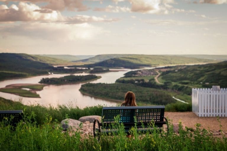
The Sagitawa Lookout is located just south of the Town of Peace River on Hwy 744 in Northern Sunrise County. Sagitawa is a Cree word meaning “Where the rivers meet”. The Lookout has a spectacular view of the Town of Peace River and the confluence of the Peace, Smoky and Heart rivers. The Lookout is complete with picnic area and historical information.
Directions from Main Street Peace River:
Drive down Main Street ( 100 Street) to the bottom of Main, then turn left onto 102 Avenue. Follow this to 102 Avenue, turn right and cross the Heart River bridge. Turn left onto 104 Avenue and follow the Hwy 744 signs. The Lookout is located up the “Judah Hill”. Watch for lookout signage.
Category: Circle Tour, Northern Sunrise County, Outdoors, Places To See, Sights & Experiences, and Things To DoTags: Circle TourAddress: Alberta 744
Marie-Reine
Alberta
T0H 2N0
CanadaThe Sagitawa Lookout is located just south of the Town of Peace River on Hwy 744 in Northern Sunrise County. Sagitawa is a Cree word meaning “Where the rivers meet”. The Lookout has a spectacular view of the Town of Peace River and the confluence of the Peace, Smoky and Heart rivers. The Lookout is complete with picnic area and historical information.
Directions from Main Street Peace River:
Drive down Main Street ( 100 Street) to the bottom of Main, then turn left onto 102 Avenue. Follow this to 102 Avenue, turn right and cross the Heart River bridge. Turn left onto 104 Avenue and follow the Hwy 744 signs. The Lookout is located up the “Judah Hill”. Watch for lookout signage.
-
SavePlace Title: NAR Station Peace River Visitor Information CentrePlace Description:
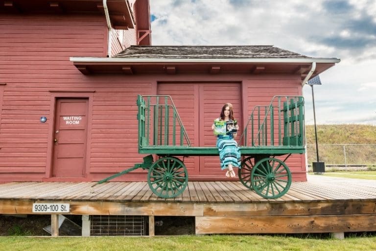
The historic Peace River NAR Station, last of its kind in northern Alberta.
The NAR Station was built in 1916, a Class C Station, it is the last of its kind in Northern Alberta. The station was restored in 1988, and declared a Provincial Historic Resource Site on April 29, 1988. It now serves as the Town of Peace River’s Visitor Information Centre. The ground floor has been furnished to the 1920s-1930s era, and upstairs features local art. Events are held at the station throughout the summer and autumn.
This is the place to make all of your Mighty Peace plans. Offering free information for sightseeing, attractions, accommodations, museums, tours and restaurants. The have a complete collection of current information on the Mighty Peace.
The Visitor Information Centre is your one-stop shop for planning your time in the Mighty Peace. The professional, highly-trained staff can help you make the most of your Mighty Peace experience and plan your journeys into Mighty Peace and beyond.
Hours of operation:
Open May long weekend until September long weekend. Friday to Monday 9am – 4:30pm.
Directions:
Please note the 98 Street exit to Downtown is presently CLOSED.
From Highway 2 (Edmonton or Fairview/Grimshaw):
Exit the highway at 100 Street (Hwy 744), and head south under the railway trestle. At the traffic circle, take the first exit (the first right); the street that leads between the Sawridge Hotel and the KFC. Follow this street until you see the NAR Station, which is a two-storey red wooden building. There is adequate parking on site.
From Highway 744 (north from Girouxville):
When you’ve made it to the bottom of Judah hill at the junction of 104th Avenue and 101 Street turn right. Follow this street (101 Street) north until you reach the T junction (the Fire Hall with a tower will be facing you). Turn left, and at the set of lights turn right. Follow this street to the traffic circle. Enter the traffic circle and take the third exit; the street that leads between the Sawridge Hotel and the KFC. Follow this street until you see the NAR Station, which is a two-storey red wooden building. There is adequate parking on site.
Accessibility:
The NAR Station does have a ramp onto the station platform, however we do not have accessible washrooms. Because we are an historic building, our doorways may be too narrow for some wheel chairs.
Facilities:
- washrooms (not wheelchair accessible)
- picnic tables
- visitor information
- exhibits
- brochures and maps for the region
Category: Attractions, McLennan, Town of Peace River, Places To See, Things To Do, and Visitor Information CentreAddress: 9309 100 St
Peace River
Alberta
T8S 1H7
CanadaThe historic Peace River NAR Station, last of its kind in northern Alberta.
The NAR Station was built in 1916, a Class C Station, it is the last of its kind in Northern Alberta. The station was restored in 1988, and declared a Provincial Historic Resource Site on April 29, 1988. It now serves as the Town of Peace River’s Visitor Information Centre. The ground floor has been furnished to the 1920s-1930s era, and upstairs features local art. Events are held at the station throughout the summer and autumn.
This is the place to make all of your Mighty Peace plans. Offering free information for sightseeing, attractions, accommodations, museums, tours and restaurants. The have a complete collection of current information on the Mighty Peace.
The Visitor Information Centre is your one-stop shop for planning your time in the Mighty Peace. The professional, highly-trained staff can help you make the most of your Mighty Peace experience and plan your journeys into Mighty Peace and beyond.
Hours of operation:
Open May long weekend until September long weekend. Friday to Monday 9am – 4:30pm.
Directions:
Please note the 98 Street exit to Downtown is presently CLOSED.
From Highway 2 (Edmonton or Fairview/Grimshaw):
Exit the highway at 100 Street (Hwy 744), and head south under the railway trestle. At the traffic circle, take the first exit (the first right); the street that leads between the Sawridge Hotel and the KFC. Follow this street until you see the NAR Station, which is a two-storey red wooden building. There is adequate parking on site.
From Highway 744 (north from Girouxville):
When you’ve made it to the bottom of Judah hill at the junction of 104th Avenue and 101 Street turn right. Follow this street (101 Street) north until you reach the T junction (the Fire Hall with a tower will be facing you). Turn left, and at the set of lights turn right. Follow this street to the traffic circle. Enter the traffic circle and take the third exit; the street that leads between the Sawridge Hotel and the KFC. Follow this street until you see the NAR Station, which is a two-storey red wooden building. There is adequate parking on site.
Accessibility:
The NAR Station does have a ramp onto the station platform, however we do not have accessible washrooms. Because we are an historic building, our doorways may be too narrow for some wheel chairs.
Facilities:
- washrooms (not wheelchair accessible)
- picnic tables
- visitor information
- exhibits
- brochures and maps for the region
-
SavePlace Title: Twelve Foot Davis GravesitePlace Description:
A breathtaking lookout over the Town of Peace River in honor of Henry Fuller Davis, a trader on the Peace River who literally struck gold on a 12 foot claim in the 1860s. The park features include pathways, landscaping, interpretive panels, picnic benches and parking. This is a great viewpoint and photography spot.
Getting There:
Once in the Town of Peace River take Highway 2 South heading up the East Hill. Once at the top of the hill take a left onto Sunrise Road and immediately turn left on Fairgrounds Road. Travel for approximately 1 kilometre, look for signage and turn left on Twelve Foot Davis Road. This road will lead to the gravesite.
Category: Attractions, Northern Sunrise County, Outdoors, Places To See, Sights & Experiences, and Things To DoAddress: Twelve Foot Davis Rd
Northern Sunrise County
Alberta
CanadaA breathtaking lookout over the Town of Peace River in honor of Henry Fuller Davis, a trader on the Peace River who literally struck gold on a 12 foot claim in the 1860s. The park features include pathways, landscaping, interpretive panels, picnic benches and parking. This is a great viewpoint and photography spot.
Getting There:
Once in the Town of Peace River take Highway 2 South heading up the East Hill. Once at the top of the hill take a left onto Sunrise Road and immediately turn left on Fairgrounds Road. Travel for approximately 1 kilometre, look for signage and turn left on Twelve Foot Davis Road. This road will lead to the gravesite.
-
SavePlace Title: World’s Largest Railroad SpikePlace Description:
Where is the World’s Largest Railroad Spike? In Hines Creek!!
When WWII broke out, construction on the railroad in northern Alberta came to a halt – in Hines Creek. The line sat unfinished until well after the war was over, but has long since completed. During the time after the war, the town become known as “the end of steel”, a moniker it has kept ever since.
Address: Hines Creek
Hines Creek
Alberta
T0H 2A0
CanadaWhere is the World’s Largest Railroad Spike? In Hines Creek!!
When WWII broke out, construction on the railroad in northern Alberta came to a halt – in Hines Creek. The line sat unfinished until well after the war was over, but has long since completed. During the time after the war, the town become known as “the end of steel”, a moniker it has kept ever since.

