No Records Found
Sorry, no records were found. Please adjust your search criteria and try again.
Google Map Not Loaded
Sorry, unable to load Google Maps API.
-
SavePlace Title: Shaftesbury Trail & FerryPlace Description:
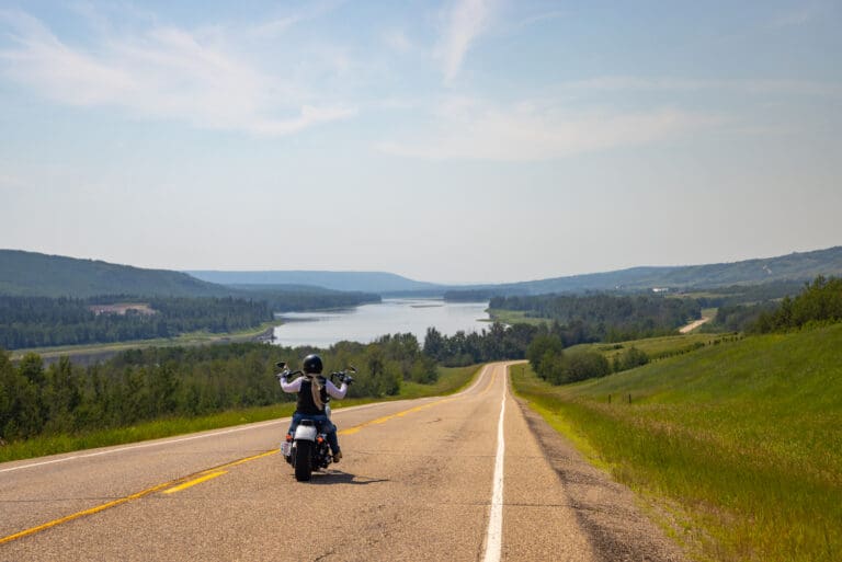
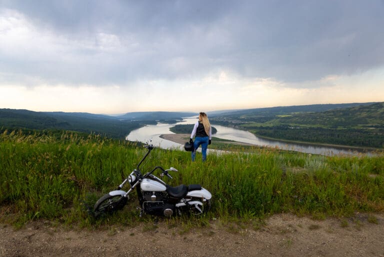
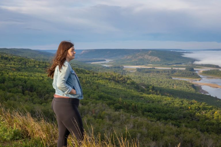
Enjoy the beauty of the Peace River and it’s valley by taking the short drive down the Shaftesbury Trail!
Running along side the Mighty Peace River for approximately 26km, the Shaftesbury Trail is one of the most scenic and interesting drives in the Peace region. Originally used by First Nations and Metis fur traders it is the location of several important historic sites. Start your tour on this paved and well maintained roadway either from Grimshaw going south on Highway 2, then taking secondary Highway 684 down into the valley or from Peace River, turn onto Highway 684, which can be accessed on the west side of the Peace River bridge. A relaxing and interesting adventure awaits! Along the way visit Fort Fork, MacKenzie Cairn as well as St. Augustine’s Mission. Stop for a picnic at Strong Creek Park and enjoy the stunning scenery and abundant wildlife! Continue on and visit the market gardens to see what’s in season! End your Shaftsbury Trail adventure with a ride on the Shaftesbury Ferry, the view of the river and surrounding hills is spectacular!
Getting There
From Grimshaw: go south on Highway 2, then take secondary Highway 684 down into the valley. From Peace River: turn onto Highway 684, which can be accessed on the west side of the Peace River bridge.
Mackenzie Cairn
It was 1793 when Sir Alexander Mackenzie, famed North American explorer, overwintered at Fort Fork before starting his transcontinental journey to the Pacific. The Mackenzie Cairn, built in 1929, honours both the Fort Fork trading post and the place where Mackenzie’s important journey began. This National Historic Site also provides a wonderful view of the Peace River, and an information kiosk offers detailed maps, drawings of the fort and early photos. Historic tours are available during the summer months.St. Augustine Mission Church
About 13 km southwest of the Town of Peace River, the St. Augustine Mission Church sits in a tranquil space in the valley. A Provincial Historic Site, St. Augustine Mission Church is the remains of the St. Augustine Mission, established in 1888. Tours of the church and grounds are available in the summer.Bridgeview Gardens
U-Pick berries and other vegetables. Call them at 780-624-1335.Fort McLeod
A historical site on the banks of the Peace River. Learn more about fur trade history with new interpretive signs, or visit the Peace River Museum, Archives and Mackenzie Centre for a more in-depth history.Strong Creek Park
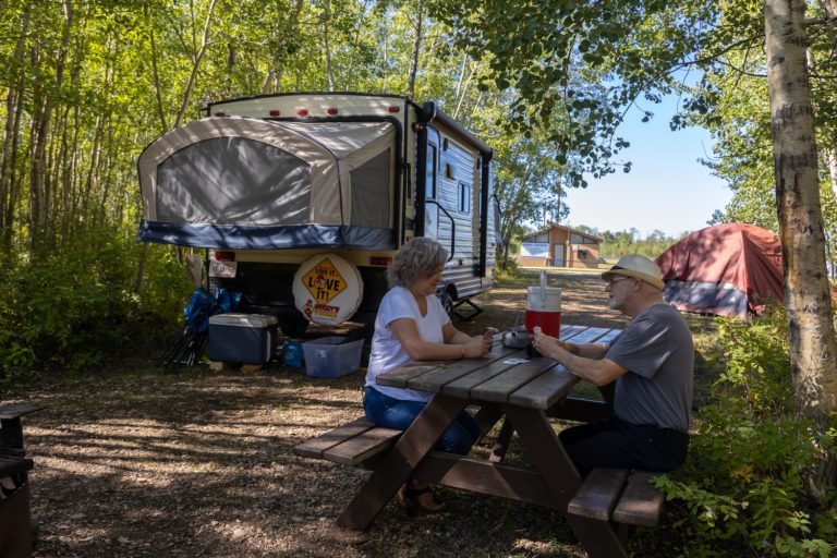
Free camping, kitchen shelter, water, fishing, hiking trails and playground, including a backstop and field for baseball/softball.Brick’s Hill
When driving from Hwy 2 near Grimshaw, take Brick’s Hill to take in the beauty of the valley floor. Named after original families owning river lots in the area, Brick’s Hill boasts an abundant landscape of agriculture and gardens. The hills are layered with history and evidence of the Cree and Beaver First Nations.Shaftesbury Ferry
A unique experience awaits at the Shaftesbury Ferry!This is one of only 6 ferries operated by Alberta Transportation in the entire province! The ferry is part of highway 740 and crosses the mighty Peace River linking the Shaftesbury Trail with the Tangent Park area. The length of the crossing is 325 metres and takes about 5 minutes. Enjoy spectacular river valley scenery during the crossing and keep your eyes open for the abundant wildlife that frequent this area. This experience is available May through the end of October, 7am to 11pm daily. The ferry is free of charge and can accommodate everything from foot traffic to large RV’s and motorcycles. Visit 511 Alberta for the most recent information about ferry operations.
Tangent Park
Tangent Park campground is located on the east bank of the river, just a ferry ride across from the Shaftesbury Trail. It offers full service sites, showers, group camping and horseback riding/hiking trails.Category: Circle Tour, Getting Here, Mighty Peace Essentials, Town of Peace River, M.D. of Peace, Sights & Experiences, and Things To DoAddress: 11510 Shaftesbury Trail
Peace River
Alberta
T8S 1P7
CanadaEnjoy the beauty of the Peace River and it’s valley by taking the short drive down the Shaftesbury Trail!
Running along side the Mighty Peace River for approximately 26km, the Shaftesbury Trail is one of the most scenic and interesting drives in the Peace region. Originally used by First Nations and Metis fur traders it is the location of several important historic sites. Start your tour on this paved and well maintained roadway either from Grimshaw going south on Highway 2, then taking secondary Highway 684 down into the valley or from Peace River, turn onto Highway 684, which can be accessed on the west side of the Peace River bridge. A relaxing and interesting adventure awaits! Along the way visit Fort Fork, MacKenzie Cairn as well as St. Augustine’s Mission. Stop for a picnic at Strong Creek Park and enjoy the stunning scenery and abundant wildlife! Continue on and visit the market gardens to see what’s in season! End your Shaftsbury Trail adventure with a ride on the Shaftesbury Ferry, the view of the river and surrounding hills is spectacular!
Getting There
From Grimshaw: go south on Highway 2, then take secondary Highway 684 down into the valley. From Peace River: turn onto Highway 684, which can be accessed on the west side of the Peace River bridge.
Mackenzie Cairn
It was 1793 when Sir Alexander Mackenzie, famed North American explorer, overwintered at Fort Fork before starting his transcontinental journey to the Pacific. The Mackenzie Cairn, built in 1929, honours both the Fort Fork trading post and the place where Mackenzie’s important journey began. This National Historic Site also provides a wonderful view of the Peace River, and an information kiosk offers detailed maps, drawings of the fort and early photos. Historic tours are available during the summer months.St. Augustine Mission Church
About 13 km southwest of the Town of Peace River, the St. Augustine Mission Church sits in a tranquil space in the valley. A Provincial Historic Site, St. Augustine Mission Church is the remains of the St. Augustine Mission, established in 1888. Tours of the church and grounds are available in the summer.Bridgeview Gardens
U-Pick berries and other vegetables. Call them at 780-624-1335.Fort McLeod
A historical site on the banks of the Peace River. Learn more about fur trade history with new interpretive signs, or visit the Peace River Museum, Archives and Mackenzie Centre for a more in-depth history.Strong Creek Park
Free camping, kitchen shelter, water, fishing, hiking trails and playground, including a backstop and field for baseball/softball.Brick’s Hill
When driving from Hwy 2 near Grimshaw, take Brick’s Hill to take in the beauty of the valley floor. Named after original families owning river lots in the area, Brick’s Hill boasts an abundant landscape of agriculture and gardens. The hills are layered with history and evidence of the Cree and Beaver First Nations.Shaftesbury Ferry
A unique experience awaits at the Shaftesbury Ferry!This is one of only 6 ferries operated by Alberta Transportation in the entire province! The ferry is part of highway 740 and crosses the mighty Peace River linking the Shaftesbury Trail with the Tangent Park area. The length of the crossing is 325 metres and takes about 5 minutes. Enjoy spectacular river valley scenery during the crossing and keep your eyes open for the abundant wildlife that frequent this area. This experience is available May through the end of October, 7am to 11pm daily. The ferry is free of charge and can accommodate everything from foot traffic to large RV’s and motorcycles. Visit 511 Alberta for the most recent information about ferry operations.
Tangent Park
Tangent Park campground is located on the east bank of the river, just a ferry ride across from the Shaftesbury Trail. It offers full service sites, showers, group camping and horseback riding/hiking trails. -
SavePlace Title: Sagitawa LookoutPlace Description:
The Sagitawa Lookout is located just south of the Town of Peace River on Hwy 744 in Northern Sunrise County. Sagitawa is a Cree word meaning “Where the rivers meet”. The Lookout has a spectacular view of the Town of Peace River and the confluence of the Peace, Smoky and Heart rivers. The Lookout is complete with picnic area and historical information.
Directions from Main Street Peace River:
Drive down Main Street ( 100 Street) to the bottom of Main, then turn left onto 102 Avenue. Follow this to 102 Avenue, turn right and cross the Heart River bridge. Turn left onto 104 Avenue and follow the Hwy 744 signs. The Lookout is located up the “Judah Hill”. Watch for lookout signage.
Category: Circle Tour, Northern Sunrise County, Outdoors, Places To See, Sights & Experiences, and Things To DoTags: Circle TourAddress: Alberta 744
Marie-Reine
Alberta
T0H 2N0
CanadaThe Sagitawa Lookout is located just south of the Town of Peace River on Hwy 744 in Northern Sunrise County. Sagitawa is a Cree word meaning “Where the rivers meet”. The Lookout has a spectacular view of the Town of Peace River and the confluence of the Peace, Smoky and Heart rivers. The Lookout is complete with picnic area and historical information.
Directions from Main Street Peace River:
Drive down Main Street ( 100 Street) to the bottom of Main, then turn left onto 102 Avenue. Follow this to 102 Avenue, turn right and cross the Heart River bridge. Turn left onto 104 Avenue and follow the Hwy 744 signs. The Lookout is located up the “Judah Hill”. Watch for lookout signage.
-
SavePlace Title: Nampa Sunrise CaféPlace Description:
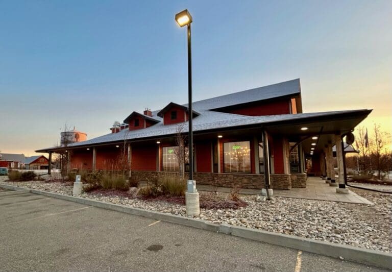
Conveniently located off the main highway in Nampa, the Nampa Sunrise Café is a one stop shop for mouthwatering meals, tantalizing treats, tasty appetizers, and so much more. With a wide range of menu items to pick from, you can choose from things such as freshly made salads, loaded burgers, donairs, quesadillas, fish tacos, pierogi platters, and even poutine. Extremely family friendly, they even have a large table equipped with a scavenger hunt for kids to enjoy. This bright, welcoming café is ready to provide you with great customer service and a cozy atmosphere to enjoy your next meal away from home. Stop in today and experience what they have to offer!
Category: Agricultural, Circle Tour, Entertainment & Nightlife, Farm Fresh Foods, Food & Drink, and Village of NampaAddress: 9902 102 Ave
Village of Nampa
Alberta
T0H 2R0
CanadaTelephone Number: (780) 322-2032Email: nampasunrisecafe@icloud.comConveniently located off the main highway in Nampa, the Nampa Sunrise Café is a one stop shop for mouthwatering meals, tantalizing treats, tasty appetizers, and so much more. With a wide range of menu items to pick from, you can choose from things such as freshly made salads, loaded burgers, donairs, quesadillas, fish tacos, pierogi platters, and even poutine. Extremely family friendly, they even have a large table equipped with a scavenger hunt for kids to enjoy. This bright, welcoming café is ready to provide you with great customer service and a cozy atmosphere to enjoy your next meal away from home. Stop in today and experience what they have to offer!
-
SavePlace Title: Figure Eight LakePlace Description:
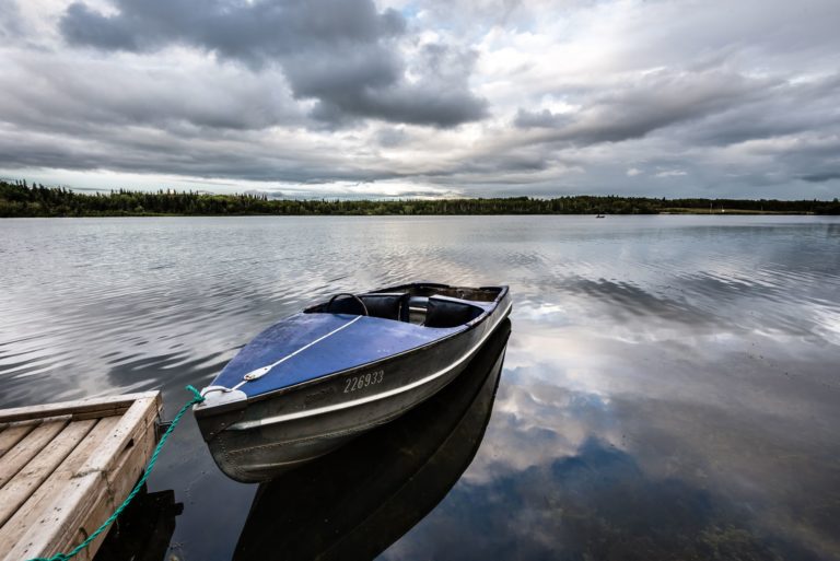
Figure Eight Lake Provincial Recreation Area is located 40 kilometers northwest of Peace River on Highway 737 in the County of Northern Lights. Figure Eight Lake takes its name from the shape it had before 1970 when the water level was low, in these earlier days the lake had two basins and resembled a figure eight.
Get There: Figure 8 Lake is 45 km west of Peace River on Highway 737.
GPS Lat/Long:
56.3007800, -117.909248
Category: Accommodations, Campgrounds, Circle Tour, Dark Sky Adventures, County of Northern Lights, and Parks & LakesAddress: Located 8 kilometers north of Grimshaw, then 20 km west on Highway 737.
MD of Peace
Alberta
T0H 1E0
CanadaTelephone Number: (780) 624-6486Figure Eight Lake Provincial Recreation Area is located 40 kilometers northwest of Peace River on Highway 737 in the County of Northern Lights. Figure Eight Lake takes its name from the shape it had before 1970 when the water level was low, in these earlier days the lake had two basins and resembled a figure eight.
Get There: Figure 8 Lake is 45 km west of Peace River on Highway 737.
GPS Lat/Long:
56.3007800, -117.909248
-
SavePlace Title: St. Isidore Museum & Cultural CentrePlace Description:
St. Isidore Museum & Cultural Centre – English
Situated in the quaint hamlet of St-Isidore, is a museum that depicts the storied heritage of the francophone community that left Quebec to establish itself in the Mighty Peace. In the museum, you’ll find costumes, pictures and artefacts that tell the story of hardships and victories. Also, theres a train car replica inside of the museum to help visualize the trek that the families had to make with their enormous families as well as with their livestock.
St. Isidore Museum & Cultural Centre – French
Situé dans le pittoresque hameau de St-Isidore, ce musée présente l’héritage historique de la communauté francophone qui a permis au gens du Québec de s’établir au sein de la région de Rivière-de-la-Paix. Dans le musée, vous trouverez des costumes, des images et des artefacts qui racontent l’histoire des épreuves et des victoires. De plus, il y a une réplique d’un wagon de train à l’intérieur du musée pour aider à visualiser le trek que les familles devaient faire avec leur famille et avec leur bétail. Nous accueillons tout le monde, même si vous ne parlez pas français.
Tisserandes De St. Isidore (St. Isidore Weavers)
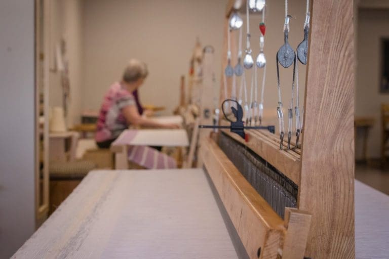
Weaving is an ancient art!
At the Centre Culturel de St-Isidore the St. Isidore Weavers share their talents and perpetuates the traditional arts and crafts of their ancestors. Stop by and admire or take home a piece of their work.
Hours Of Operation:
- Monday – Thursday, 9:00am -4:30pm
- Fridays – Call (780)624-8481
Category: Agricultural, Arts & Culture, Attractions, Library, Museums, Places To See, Shopping, and Town of Saint IsidoreTags: Circle Tour Contest, Edu-vacation, Francophone Circle Tour, and Northern Sunrise County DestinationAddress: Bouchard Road
Saint Isidore
Alberta
T0H 3B0
CanadaTelephone Number: (780) 624-8481Email: explorestisidore@gmail.comSt. Isidore Museum & Cultural Centre – English
Situated in the quaint hamlet of St-Isidore, is a museum that depicts the storied heritage of the francophone community that left Quebec to establish itself in the Mighty Peace. In the museum, you’ll find costumes, pictures and artefacts that tell the story of hardships and victories. Also, theres a train car replica inside of the museum to help visualize the trek that the families had to make with their enormous families as well as with their livestock.
St. Isidore Museum & Cultural Centre – French
Situé dans le pittoresque hameau de St-Isidore, ce musée présente l’héritage historique de la communauté francophone qui a permis au gens du Québec de s’établir au sein de la région de Rivière-de-la-Paix. Dans le musée, vous trouverez des costumes, des images et des artefacts qui racontent l’histoire des épreuves et des victoires. De plus, il y a une réplique d’un wagon de train à l’intérieur du musée pour aider à visualiser le trek que les familles devaient faire avec leur famille et avec leur bétail. Nous accueillons tout le monde, même si vous ne parlez pas français.
Tisserandes De St. Isidore (St. Isidore Weavers)
Weaving is an ancient art!
At the Centre Culturel de St-Isidore the St. Isidore Weavers share their talents and perpetuates the traditional arts and crafts of their ancestors. Stop by and admire or take home a piece of their work.
Hours Of Operation:
- Monday – Thursday, 9:00am -4:30pm
- Fridays – Call (780)624-8481
-
SavePlace Title: Nampa and District Museum and Tourist Information CenterPlace Description:
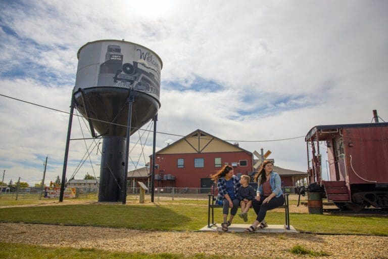
Explore the legendary Mighty Peace, from the fur trade to modern times, through the exhibits at our museum. Discover Nampa and Northern Sunrise County’s historic multicultural roots by following the steps of those who ventured to Canada’s northern-most homesteading area, across the Grouard Trail and onto the railways that took people from all over the world through muskeg to the Mighty Peace Country. Learn about local industries, about farming, about traditional ways as we guide you through the indoor and outdoor exhibits and buildings. With displays on two floors open year round and outdoor exhibits accessible from May to September, the Nampa and District Museum is more than worth a gander.
Major attractions include:
- The original water tank built by the Central Canada Railway to which Nampa owes its very own existence;
- Our old-time boardwalk of shops and businesses from the early to mid 1900’s;
- Our taxidermy exhibits, showing off local wildlife in the area
- The Rucka settlement house (circa 1937)
- Reno’s Ukrainian Catholic Church (circa 1946)
And so much more.
Hours of Operation
- June 1st to August 31st – 10 am to 5 pm / 7 days a week
- September 1st to May 31st – 10 am to 5 pm / Monday to Friday
- Admission: Seniors 65+ $3, Family $15, Adults $7, Students/children attending school $3, Children under 6 Free
Category: Agricultural, Arts & Culture, Circle Tour, Gift Shops & Other, Motorcycle Tours, Museums, Northern Sunrise County, Places To See, Shopping, Things To Do, and Village of NampaAddress: 9902 102 Avenue
Nampa
Alberta
T0H 2R0
CanadaTelephone Number: (780) 322-2777Email: nampamuseum@gmail.comExplore the legendary Mighty Peace, from the fur trade to modern times, through the exhibits at our museum. Discover Nampa and Northern Sunrise County’s historic multicultural roots by following the steps of those who ventured to Canada’s northern-most homesteading area, across the Grouard Trail and onto the railways that took people from all over the world through muskeg to the Mighty Peace Country. Learn about local industries, about farming, about traditional ways as we guide you through the indoor and outdoor exhibits and buildings. With displays on two floors open year round and outdoor exhibits accessible from May to September, the Nampa and District Museum is more than worth a gander.
Major attractions include:
- The original water tank built by the Central Canada Railway to which Nampa owes its very own existence;
- Our old-time boardwalk of shops and businesses from the early to mid 1900’s;
- Our taxidermy exhibits, showing off local wildlife in the area
- The Rucka settlement house (circa 1937)
- Reno’s Ukrainian Catholic Church (circa 1946)
And so much more.
Hours of Operation
- June 1st to August 31st – 10 am to 5 pm / 7 days a week
- September 1st to May 31st – 10 am to 5 pm / Monday to Friday
- Admission: Seniors 65+ $3, Family $15, Adults $7, Students/children attending school $3, Children under 6 Free
-
SavePlace Title: The Green GoddessPlace Description:
The Green Goddess is a small local business that creates truly natural skincare and wellness products for the whole family. As a passionate herbalist and aspiring homesteader who loves serving her community, Sarah is often found at our local Farmer’s Market, chatting with customers while selling her handcrafted creations. Inspired by her love of people and the planet, her vast product collection features only the highest quality organic and ethically sourced ingredients. Some of her most beloved products by the community, like her plantain salve, include acreage-grown or wildcrafted plants found right here in the Peace Country.
Beyond her beloved product line, Sarah is also a passionate teacher who offers a variety of fun and educational workshops at her beautiful acreage studio. From crafting skincare to blending herbal teas or learning how to make traditional medicines like elderberry syrup, Sarah inspires her guests to take their wellness into their own hands by creating safe and natural products for themselves and their families. She dreams of converting their acreage into a botanical garden destination and offering garden tours featuring local and medicinal plants. Be sure to follow The Green Goddess as she works towards becoming an official tourist destination in the north!
The Green Goddess Studio is located 20 minutes from Peace River: Take Highway 2 south to Nampa, and just before Nampa, turn left on South Harmon Valley Road for 11 km. Turn right on Range Road 195; the studio is located on the first acreage on the left.
View our Q&A with the Green Goddess Studio >
Workshops:
All workshops can be found here.
- The Art of Fire Cider: Herbal Immunity Workshop – November 1st at 1:00pm
- Stocking Stuffer Workshop: Tasty Tea-Making Edition – November 5th at 6:30pm
- The Magic of Elderberry: Immune Support Workshop – November 9th at 1:00pm
- Alchemy of Garlic: Food as Medicine Workshop – November 21st at 6:30pm
- Stocking Stuffer Workshop: Natural Skincare Edition – November 23rd at 1:00pm
- The Magic of Elderberry: Immune Support Workshop – December 5th at 6:30pm
- Stocking Stuffer Workshop: Tasty Tea-Making Edition – December 7th at 1:00pm
- The Art of Bone Broth: Pressure Canning for Nourishment and Confidence – December 11th at 6:30pm
- Stocking Stuffer Workshop: Natural Skincare Edition – December 14th at 1:00pm
- The Power of Echinacea: Herbal Tincture Workshop – December 16th at 6:30pm
Address: 81527, Range Rd 195
Nampa
Alberta
CanadaTelephone Number: (780) 625-1710Email: sarah@iamthegreengoddess.comThe Green Goddess is a small local business that creates truly natural skincare and wellness products for the whole family. As a passionate herbalist and aspiring homesteader who loves serving her community, Sarah is often found at our local Farmer’s Market, chatting with customers while selling her handcrafted creations. Inspired by her love of people and the planet, her vast product collection features only the highest quality organic and ethically sourced ingredients. Some of her most beloved products by the community, like her plantain salve, include acreage-grown or wildcrafted plants found right here in the Peace Country.
Beyond her beloved product line, Sarah is also a passionate teacher who offers a variety of fun and educational workshops at her beautiful acreage studio. From crafting skincare to blending herbal teas or learning how to make traditional medicines like elderberry syrup, Sarah inspires her guests to take their wellness into their own hands by creating safe and natural products for themselves and their families. She dreams of converting their acreage into a botanical garden destination and offering garden tours featuring local and medicinal plants. Be sure to follow The Green Goddess as she works towards becoming an official tourist destination in the north!
The Green Goddess Studio is located 20 minutes from Peace River: Take Highway 2 south to Nampa, and just before Nampa, turn left on South Harmon Valley Road for 11 km. Turn right on Range Road 195; the studio is located on the first acreage on the left.
View our Q&A with the Green Goddess Studio >
Workshops:
All workshops can be found here.
- The Art of Fire Cider: Herbal Immunity Workshop – November 1st at 1:00pm
- Stocking Stuffer Workshop: Tasty Tea-Making Edition – November 5th at 6:30pm
- The Magic of Elderberry: Immune Support Workshop – November 9th at 1:00pm
- Alchemy of Garlic: Food as Medicine Workshop – November 21st at 6:30pm
- Stocking Stuffer Workshop: Natural Skincare Edition – November 23rd at 1:00pm
- The Magic of Elderberry: Immune Support Workshop – December 5th at 6:30pm
- Stocking Stuffer Workshop: Tasty Tea-Making Edition – December 7th at 1:00pm
- The Art of Bone Broth: Pressure Canning for Nourishment and Confidence – December 11th at 6:30pm
- Stocking Stuffer Workshop: Natural Skincare Edition – December 14th at 1:00pm
- The Power of Echinacea: Herbal Tincture Workshop – December 16th at 6:30pm
-
SavePlace Title: Falher Municipal CampgroundPlace Description:
Reconnect with nature this summer, kick back and relax at the Falher Municipal Campground. This cozy campground offers 30 powered sites as well as washrooms with showers for visitors traveling in the beautiful Smoky River region. Enjoy the convenience of town water for RV refills and a sanitary disposal system. Larger groups may book the powered shelter building complete with a wood stove. There’s something for everyone to enjoy, take a stroll, discover the campground’s play area or relax with a good book. Explore some of the attractions in the Town of Falher as well, the campground is within walking distance of the regional outdoor pool, the Splash Park, and the Honey Capital Park! End the day with an evening of stargazing and great conversation around the campfire (firewood is free!)
The campground is open from May 1st to September 30th.
Fees Power No Power
Nightly $30.00 $25.00
Weekly $200.00 $170.00
Day Use: Free (no firewood)
Group Camping: $60.00/day (Shelter/if required) + $25.00/unit/day (overflow no power) + $200.00 Damage Deposit
Shelter: $60.00/day+ $200 Damage Deposit
Non-Registered Campers: Water or Sewer: $5.00, Shower: $3.00Special Rates Apply During Honey Fest
For camping site reservations, please contact our Campground Attendant – 780-837-6326.
Get there: Just off of Highway 49 on the South end of the Town of Falher – behind the Bumper to Bumper.
Category: CampgroundsAddress: Town of Falher
Falher
Alberta
T0H 1M0
CanadaTelephone Number: 780-837-6326Email: vmarcoux@falher.caReconnect with nature this summer, kick back and relax at the Falher Municipal Campground. This cozy campground offers 30 powered sites as well as washrooms with showers for visitors traveling in the beautiful Smoky River region. Enjoy the convenience of town water for RV refills and a sanitary disposal system. Larger groups may book the powered shelter building complete with a wood stove. There’s something for everyone to enjoy, take a stroll, discover the campground’s play area or relax with a good book. Explore some of the attractions in the Town of Falher as well, the campground is within walking distance of the regional outdoor pool, the Splash Park, and the Honey Capital Park! End the day with an evening of stargazing and great conversation around the campfire (firewood is free!)
The campground is open from May 1st to September 30th.
Fees Power No Power
Nightly $30.00 $25.00
Weekly $200.00 $170.00
Day Use: Free (no firewood)
Group Camping: $60.00/day (Shelter/if required) + $25.00/unit/day (overflow no power) + $200.00 Damage Deposit
Shelter: $60.00/day+ $200 Damage Deposit
Non-Registered Campers: Water or Sewer: $5.00, Shower: $3.00Special Rates Apply During Honey Fest
For camping site reservations, please contact our Campground Attendant – 780-837-6326.
Get there: Just off of Highway 49 on the South end of the Town of Falher – behind the Bumper to Bumper.
-
SavePlace Title: Richardson Pioneer Spray ParkPlace Description:
Cool off and have fun on a warm summer day at the Richardson Pioneer Splash Park. Several fun and exciting water features provide hours of active entertainment for all ages!
Get There: Located in the Town of Falher at #018 Central Avenue NW, beside the Falher Regional Recreation Complex. Open seven days a week 10am to 8pm.
Category: Splash & PlayAddress: #018 Central Avenue NW
Falher
Alberta
T0H 1M0
CanadaTelephone Number: (780) 837-2247Email: vmarcoux@falher.caCool off and have fun on a warm summer day at the Richardson Pioneer Splash Park. Several fun and exciting water features provide hours of active entertainment for all ages!
Get There: Located in the Town of Falher at #018 Central Avenue NW, beside the Falher Regional Recreation Complex. Open seven days a week 10am to 8pm.
-
SavePlace Title: Haig LakePlace Description:
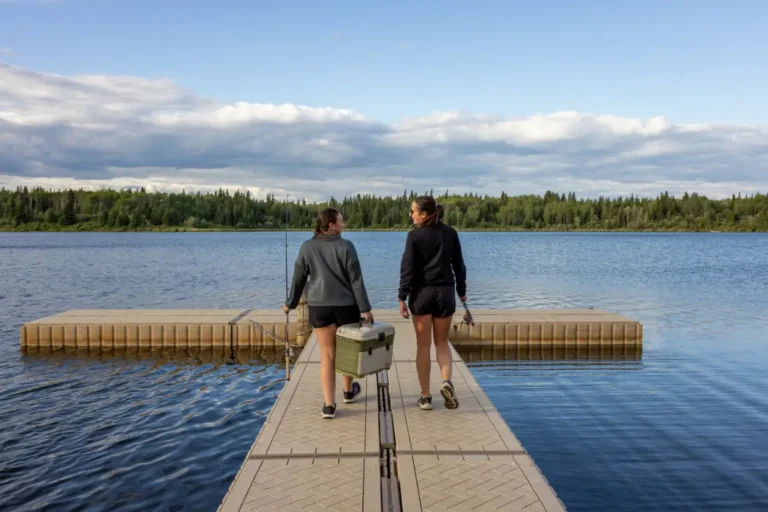
Known for fantastic fishing with a gorgeous backdrop, Haig Lake is worth the drive. Located in the Woodland Cree First Nation, this 881.8ha lake has pickerel, whitefish and jackfish. If you don’t feel like fishing, you can enjoy the day on your motorized boat, canoe, paddleboard or kayak. Nestled in pristine backcountry, the peace and tranquillity experienced here are second to none. They also have eight unserviced camping sites, firepits, picnic tables, a hiking trail and excellent cell phone service if you need to stay connected.
Get there: Take Highway 743 north to highway 986, turn left onto Township Road 871A. Haig Lake is approximately 1.5 hours northeast of Peace River.
Tags: Must-See FishingAddress: Haig Lake
Woodland Cree First Nation
Alberta
CanadaTelephone Number: (780) 629-3803Known for fantastic fishing with a gorgeous backdrop, Haig Lake is worth the drive. Located in the Woodland Cree First Nation, this 881.8ha lake has pickerel, whitefish and jackfish. If you don’t feel like fishing, you can enjoy the day on your motorized boat, canoe, paddleboard or kayak. Nestled in pristine backcountry, the peace and tranquillity experienced here are second to none. They also have eight unserviced camping sites, firepits, picnic tables, a hiking trail and excellent cell phone service if you need to stay connected.
Get there: Take Highway 743 north to highway 986, turn left onto Township Road 871A. Haig Lake is approximately 1.5 hours northeast of Peace River.
-
SavePlace Title: Honey Capital ParkPlace Description:
The kids will be happy for hours at the Honey Capital Park! This bee themed fun haven for kids has a water splash park (sponsored by Richardson), a 27-foot slide, a four-story beehive structure to play on, a toddler park, and a soccer net. It’s perfect for a playdate, picnic or family get-together.
Get there: Honey Capital Park is located in Falher, just off Mainstreet next door to the Falher Regional Recreation Complex.
Address: #018 Central Ave. NW, Falher, AB T0H 1M0
Falher
Alberta
T0H 1M0
CanadaTelephone Number: (780) 837-2247The kids will be happy for hours at the Honey Capital Park! This bee themed fun haven for kids has a water splash park (sponsored by Richardson), a 27-foot slide, a four-story beehive structure to play on, a toddler park, and a soccer net. It’s perfect for a playdate, picnic or family get-together.
Get there: Honey Capital Park is located in Falher, just off Mainstreet next door to the Falher Regional Recreation Complex.
-
SavePlace Title: World's Largest BeePlace Description:
Did you know that Falher is home to the world’s largest bee statue? This stunning structure was created in 1990 by a local welder, Richard Ethier and sits proudly on display 20 feet in the air in the heart of downtown Falher. Be sure to take a selfie with the bee and read up on the historical information displayed on site.
Get there: Falher is located 37 km north of Nampa on Highway 2.
Address: 1 3 Ave SE, Falher, AB T0H 1M0
Falher
Alberta
T0H 1M0
CanadaTelephone Number: (780) 837-2247Did you know that Falher is home to the world’s largest bee statue? This stunning structure was created in 1990 by a local welder, Richard Ethier and sits proudly on display 20 feet in the air in the heart of downtown Falher. Be sure to take a selfie with the bee and read up on the historical information displayed on site.
Get there: Falher is located 37 km north of Nampa on Highway 2.
-
SavePlace Title: High Prairie and District Golf ClubPlace Description:
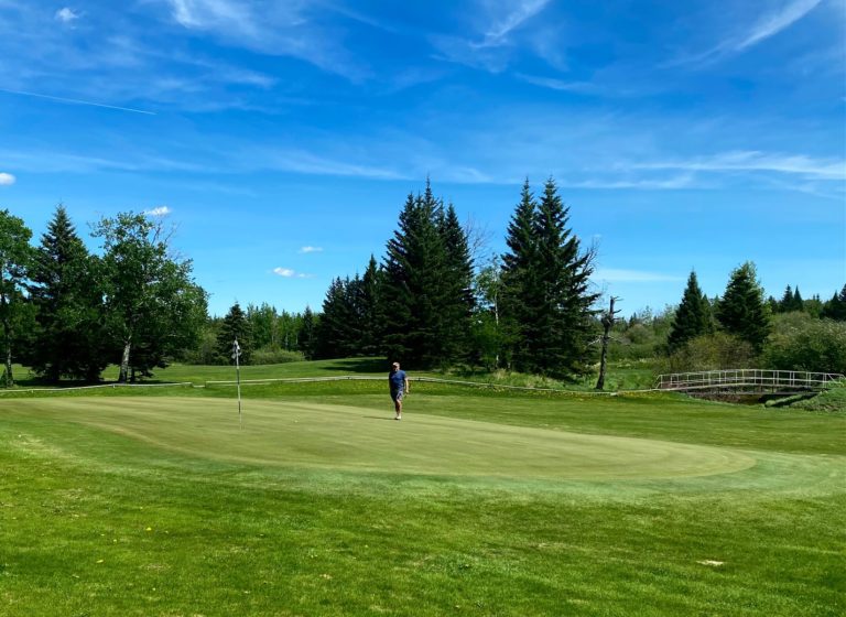
Get ready to enjoy some incredible moments while discovering one of the most enjoyable golf courses in northwest Alberta. The High Prairie & District Golf Club is a friendly and welcoming par 36 course with a pro shop, that offers 9 beautiful holes for enjoyment by experienced as well as novice golfers. This scenic, spacious, and immaculately maintained course known for its excellent greens, is located just 7km west of the Town of High Prairie. Designed for maximum enjoyment regardless of your golfing abilities, this course welcomes beginners and offers a challenge for the low handicapper. The Iroquois Creek meanders through the course coming into play on five holes offering visitors some stunning views and challenging shots! The island green on hole #5 will get even the most seasoned golfer’s blood pumping! After a great day of golf, relax on the spacious patio and enjoy refreshments from the fully licensed restaurant and lounge.
Tournaments
- May 30th: 2 Man Scramble Flighted Scramble
- June 20th: 2×4 Ball Flighted Scramble
- August 8th & 9th: High Prairie Open
- August 23rd: Fall 4 Person Flighted Scramble
- September 19th: Club Championship including Sr/Jr Championship & AGM
Address: High Prairie (town)
High Prairie
Alberta
T0G 1E0
CanadaTelephone Number: (780) 523-2696Email: highprairiegolf@gmail.comGet ready to enjoy some incredible moments while discovering one of the most enjoyable golf courses in northwest Alberta. The High Prairie & District Golf Club is a friendly and welcoming par 36 course with a pro shop, that offers 9 beautiful holes for enjoyment by experienced as well as novice golfers. This scenic, spacious, and immaculately maintained course known for its excellent greens, is located just 7km west of the Town of High Prairie. Designed for maximum enjoyment regardless of your golfing abilities, this course welcomes beginners and offers a challenge for the low handicapper. The Iroquois Creek meanders through the course coming into play on five holes offering visitors some stunning views and challenging shots! The island green on hole #5 will get even the most seasoned golfer’s blood pumping! After a great day of golf, relax on the spacious patio and enjoy refreshments from the fully licensed restaurant and lounge.
Tournaments
- May 30th: 2 Man Scramble Flighted Scramble
- June 20th: 2×4 Ball Flighted Scramble
- August 8th & 9th: High Prairie Open
- August 23rd: Fall 4 Person Flighted Scramble
- September 19th: Club Championship including Sr/Jr Championship & AGM
-
SavePlace Title: Judah HillPlace Description:
Judah Hill provides stunning views of the Land of the Mighty Peace and leads to one of Peace River’s most incredible and historical lookout points – Sagitawa Lookout.
Get There: Drive down Main Street (100 Street) to the bottom of Main, then turn left onto 102 Avenue. Follow this to 102 Avenue, turn right and cross the Heart River bridge. Turn left onto 104 Avenue and follow the Hwy 744 signs.
Address: Judah Hill Road, South End
Peace River
Peace River
T8S 1Y7
CanadaJudah Hill provides stunning views of the Land of the Mighty Peace and leads to one of Peace River’s most incredible and historical lookout points – Sagitawa Lookout.
Get There: Drive down Main Street (100 Street) to the bottom of Main, then turn left onto 102 Avenue. Follow this to 102 Avenue, turn right and cross the Heart River bridge. Turn left onto 104 Avenue and follow the Hwy 744 signs.
-
SavePlace Title: Black Swan HelicoptersPlace Description:
What does the Peace Country look like from the air? Find out with a thrilling helicopter tour with Black Swan Helicopters. You will be in awe of the beauty of the valley and the rich landscapes of the Peace region with 360-degree views.
During a Black Swan Helicopter Tour, passengers experience the incredible feeling of lifting-off and flying (which feels more like floating) through the low-level air, surrounded by beautiful topography that makes the Peace Region one of the most beautiful places in Northern Alberta. It will be hard putting your camera down; the view of the river valley and surrounding landscapes are absolutely breathtaking.
The once-in-a-lifetime experience is popular among residents and visitors to the area. Guests can request to fly over specific areas or choose the awe-inspiring Smoky River Tour, where passengers get up-close views of the Smoky River and the surrounding region. Tours are available all year round and cost $500 for a half-hour (with a maximum of 4 passengers).
In addition to providing tour services in the region, the company transports firefighters, cargo and equipment to fire sites and provides essential support to extinguish fires and limit fire expansion. Black Swan also transports visiting biologists performing research in the area.
Black Swan Helicopters is located in Berwyn, Alberta, serving the region since 2003.
Category: Guided AdventureTags: MD of Peace Do Not MissAddress: 50 Avenue, Berwyn
Berwyn
Alberta
T0H 0E0
CanadaTelephone Number: (780) 338-2964What does the Peace Country look like from the air? Find out with a thrilling helicopter tour with Black Swan Helicopters. You will be in awe of the beauty of the valley and the rich landscapes of the Peace region with 360-degree views.
During a Black Swan Helicopter Tour, passengers experience the incredible feeling of lifting-off and flying (which feels more like floating) through the low-level air, surrounded by beautiful topography that makes the Peace Region one of the most beautiful places in Northern Alberta. It will be hard putting your camera down; the view of the river valley and surrounding landscapes are absolutely breathtaking.
The once-in-a-lifetime experience is popular among residents and visitors to the area. Guests can request to fly over specific areas or choose the awe-inspiring Smoky River Tour, where passengers get up-close views of the Smoky River and the surrounding region. Tours are available all year round and cost $500 for a half-hour (with a maximum of 4 passengers).
In addition to providing tour services in the region, the company transports firefighters, cargo and equipment to fire sites and provides essential support to extinguish fires and limit fire expansion. Black Swan also transports visiting biologists performing research in the area.
Black Swan Helicopters is located in Berwyn, Alberta, serving the region since 2003.
-
SavePlace Title: Western Budget MotelPlace Description:
If you are looking for a home away from home or a quick overnight stay in Peace River, the Western Budget Motel is an excellent choice for you.
Guests can choose a single, double, kitchenette, or jacuzzi room, which all come outfitted with a full-size fridge, flat-screen TV and free high-speed internet. Are you bringing your furry family member? No worries, the Western Budget Motel also has a few pet-friendly rooms.
Not only is this motel comfy, clean, and affordable, there is a restaurant, lounge and hair salon on site. The location couldn’t get better being situated on Peace River’s west hill, only steps away from a large grocery store and a gas station. And if you rely on your Tim Horton’s coffee fix in the morning, you’re covered – it’s located right across the street in the Peace River square.’
Make sure you check out Northern Roots Grill and Bar that is located inside Western Budget. Try your luck at one of the VLT machines!
While you are here, be sure to check out all the beauty and attractions the Town of Peace River and surrounding areas have to offer – you won’t be disappointed.
Address: 7701 100 Avenue
Peace River
Alberta
T8S 1M5
CanadaTelephone Number: (780) 624-3445If you are looking for a home away from home or a quick overnight stay in Peace River, the Western Budget Motel is an excellent choice for you.
Guests can choose a single, double, kitchenette, or jacuzzi room, which all come outfitted with a full-size fridge, flat-screen TV and free high-speed internet. Are you bringing your furry family member? No worries, the Western Budget Motel also has a few pet-friendly rooms.
Not only is this motel comfy, clean, and affordable, there is a restaurant, lounge and hair salon on site. The location couldn’t get better being situated on Peace River’s west hill, only steps away from a large grocery store and a gas station. And if you rely on your Tim Horton’s coffee fix in the morning, you’re covered – it’s located right across the street in the Peace River square.’
Make sure you check out Northern Roots Grill and Bar that is located inside Western Budget. Try your luck at one of the VLT machines!
While you are here, be sure to check out all the beauty and attractions the Town of Peace River and surrounding areas have to offer – you won’t be disappointed.
-
SavePlace Title: Northern Alberta Historical Railway MuseumPlace Description:
Engaging indoor and outdoor exhibits beckon visitors to explore this museum located on the northwest side of McLennan on Hwy 2. This carefully curated collection of artifacts from the pioneer days of northern Alberta are artfully displayed within historic buildings such as a NAR station, hospital, a store as well as a church, school and a library. Visitors are sure to discover one-of-a kind displays that will educate and inspire!
Open May – August. Outdoor exhibits open year-round.
For Information call – 780-827-1292 or 780-925-0405
Category: McLennanTags: Edu-vacationAddress: 3 Avenue N
McLennan
Alberta
T0H 2L0
CanadaTelephone Number: 780-925-0405Engaging indoor and outdoor exhibits beckon visitors to explore this museum located on the northwest side of McLennan on Hwy 2. This carefully curated collection of artifacts from the pioneer days of northern Alberta are artfully displayed within historic buildings such as a NAR station, hospital, a store as well as a church, school and a library. Visitors are sure to discover one-of-a kind displays that will educate and inspire!
Open May – August. Outdoor exhibits open year-round.
For Information call – 780-827-1292 or 780-925-0405
-
SavePlace Title: McLennan Municipal Kimiwan CampgroundPlace Description:
A warm welcome awaits visitors at the Kimiwan Lake Municipal Campground in the Town of McLennan. This campground is conveniently located within town limits for visitors to access amenities like groceries, laundromat services and fuel. Visitors can self-register before choosing one of the 18 available sites. Choose a serviced or non-serviced site, both have fire pits and picnic tables, and prepare to enjoy a relaxing stay in this beautiful area. There is also an inviting day use area for an impromptu picnic and a fully stocked pond for fishing. This is the perfect spot to set off from and explore the nearby Kimiwan Lake Bird Walk and Interpretive Centre as well as the Railway Museum. There’s something for everyone with The Smoky River Regional Golf Course nearby for those interested in hitting the links! Little campers will also enjoy the playground and wooden train play centre as well as the catch and release fish pond that is within the campground area. Campers will also find a shelter with a cook stove, washrooms, showers, sewage disposal, town water and free firewood are all available to make their stay more comfortable. The campground is open May 1st – September 30th.
For more information contact the McLennan town office at 780-324-3065.
2022 Camping Fees 12 Power Sites (30 amp)
$30/night
$150/week
$550/month6 Non-Service Sites
$20/night
$120/week
$450/monthGroup rate is $200/night, to book all 18 stalls for private functions.
Address: Bousfield Avenue
McLennan
Alberta
T0H 2L0
CanadaTelephone Number: 780-324-3065A warm welcome awaits visitors at the Kimiwan Lake Municipal Campground in the Town of McLennan. This campground is conveniently located within town limits for visitors to access amenities like groceries, laundromat services and fuel. Visitors can self-register before choosing one of the 18 available sites. Choose a serviced or non-serviced site, both have fire pits and picnic tables, and prepare to enjoy a relaxing stay in this beautiful area. There is also an inviting day use area for an impromptu picnic and a fully stocked pond for fishing. This is the perfect spot to set off from and explore the nearby Kimiwan Lake Bird Walk and Interpretive Centre as well as the Railway Museum. There’s something for everyone with The Smoky River Regional Golf Course nearby for those interested in hitting the links! Little campers will also enjoy the playground and wooden train play centre as well as the catch and release fish pond that is within the campground area. Campers will also find a shelter with a cook stove, washrooms, showers, sewage disposal, town water and free firewood are all available to make their stay more comfortable. The campground is open May 1st – September 30th.
For more information contact the McLennan town office at 780-324-3065.
2022 Camping Fees 12 Power Sites (30 amp)
$30/night
$150/week
$550/month6 Non-Service Sites
$20/night
$120/week
$450/monthGroup rate is $200/night, to book all 18 stalls for private functions.
-
SavePlace Title: Kimiwan Lake Bird WalkPlace Description:
Come explore one of the must-see birding destinations in the Peace Region, the Kimiwan Bird Walk. This area in McLennan is indisputably one of the premier waterfowl sighting areas in North America. The Interpretive Centre is open May through October and will lend you a pair of binoculars to get a close-up view of wildlife.
The first portion of the self-guided Bird Walk is a hard-packed gravel walking trail of approximately 300 m which circles around a wetland and leads you to the wooden portion of the walkway. Walk slowly and quietly to have the best chance to observe some really interesting bird behaviour. Be sure to check out each “Watchable Wildlife Fact” sign which highlights a specific bird that is common to the site.
The wooden portion of the walkway takes you approximately 400 m out towards the main lake and over shallow water. Each step you take can result in a different sighting or bird behaviour. Walk past a second small wetland and then proceed out into the lake. There are three decks along the wooden walkway stretch, each with a picnic table and a garbage can. At the last deck and furthest into the lake, there is a viewing scope for your pleasure. Experience the excitement of spotting a variety of waterfowl species coming in for a smooth landing on the water or a red winged blackbird perched on a cattail. Listen for the sweet song of a thrush or witness the hunting prowess of a bald eagle! Nothing compares to the wild and wide-open spaces of the north.
Allow yourself at least 30 minutes to complete the bird walk. Kimiwan Lake hosts 1000s of migratory birds per day during the migratory seasons and hundreds of other bird species can be seen throughout the summer season. Exploration is worthwhile all year long as other wild life is often spotted during the winter months as well.
Tags: McLennan WinterAddress: Bousfield Avenue
McLennan
Alberta
T0H 2L0
CanadaCome explore one of the must-see birding destinations in the Peace Region, the Kimiwan Bird Walk. This area in McLennan is indisputably one of the premier waterfowl sighting areas in North America. The Interpretive Centre is open May through October and will lend you a pair of binoculars to get a close-up view of wildlife.
The first portion of the self-guided Bird Walk is a hard-packed gravel walking trail of approximately 300 m which circles around a wetland and leads you to the wooden portion of the walkway. Walk slowly and quietly to have the best chance to observe some really interesting bird behaviour. Be sure to check out each “Watchable Wildlife Fact” sign which highlights a specific bird that is common to the site.
The wooden portion of the walkway takes you approximately 400 m out towards the main lake and over shallow water. Each step you take can result in a different sighting or bird behaviour. Walk past a second small wetland and then proceed out into the lake. There are three decks along the wooden walkway stretch, each with a picnic table and a garbage can. At the last deck and furthest into the lake, there is a viewing scope for your pleasure. Experience the excitement of spotting a variety of waterfowl species coming in for a smooth landing on the water or a red winged blackbird perched on a cattail. Listen for the sweet song of a thrush or witness the hunting prowess of a bald eagle! Nothing compares to the wild and wide-open spaces of the north.
Allow yourself at least 30 minutes to complete the bird walk. Kimiwan Lake hosts 1000s of migratory birds per day during the migratory seasons and hundreds of other bird species can be seen throughout the summer season. Exploration is worthwhile all year long as other wild life is often spotted during the winter months as well.
-
SavePlace Title: McLennan Lake Shore Walking TrailsPlace Description:
Explore the lakeshore of Lake Kimiwan and all of its many species of wildlife along the paved walking trails established by the McLennan Recreation and Leisure Society. Discover the new covered bridge as well as the many ponds and trees along the trail that the wild waterfowl enjoy throughout the season. Run, walk or bike these trails, it’s a great way to get out with family, friends and pets to enjoy the natural beauty of the area. Memorial benches can be found along the trail to take a break and let nature rejuvenate and inspire you. The trails have been built wide and smooth enough to encourage everyone from tiny walkers to those requiring the assistance of a wheelchair to participate in some great outdoor activity.
Category: McLennanAddress: Bousfield Avenue
McLennan
Alberta
T0H 2L0
CanadaExplore the lakeshore of Lake Kimiwan and all of its many species of wildlife along the paved walking trails established by the McLennan Recreation and Leisure Society. Discover the new covered bridge as well as the many ponds and trees along the trail that the wild waterfowl enjoy throughout the season. Run, walk or bike these trails, it’s a great way to get out with family, friends and pets to enjoy the natural beauty of the area. Memorial benches can be found along the trail to take a break and let nature rejuvenate and inspire you. The trails have been built wide and smooth enough to encourage everyone from tiny walkers to those requiring the assistance of a wheelchair to participate in some great outdoor activity.