No Records Found
Sorry, no records were found. Please adjust your search criteria and try again.
Google Map Not Loaded
Sorry, unable to load Google Maps API.
-
SavePlace Title: Stoney LakePlace Description:
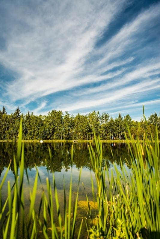
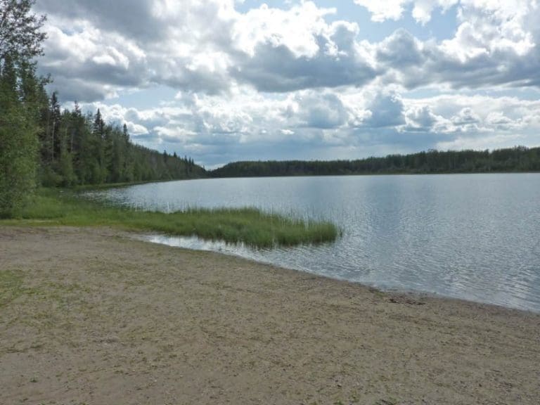
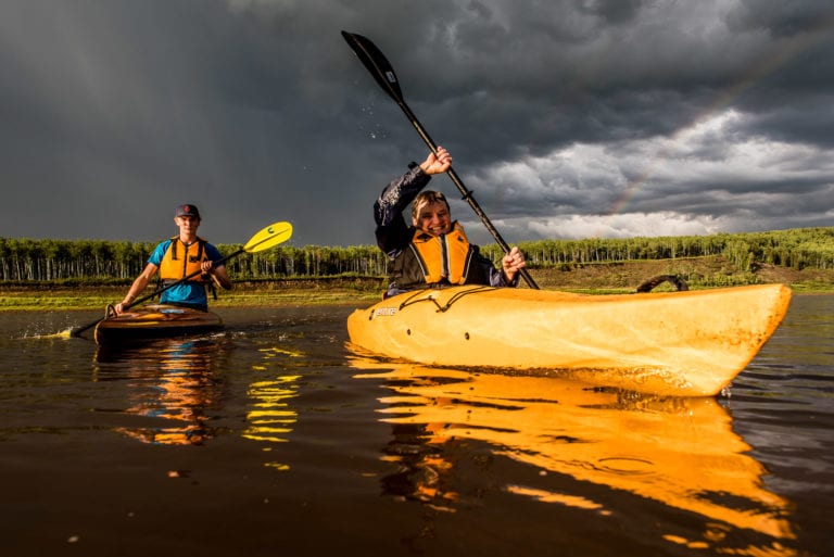
Well treed, private camping sites near the shore of Montagneuse Lake within the Stoney Lake Recreational area are available to visitors looking to get away from it all and enjoy some nature! This is a user-maintained campground with firepits and picnic tables available. The calm clear lake provides opportunities to swim, paddle board, canoe or kayak! Fishing enthusiasts can cast a line from the pier or their non motorized boat! There is a boat launch available. There is something for everyone to enjoy in this beautiful and remote area. Many different species of birds and wild animals can be enjoyed while hiking or mountain biking the area trails. Don’t forget you can also enjoy a crisp clear winter day by going ice fishing on the lake or doing some snowshoeing and cross-country skiing on the ungroomed trails.
Stoney Lake Recreation Area is a scenic drive 50km North of Fairview or 20km North of Hines Creek. The campground is open mid May to mid September.
For information please call – 780-624-6486
Address: Hines Creek
Hines Creek
Alberta
T0H 0B6
CanadaWell treed, private camping sites near the shore of Montagneuse Lake within the Stoney Lake Recreational area are available to visitors looking to get away from it all and enjoy some nature! This is a user-maintained campground with firepits and picnic tables available. The calm clear lake provides opportunities to swim, paddle board, canoe or kayak! Fishing enthusiasts can cast a line from the pier or their non motorized boat! There is a boat launch available. There is something for everyone to enjoy in this beautiful and remote area. Many different species of birds and wild animals can be enjoyed while hiking or mountain biking the area trails. Don’t forget you can also enjoy a crisp clear winter day by going ice fishing on the lake or doing some snowshoeing and cross-country skiing on the ungroomed trails.
Stoney Lake Recreation Area is a scenic drive 50km North of Fairview or 20km North of Hines Creek. The campground is open mid May to mid September.
For information please call – 780-624-6486
-
SavePlace Title: Tangent ParkPlace Description:
24 km south of Peace River on highway 740 (Shaftesbury Trail), then a free ferry ride across the Peace River. Full hook ups, kitchen shelter, group picnic area, group camping area, tenting area, horse watering stations, concession, showers, hiking trails, horseshoes, playground, fishing.
Category: Accommodations, On the Peace River, Campgrounds, Outdoors, Parks & Lakes, and M.D. of PeaceTags: Camping Near RiverAddress: Alberta 740
Grimshaw
Alberta
T0H 1W0
Canada24 km south of Peace River on highway 740 (Shaftesbury Trail), then a free ferry ride across the Peace River. Full hook ups, kitchen shelter, group picnic area, group camping area, tenting area, horse watering stations, concession, showers, hiking trails, horseshoes, playground, fishing.
-
SavePlace Title: The Best Western Plus Peace RiverPlace Description:
Special Offer: The first two guests daily will receive a free round of golf daily at the Mighty Peace Golf Club. Book through the front desk.
They also offer this deal – The hotel will offer the first 2 guests a free round of golf
daily at Mighty Peace Golf club (book through our front desk )With a stay at Best Western Plus Peace River Hotel & Suites in Peace River, you’ll be conveniently located close to Misery Mountain Ski Hill and Riverfront Park. This hotel is within the region of Normand Boucher Community Arboretum and Mile Zero Regional Multiplex.
Make yourself at home in one of the 98 individually furnished guestrooms, featuring refrigerators and flat-screen televisions. Your room comes with a pillowtop bed. Complimentary wired and wireless Internet access keeps you connected, and satellite programming provides entertainment. Private bathrooms with shower/tub combinations feature deep soaking bathtubs and complimentary toiletries.
A complimentary full breakfast is served daily. Featured amenities include complimentary high-speed (wired) Internet access, a business center, and express check-out. Free self parking is available onsite.
Address: 8016 99 Ave
Peace River
Alberta
T8S 1R2
CanadaTelephone Number: (780) 617-7600Special Offer: The first two guests daily will receive a free round of golf daily at the Mighty Peace Golf Club. Book through the front desk.
They also offer this deal – The hotel will offer the first 2 guests a free round of golf
daily at Mighty Peace Golf club (book through our front desk )With a stay at Best Western Plus Peace River Hotel & Suites in Peace River, you’ll be conveniently located close to Misery Mountain Ski Hill and Riverfront Park. This hotel is within the region of Normand Boucher Community Arboretum and Mile Zero Regional Multiplex.
Make yourself at home in one of the 98 individually furnished guestrooms, featuring refrigerators and flat-screen televisions. Your room comes with a pillowtop bed. Complimentary wired and wireless Internet access keeps you connected, and satellite programming provides entertainment. Private bathrooms with shower/tub combinations feature deep soaking bathtubs and complimentary toiletries.
A complimentary full breakfast is served daily. Featured amenities include complimentary high-speed (wired) Internet access, a business center, and express check-out. Free self parking is available onsite.
-
SavePlace Title: Third Mission Heritage SuitesPlace Description:
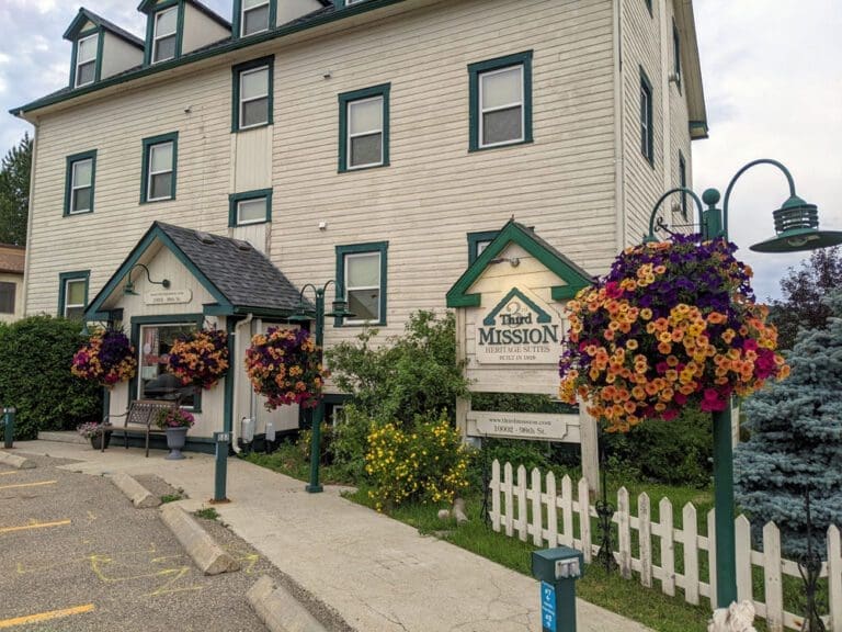
The Third Mission Heritage Suites are conveniently located on the riverfront in the Town Centre of Peace River and offer all the services you expect in a luxury boutique hotel including a beautiful view.
All suites are apartment styled with 2 bedrooms, full kitchens, in suite laundry & a variety of complimentary snacks, tea & coffee
* Please note that this building does not have an elevator or wheelchair accessibility.
* Booking upper levels is discouraged for seniors or those who may have challenges with stairs.
Tags: Destination Peace RiverAddress: 10002 98 St
Peace River
Alberta
T8S 1S4
CanadaTelephone Number: 1-866-624-3883Email: carole@thirdmission.comThe Third Mission Heritage Suites are conveniently located on the riverfront in the Town Centre of Peace River and offer all the services you expect in a luxury boutique hotel including a beautiful view.
All suites are apartment styled with 2 bedrooms, full kitchens, in suite laundry & a variety of complimentary snacks, tea & coffee
* Please note that this building does not have an elevator or wheelchair accessibility.
* Booking upper levels is discouraged for seniors or those who may have challenges with stairs.
-
SavePlace Title: 12 Foot Davis Events ParkPlace Description:
There is nothing better than getting your basket in gear and heading out to a grassy escape for a feast!
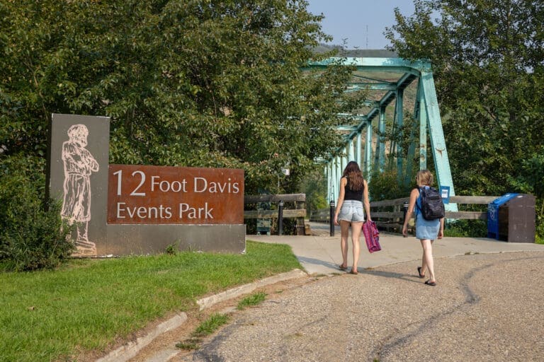
The Twelve Foot Davis Events Park is a hidden gem tucked away downtown, along the shores of the Heart River. This is a great location to roast hot dogs with a river valley view, toss a ball, have a romantic dinner and watch the sunset or simply for a picturesque walk. This is one of the best outdoor concert venues in the Mighty Peace. The shape of the hill surrounding the park makes a natural amphitheater it has made this location a prime choice for large events such as Peacefest a iconic annual music festival.
Address: 103 Avenue
Peace River
Alberta
T0H 1L0
CanadaTelephone Number: (780) 624-1000There is nothing better than getting your basket in gear and heading out to a grassy escape for a feast!
The Twelve Foot Davis Events Park is a hidden gem tucked away downtown, along the shores of the Heart River. This is a great location to roast hot dogs with a river valley view, toss a ball, have a romantic dinner and watch the sunset or simply for a picturesque walk. This is one of the best outdoor concert venues in the Mighty Peace. The shape of the hill surrounding the park makes a natural amphitheater it has made this location a prime choice for large events such as Peacefest a iconic annual music festival.
-
SavePlace Title: Twelve Foot Davis GravesitePlace Description:
A breathtaking lookout over the Town of Peace River in honor of Henry Fuller Davis, a trader on the Peace River who literally struck gold on a 12 foot claim in the 1860s. The park features include pathways, landscaping, interpretive panels, picnic benches and parking. This is a great viewpoint and photography spot.
Getting There:
Once in the Town of Peace River take Highway 2 South heading up the East Hill. Once at the top of the hill take a left onto Sunrise Road and immediately turn left on Fairgrounds Road. Travel for approximately 1 kilometre, look for signage and turn left on Twelve Foot Davis Road. This road will lead to the gravesite.
Category: Attractions, Northern Sunrise County, Outdoors, Places To See, Sights & Experiences, and Things To DoAddress: Twelve Foot Davis Rd
Northern Sunrise County
Alberta
CanadaA breathtaking lookout over the Town of Peace River in honor of Henry Fuller Davis, a trader on the Peace River who literally struck gold on a 12 foot claim in the 1860s. The park features include pathways, landscaping, interpretive panels, picnic benches and parking. This is a great viewpoint and photography spot.
Getting There:
Once in the Town of Peace River take Highway 2 South heading up the East Hill. Once at the top of the hill take a left onto Sunrise Road and immediately turn left on Fairgrounds Road. Travel for approximately 1 kilometre, look for signage and turn left on Twelve Foot Davis Road. This road will lead to the gravesite.
-
SavePlace Title: Twin Lakes Provincial ParkPlace Description:
This cozy, private, 49 site camp ground in the Twin Lakes Provincial Park is located 65 km north of Manning. Twin Lakes Provincial Park is named for the two lakes neighboring one another within the park. A smaller lake where the camp ground is located and a larger one accessible to visitors on foot. Campers arriving at the park will see a modern playground located in the central part of the park as well as the self registration area and washrooms nearby. After settling into a private well treed site, fishing enthusiasts can launch an electric motor boat on to the lake or cast their line from the dock and enjoy fishing for trout! A modern fish cleaning station makes it easy to prep the day’s catch! Canoeing, kayaking, paddle boarding as well as swimming will provide hours of enjoyment for campers of all ages! A small sandy beach on the lake shore offers even more fun! After a day of exciting activities, absorb the serenity of this beautiful area and the abundant wildlife that make their home here while hiking the walking trail around the first lake to the second lake. This scenic trail was constructed by a Junior Forest Ranger Crew in 1997 and is approximately 3km in length. Enjoy all the seasons in this area and experience a beautiful northern winter day in the park while ice fishing!
Address: 65 kilometers north of Manning on Highway 35
Manning
Alberta
T0H
CanadaTelephone Number: 780-274-0345This cozy, private, 49 site camp ground in the Twin Lakes Provincial Park is located 65 km north of Manning. Twin Lakes Provincial Park is named for the two lakes neighboring one another within the park. A smaller lake where the camp ground is located and a larger one accessible to visitors on foot. Campers arriving at the park will see a modern playground located in the central part of the park as well as the self registration area and washrooms nearby. After settling into a private well treed site, fishing enthusiasts can launch an electric motor boat on to the lake or cast their line from the dock and enjoy fishing for trout! A modern fish cleaning station makes it easy to prep the day’s catch! Canoeing, kayaking, paddle boarding as well as swimming will provide hours of enjoyment for campers of all ages! A small sandy beach on the lake shore offers even more fun! After a day of exciting activities, absorb the serenity of this beautiful area and the abundant wildlife that make their home here while hiking the walking trail around the first lake to the second lake. This scenic trail was constructed by a Junior Forest Ranger Crew in 1997 and is approximately 3km in length. Enjoy all the seasons in this area and experience a beautiful northern winter day in the park while ice fishing!
-
SavePlace Title: World’s Largest Railroad SpikePlace Description:
Where is the World’s Largest Railroad Spike? In Hines Creek!!
When WWII broke out, construction on the railroad in northern Alberta came to a halt – in Hines Creek. The line sat unfinished until well after the war was over, but has long since completed. During the time after the war, the town become known as “the end of steel”, a moniker it has kept ever since.
Address: Hines Creek
Hines Creek
Alberta
T0H 2A0
CanadaWhere is the World’s Largest Railroad Spike? In Hines Creek!!
When WWII broke out, construction on the railroad in northern Alberta came to a halt – in Hines Creek. The line sat unfinished until well after the war was over, but has long since completed. During the time after the war, the town become known as “the end of steel”, a moniker it has kept ever since.
-
SavePlace Title: Worsley Heritage ParkPlace Description:
Located in Worsley, full hookups.
Address: Worsley
Worsley
Alberta
T0H 0B6
CanadaLocated in Worsley, full hookups.
-
SavePlace Title: Peace River Spray ParkPlace Description:
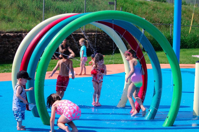
Beat the heat and enjoy the summer weather at the Town of Peace River’s Spray Park. Cool off in the parks unexpected water spouts, cannon streams, flower showers, and more. Pack a picnic because the kiddos are not going to want to leave the park.
Address: 10017 102 St
Peace River
Alberta
T0H
CanadaTelephone Number: (780) 624-1000Beat the heat and enjoy the summer weather at the Town of Peace River’s Spray Park. Cool off in the parks unexpected water spouts, cannon streams, flower showers, and more. Pack a picnic because the kiddos are not going to want to leave the park.
-
SavePlace Title: Heilan Beer HousePlace Description:
Heilan Beer House is a family friendly establishment that was built from the ground up by a small crew alongside the owners, and opened in 2019. When entering the brewery you will notice features such as the hop lighting, beer taps, and table tops that are unique only to this brewery. If you love pizza, their wood fired oven is sure to impress and with constant rotating taps, one visit will not be enough to satisfy your cravings.
If you are interested in live music, Open Mic Thursday’s with the local talent is not to be missed. This small town brewery will be sure to impress and have you coming back for more or at the very least, you will be talking a growler home with you!
Category: Agricultural, Brewery & Distillery, Food & Drink, Made in the Mighty Peace, Motorcycle Tours, Restaurant, and Town of FairviewAddress: 9212 113
Fairview
Alberta
T0H 1L0
CanadaTelephone Number: (780) 306-7686Email: admin@kerbagroup.comHeilan Beer House is a family friendly establishment that was built from the ground up by a small crew alongside the owners, and opened in 2019. When entering the brewery you will notice features such as the hop lighting, beer taps, and table tops that are unique only to this brewery. If you love pizza, their wood fired oven is sure to impress and with constant rotating taps, one visit will not be enough to satisfy your cravings.
If you are interested in live music, Open Mic Thursday’s with the local talent is not to be missed. This small town brewery will be sure to impress and have you coming back for more or at the very least, you will be talking a growler home with you!
-
SavePlace Title: Sulphur LakePlace Description:
Begin your get away with the relaxing and scenic drive to Sulphur Lake Provincial Recreation area. This well forested campground is tucked into the shore of Sulphur Lake. Bring your own firewood and drinking water and relax around a crackling fire in one of the un-serviced sites. Campers of all ages will be entertained for hours canoeing, kayaking, paddle boarding and swimming on the calm friendly waters of Sulphur Lake. Fishing enthusiasts can use the hand launch for electric motor boats and the fish cleaning station. The lake is aerated to ensure theyear-roundsurvival of the stocked trout population. Kids will enjoy the park and playground adjacent to the campground. RV dumping station also available. Northern Alberta’s crisp clear winters can be enjoyed on and around our lakes while ice fishing, cross-country skiing and snowshoeing.
Sulphur Lake is 30 km Northeast of Hines Creek. Campground is open mid May to Mid September.
Address: Located 32 kilometers west of Dixonville and 24 km North.
Clear Hills County
Alberta
CanadaBegin your get away with the relaxing and scenic drive to Sulphur Lake Provincial Recreation area. This well forested campground is tucked into the shore of Sulphur Lake. Bring your own firewood and drinking water and relax around a crackling fire in one of the un-serviced sites. Campers of all ages will be entertained for hours canoeing, kayaking, paddle boarding and swimming on the calm friendly waters of Sulphur Lake. Fishing enthusiasts can use the hand launch for electric motor boats and the fish cleaning station. The lake is aerated to ensure theyear-roundsurvival of the stocked trout population. Kids will enjoy the park and playground adjacent to the campground. RV dumping station also available. Northern Alberta’s crisp clear winters can be enjoyed on and around our lakes while ice fishing, cross-country skiing and snowshoeing.
Sulphur Lake is 30 km Northeast of Hines Creek. Campground is open mid May to Mid September.
-
SavePlace Title: Battle River Pioneer MuseumPlace Description:
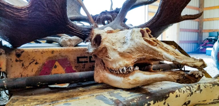
A mounted albino moose and a 1500 year old arrow head are just a couple of amazing things available to see at the Battle River Pioneer Museum. Visitors can easily imagine the town of Manning many years ago while touring the large main building, a cabin, post office, blacksmith shop and machine shed. An annual Heritage Day weekend antique tractor parade showcases the farm machinery used many years ago! Imagine the early pioneers at work while watching the Heritage Day demonstrations that may include wood working, rope making, and flour milling. The museum’s collection also includes a mounted moose, timber wolf, cougar, grizzly bear, albino porcupine and many other odd and unusual items.This museum located 1 km east of the Town of Manning on Secondary Highway 700 Hwy 691, Manning AB T0H 2M0.
Open May 15 – September 15, 10am to 6pm daily.
Museum – 780-836-2374
Off Season Museum – 780-836-0734
Address: 700 Hwy 691, Manning AB T0H 2M0
Town of Manning
Alberta
T0H 2M0
CanadaTelephone Number: 780 836-0734A mounted albino moose and a 1500 year old arrow head are just a couple of amazing things available to see at the Battle River Pioneer Museum. Visitors can easily imagine the town of Manning many years ago while touring the large main building, a cabin, post office, blacksmith shop and machine shed. An annual Heritage Day weekend antique tractor parade showcases the farm machinery used many years ago! Imagine the early pioneers at work while watching the Heritage Day demonstrations that may include wood working, rope making, and flour milling. The museum’s collection also includes a mounted moose, timber wolf, cougar, grizzly bear, albino porcupine and many other odd and unusual items.This museum located 1 km east of the Town of Manning on Secondary Highway 700 Hwy 691, Manning AB T0H 2M0.
Open May 15 – September 15, 10am to 6pm daily.
Museum – 780-836-2374
Off Season Museum – 780-836-0734
-
SavePlace Title: Lac Cardinal Pioneer Village MuseumPlace Description:
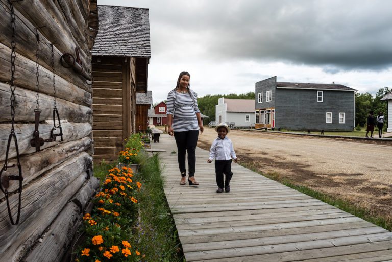
Experience the day to day life of a Peace Country pioneer at the Lac Cardinal Pioneer Village Museum. Stroll through this depiction of a typical 1920s to 1940s pioneer village and experience what life would have been like for these hardy pioneers. Immerse yourself in history as you tour four fully furnished houses, a school, a blacksmith shop and a general store! You can practically smell the bread baking in the bakery! The village also includes a fire hall, municipal office, carpenter shop, church, barn and library!
Pioneer Day celebrations are held annually on the second Saturday of August. This is a great way to enjoy the museum! Start your day with a pancake breakfast and then actually see the saw mill, threshing machine and blacksmith in operation! Witness butter being churned the old- fashioned way and then take a horse and wagon ride! Enjoy a lunch of beef on a bun and pie while listening to the musical entertainment on offer.
Directions – from Grimshaw – next to Queen Elizabeth Provincial Park, access from either Highway 2 or Secondary Highway 685.
Open May long weekend to September long weekend.
Hours of operation – Open Thursday to Monday (Closed Tuesday and Wednesday) 10:30am – 4:30pm.
Admission by donation.
Contact – 780-332-2030
Tags: Edu-vacationAddress: 10 km north-west of Grimshaw in northern Alberta, west of the junction of Highway 2 and Mackenzie Highway.
Grimshaw
Alberta
T0H 1W0
CanadaTelephone Number: (780) 332-2030Experience the day to day life of a Peace Country pioneer at the Lac Cardinal Pioneer Village Museum. Stroll through this depiction of a typical 1920s to 1940s pioneer village and experience what life would have been like for these hardy pioneers. Immerse yourself in history as you tour four fully furnished houses, a school, a blacksmith shop and a general store! You can practically smell the bread baking in the bakery! The village also includes a fire hall, municipal office, carpenter shop, church, barn and library!
Pioneer Day celebrations are held annually on the second Saturday of August. This is a great way to enjoy the museum! Start your day with a pancake breakfast and then actually see the saw mill, threshing machine and blacksmith in operation! Witness butter being churned the old- fashioned way and then take a horse and wagon ride! Enjoy a lunch of beef on a bun and pie while listening to the musical entertainment on offer.
Directions – from Grimshaw – next to Queen Elizabeth Provincial Park, access from either Highway 2 or Secondary Highway 685.
Open May long weekend to September long weekend.
Hours of operation – Open Thursday to Monday (Closed Tuesday and Wednesday) 10:30am – 4:30pm.
Admission by donation.
Contact – 780-332-2030
-
SavePlace Title: Fort Fork/Mackenzie CairnPlace Description:
Paddling furiously along the Peace River to beat freeze up, Alexander Mackenzie and his crew must have been very glad to reach the area where Fort Fork was to be built and where they were able to find shelter from the coming winter weather. Soon after his arrival Mackenzie observed “the river stopped” indicating freeze up had arrived! Mackenzie, a Scottish born explorer and fur trader was to spend the winter of 1792 – 93 at Fort Fork before continuing on his famed journey to the Pacific Ocean. Fort Fork was named for its close proximity to the convergence of the Smoky and Peace Rivers. The fort provided shelter for Mackenzie and several years later the explorer – geographer David Thompson. The fort was also the main North West Company post in the Peace Country until 1806 when its operations were moved to Fort Dunvegan. Stones from an original chimney in the fort have been preserved and fashioned into a fireplace for the public to view at the Peace River Museum, Archives and Mackenzie Centre.
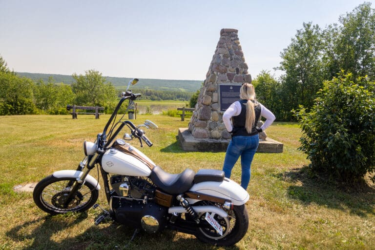
Mackenzie Cairn, a National Historic site since 1929, was built to commemorate Fort Fork and marks the spot where visitors can look across the river to the approximate area of Fort Fork which has long since been erased by the ravages of time and river erosion. Mackenzie Cairn is found a short distance from the Town of Peace River, along the Shaftsbury Trail.
Tags: Circle TourAddress: On the Shaftesbury Trail
Peace River
Alberta
T8S 1X2
CanadaPaddling furiously along the Peace River to beat freeze up, Alexander Mackenzie and his crew must have been very glad to reach the area where Fort Fork was to be built and where they were able to find shelter from the coming winter weather. Soon after his arrival Mackenzie observed “the river stopped” indicating freeze up had arrived! Mackenzie, a Scottish born explorer and fur trader was to spend the winter of 1792 – 93 at Fort Fork before continuing on his famed journey to the Pacific Ocean. Fort Fork was named for its close proximity to the convergence of the Smoky and Peace Rivers. The fort provided shelter for Mackenzie and several years later the explorer – geographer David Thompson. The fort was also the main North West Company post in the Peace Country until 1806 when its operations were moved to Fort Dunvegan. Stones from an original chimney in the fort have been preserved and fashioned into a fireplace for the public to view at the Peace River Museum, Archives and Mackenzie Centre.
Mackenzie Cairn, a National Historic site since 1929, was built to commemorate Fort Fork and marks the spot where visitors can look across the river to the approximate area of Fort Fork which has long since been erased by the ravages of time and river erosion. Mackenzie Cairn is found a short distance from the Town of Peace River, along the Shaftsbury Trail.
-
SavePlace Title: Mile Zero MarkerPlace Description:
Exploring Alberta’s North and beyond?
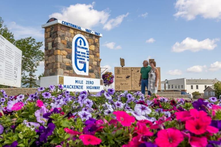
Be sure to stop in at the Mile Zero Marker in Grimshaw and get a photo! This monument which is part of the Tom Baldwin Memorial Arboretum and the Historic Mackenzie Highway Park, is easy to find, right off the main highway 2 going through the town of Grimshaw. The historic Northern Alberta Railway car beside the marker, offers another photo opportunity for visitors. The monument marks mile zero of the Mackenzie Highway that will lead visitors north to Manning, High Level, Hay River, Yellowknife and beyond.
Tags: Circle TourAddress: 5020 55th Avenue
Grimshaw
Alberta
T0H 1W0
CanadaExploring Alberta’s North and beyond?
Be sure to stop in at the Mile Zero Marker in Grimshaw and get a photo! This monument which is part of the Tom Baldwin Memorial Arboretum and the Historic Mackenzie Highway Park, is easy to find, right off the main highway 2 going through the town of Grimshaw. The historic Northern Alberta Railway car beside the marker, offers another photo opportunity for visitors. The monument marks mile zero of the Mackenzie Highway that will lead visitors north to Manning, High Level, Hay River, Yellowknife and beyond.
-
SavePlace Title: All Saints Anglican ChurchPlace Description:
All Saints Anglican Church was declared a Municipal Historic Resource in 2009. The Church has been available to everyone for worship services, baptisms, weddings and funerals for the past 80 years. The church was an integral part of the early settlers’ community in an area that was geographically isolated by rivers on all sides and was a social focal point for three communities; Cherry Pont, Bear Canyon and Clayhurst.
Anglican missionaries began working in the area in the early 1930s, shortly after the first settlers arrived. Local volunteers constructed the building and the first service was held in the unfinished building on August 25, 1937.
The All Saints Anglican Church architecture incorporates gothic revival features such as the pointed arch windows and vaulted sanctuary that is separated from the nave by a railing. The original handmade box for the Chalice and Communion set is still used and the pews are original and hand hewn.
All Saints Anglican Church can be found approximately 80km West of Worsley in the Cherry Point area.
For information call – 780-685-3925
Address: All Saints Anglican Church can be found approximately 80km West of Worsley in the Cherry Point area.
Cherry Point
Clear Hills County
CanadaTelephone Number: 780-685-3925All Saints Anglican Church was declared a Municipal Historic Resource in 2009. The Church has been available to everyone for worship services, baptisms, weddings and funerals for the past 80 years. The church was an integral part of the early settlers’ community in an area that was geographically isolated by rivers on all sides and was a social focal point for three communities; Cherry Pont, Bear Canyon and Clayhurst.
Anglican missionaries began working in the area in the early 1930s, shortly after the first settlers arrived. Local volunteers constructed the building and the first service was held in the unfinished building on August 25, 1937.
The All Saints Anglican Church architecture incorporates gothic revival features such as the pointed arch windows and vaulted sanctuary that is separated from the nave by a railing. The original handmade box for the Chalice and Communion set is still used and the pews are original and hand hewn.
All Saints Anglican Church can be found approximately 80km West of Worsley in the Cherry Point area.
For information call – 780-685-3925
-
SavePlace Title: Clear River CampgroundPlace Description:
Looking for the ideal setting to kick back and relax? Try the Clear River Campground! The campground is tucked in alongside the beautiful Clear River, just 13km Southwest of the Cleardale Store on highway 64. Enjoy the serenity of the area in one of the river side sites that offer picnic tables, firepits and firewood all for $12 per night. Self registration available. Explore the river on a hike and watch for the abundant wildlife that call this area home.
The Clear River Rodeo grounds are adjacent to the campground, making it the perfect spot to stay while enjoying the Heavy Horse Days event that is held here annually.
For information call – 780-835-9403
Address: 13km Southwest of the Cleardale Store on highway 64.
Clear Hills County
Clear Hills County
CanadaTelephone Number: 780-835-9403Looking for the ideal setting to kick back and relax? Try the Clear River Campground! The campground is tucked in alongside the beautiful Clear River, just 13km Southwest of the Cleardale Store on highway 64. Enjoy the serenity of the area in one of the river side sites that offer picnic tables, firepits and firewood all for $12 per night. Self registration available. Explore the river on a hike and watch for the abundant wildlife that call this area home.
The Clear River Rodeo grounds are adjacent to the campground, making it the perfect spot to stay while enjoying the Heavy Horse Days event that is held here annually.
For information call – 780-835-9403
-
SavePlace Title: Cleardale CampgroundPlace Description:
Take some time to enjoy the wild beauty of the Clear Hills area — exploring this vast region is an adventure in itself! The Cleardale Campground offers explorers a cozy spot to set up camp, just 1 km east of the Cleardale Store. Powered sites are available for $25 per night, or unpowered for $12 per night. You’ll find picnic tables, firepits, and firewood ready for your campfire evenings, plus a playground to keep younger campers entertained. No camping gear? No problem — tent rentals are available on-site!
The campground is also a hub for community fun. Every year, the campground hosts a Summer and Winter Carnival, an Annual Golf Tournament, and an Annual Ranch Rodeo, drawing visitors from across the region. It’s also home to the Clearfest Music Festival, making this the perfect place to settle in and enjoy great music, exciting events, and small-town hospitality surrounded by nature.
Cleardale is found 98km Northwest of Fairview on highway 64.
For information call – 780-835-9403
Prices
Group Area Reservation:
(Gravel Pad)
$100 non-refundable deposit upon reservation.
All units pay separately per night.
Stage Area Reservation:
(Grass Area in Front of Stage – Does Not Include Playground)
$100 non-refundable deposit upon reservation.
All units pay separately per night.
Power Sites:
$35/unit/night.
$200/unit/week.
$750/unit/month
Non-Power Sites:
$20/unit/night. (ALL CAMPSITES HAVE SAME RATE)
Kitchen Booth:
$250 damage deposit. $50/day.
Stage:
$50/day. $100/week-end
Day Use:
No charge. (ALL CAMPSITES HAVE SAME RATE)
Clear Reservation:
(Whole Campsite)
$100 non-refundable deposit upon reservation.
All units pay separately per night.
TO RESERVE, MESSAGE 780-834-7844
Address: 8km Northwest of Fairview on highway 64.
Cleardale
Clear Hills County
CanadaTelephone Number: 780-835-9403Email: cleardaleag@live.comTake some time to enjoy the wild beauty of the Clear Hills area — exploring this vast region is an adventure in itself! The Cleardale Campground offers explorers a cozy spot to set up camp, just 1 km east of the Cleardale Store. Powered sites are available for $25 per night, or unpowered for $12 per night. You’ll find picnic tables, firepits, and firewood ready for your campfire evenings, plus a playground to keep younger campers entertained. No camping gear? No problem — tent rentals are available on-site!
The campground is also a hub for community fun. Every year, the campground hosts a Summer and Winter Carnival, an Annual Golf Tournament, and an Annual Ranch Rodeo, drawing visitors from across the region. It’s also home to the Clearfest Music Festival, making this the perfect place to settle in and enjoy great music, exciting events, and small-town hospitality surrounded by nature.
Cleardale is found 98km Northwest of Fairview on highway 64.
For information call – 780-835-9403
Prices
Group Area Reservation:
(Gravel Pad)
$100 non-refundable deposit upon reservation.
All units pay separately per night.
Stage Area Reservation:
(Grass Area in Front of Stage – Does Not Include Playground)
$100 non-refundable deposit upon reservation.
All units pay separately per night.
Power Sites:
$35/unit/night.
$200/unit/week.
$750/unit/month
Non-Power Sites:
$20/unit/night. (ALL CAMPSITES HAVE SAME RATE)
Kitchen Booth:
$250 damage deposit. $50/day.
Stage:
$50/day. $100/week-end
Day Use:
No charge. (ALL CAMPSITES HAVE SAME RATE)
Clear Reservation:
(Whole Campsite)
$100 non-refundable deposit upon reservation.
All units pay separately per night.
TO RESERVE, MESSAGE 780-834-7844
-
SavePlace Title: Many Islands CampgroundPlace Description:
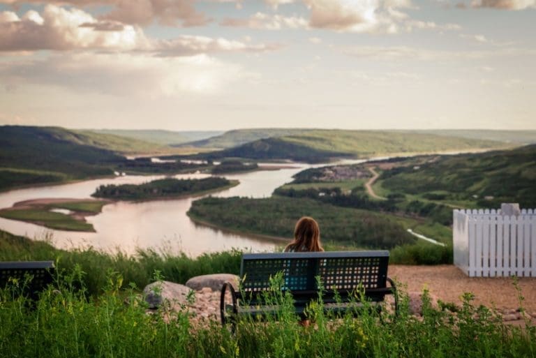
Enjoy sweeping views from the top of the riverbanks as you descend toward Many Islands Campground, a peaceful retreat nestled along the banks of the mighty Peace River. As you arrive, you may spot the cluster of small islands that give the campground its name.
There are few experiences more relaxing than sitting by a crackling campfire, watching the quiet power of the river flow past. This campground is a gem in the Peace River Valley, offering stunning natural scenery and a chance to spot local wildlife.
Campers can enjoy:
-
26 regular campsites and 44 seasonal sites
-
Two group camping areas
-
Well-maintained boat launch for river boating and fishing
-
Camp kitchens, picnic tables, fire pits, and outhouses
-
Three playgrounds, hiking trails, horseshoe pits, volleyball and basketball nets
-
A variety of games available for campers to borrow
August Long Weekend is packed with fun activities for the whole family, including:
-
Boat rally
-
Dance
-
Kids’ bike parade
-
Golf cart parade
-
Bouncy castle
-
Horseshoe tournament
Many Islands Campground is 24km Southeast of Worsley off highway 64.
Check out our River Guide to help you plan your trip.
Address: Unnamed Road
Bear Canyon
Alberta
T0H 0B0
CanadaEnjoy sweeping views from the top of the riverbanks as you descend toward Many Islands Campground, a peaceful retreat nestled along the banks of the mighty Peace River. As you arrive, you may spot the cluster of small islands that give the campground its name.
There are few experiences more relaxing than sitting by a crackling campfire, watching the quiet power of the river flow past. This campground is a gem in the Peace River Valley, offering stunning natural scenery and a chance to spot local wildlife.
Campers can enjoy:
-
26 regular campsites and 44 seasonal sites
-
Two group camping areas
-
Well-maintained boat launch for river boating and fishing
-
Camp kitchens, picnic tables, fire pits, and outhouses
-
Three playgrounds, hiking trails, horseshoe pits, volleyball and basketball nets
-
A variety of games available for campers to borrow
August Long Weekend is packed with fun activities for the whole family, including:
-
Boat rally
-
Dance
-
Kids’ bike parade
-
Golf cart parade
-
Bouncy castle
-
Horseshoe tournament
Many Islands Campground is 24km Southeast of Worsley off highway 64.
Check out our River Guide to help you plan your trip.
-

