No Records Found
Sorry, no records were found. Please adjust your search criteria and try again.
Google Map Not Loaded
Sorry, unable to load Google Maps API.
-
SavePlace Title: Fourth Creek CampgroundPlace Description:
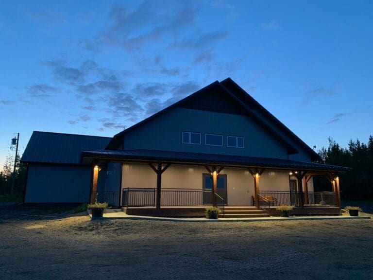
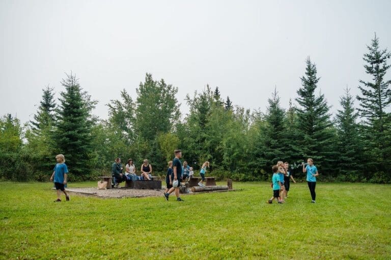
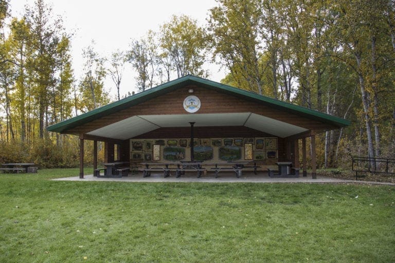
The Fourth Creek Community Association maintains this multiuse area. The Fourth Creek Community Hall is a new beautifully designed venue available for rent for any event or celebration. Ten campsites are nearby offering power, camp tables, firepits and plenty of firewood. Campers can access a bathroom and a shower room located in the hall. A large recreation area with a playground is adjacent providing visitors with a spacious area for all sorts of fun activities. The community association also hosts several annual events such as dances, suppers and barbeques to bring friends and neighbors together.
For campground information call (780) 500-6441 or email fourthcreekhall@gmail.com.
Address: Town of Spirit River
Saddle Hills County
Alberta
CanadaTelephone Number: (780) 500-6441Email: fourthcreekhall@gmail.comThe Fourth Creek Community Association maintains this multiuse area. The Fourth Creek Community Hall is a new beautifully designed venue available for rent for any event or celebration. Ten campsites are nearby offering power, camp tables, firepits and plenty of firewood. Campers can access a bathroom and a shower room located in the hall. A large recreation area with a playground is adjacent providing visitors with a spacious area for all sorts of fun activities. The community association also hosts several annual events such as dances, suppers and barbeques to bring friends and neighbors together.
For campground information call (780) 500-6441 or email fourthcreekhall@gmail.com.
-
SavePlace Title: Blue Bridge CampgroundPlace Description:
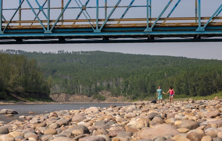
Looking for some of the best views of the Little Smoky River valley? Breathtaking scenery abounds for visitors travelling down into the valley to the Blue Bridge campground. No wonder so many locals choose this scenic spot for their special occasion photoshoots! Explorers can also enjoy rustic camping, access to the river as well as some great OHV and sled trails here. The Blue Bridge campground can be reached from the Donnelly corner by travelling west on Highway 49 for approximately 13km and then turning south on Highway 744 and travelling approximately 17km to the campground area near the bridge. For more information contact the MD of Smoky River at 780-837-2221
Address: Municipal District of Smoky River
MD of Smoky River
Alberta
CanadaTelephone Number: 780-837-2221Looking for some of the best views of the Little Smoky River valley? Breathtaking scenery abounds for visitors travelling down into the valley to the Blue Bridge campground. No wonder so many locals choose this scenic spot for their special occasion photoshoots! Explorers can also enjoy rustic camping, access to the river as well as some great OHV and sled trails here. The Blue Bridge campground can be reached from the Donnelly corner by travelling west on Highway 49 for approximately 13km and then turning south on Highway 744 and travelling approximately 17km to the campground area near the bridge. For more information contact the MD of Smoky River at 780-837-2221
-
SavePlace Title: Cummings Lake CampgroundPlace Description:
Nestled near Fairview, Alberta, Cummings Lake Campground is a serene retreat offering a variety of amenities to ensure a comfortable and enjoyable stay. With 28 spacious camping stalls, the campground provides electrical hookups, firewood, and well-maintained outhouses for convenience. Families will appreciate the playground, tire park, and ball diamonds, while nature enthusiasts can explore the scenic walking trails and enjoy bird watching. Adventure awaits with canoe rentals and a dedicated canoe and kayak launch, making it easy to immerse yourself in the tranquil waters. Whether you’re seeking outdoor activities or simply looking to relax in nature, Cummings Lake Campground is the perfect destination for a memorable camping experience.
Located on Hwy 732 – Adjacent to Fairview
Tags: campingAddress: Highway 732
Division No. 19
Alberta
T0H 1L0
CanadaTelephone Number: 780-835-8651Email: Cummingslake1@gmail.comNestled near Fairview, Alberta, Cummings Lake Campground is a serene retreat offering a variety of amenities to ensure a comfortable and enjoyable stay. With 28 spacious camping stalls, the campground provides electrical hookups, firewood, and well-maintained outhouses for convenience. Families will appreciate the playground, tire park, and ball diamonds, while nature enthusiasts can explore the scenic walking trails and enjoy bird watching. Adventure awaits with canoe rentals and a dedicated canoe and kayak launch, making it easy to immerse yourself in the tranquil waters. Whether you’re seeking outdoor activities or simply looking to relax in nature, Cummings Lake Campground is the perfect destination for a memorable camping experience.
Located on Hwy 732 – Adjacent to Fairview
-
SavePlace Title: Donnelly CampgroundPlace Description:
The Donnelly Campground is a charming and well-equipped retreat for travelers looking to enjoy the great outdoors with all the comforts of home. This fully serviced campground offers 15 power stalls, each with full hookups, including water, sewer, and power, making it the perfect place to set up camp. Whether you’re staying for a night or a week, the campground’s inviting atmosphere, complete with picnic tables and fire pits, creates a cozy and comfortable stay. With a first-come, first-served booking system, you can easily find a spot to unwind and relax. At just $30 per night or $160 for the week, or $580 per month the Donnelly Campground provides excellent value for a peaceful, convenient, and enjoyable camping experience. It’s the perfect place to rest and recharge while exploring the beautiful surroundings.
Category: CampgroundsAddress: Gravel Avenue, Village of Donnelly
Village of Donnelly
Alberta
CanadaTelephone Number: 780-925-3835Email: admin@donnelly.caThe Donnelly Campground is a charming and well-equipped retreat for travelers looking to enjoy the great outdoors with all the comforts of home. This fully serviced campground offers 15 power stalls, each with full hookups, including water, sewer, and power, making it the perfect place to set up camp. Whether you’re staying for a night or a week, the campground’s inviting atmosphere, complete with picnic tables and fire pits, creates a cozy and comfortable stay. With a first-come, first-served booking system, you can easily find a spot to unwind and relax. At just $30 per night or $160 for the week, or $580 per month the Donnelly Campground provides excellent value for a peaceful, convenient, and enjoyable camping experience. It’s the perfect place to rest and recharge while exploring the beautiful surroundings.
-
SavePlace Title: Berwyn Baseball DiamondPlace Description:
The Village of Berwyn has put a fun twist on its community baseball diamond by turning it into a casual disc golf course. This laid-back spot is perfect for anyone looking to try the sport or enjoy a relaxed game with friends. Bring your own discs, soak in the small-town atmosphere, and enjoy a round of disc golf in this unique community setting.
Located 1 mile west and 1/2 mile north of the Hamlet of Brownvale. As well as ball diamonds, there are fire pits, 10 basic camping sites $20/night, day-use area, outhouses, and 2 horseshoe pits.
Book here: https://www.mdpeace.com/index-pages/directory-listings/brownvale-ball-diamonds
Address: Brownvale
Municipal District of Peace No. 135
Alberta
T0H 0L0
CanadaTelephone Number: 780-338-3845Email: info@mdpeace.comThe Village of Berwyn has put a fun twist on its community baseball diamond by turning it into a casual disc golf course. This laid-back spot is perfect for anyone looking to try the sport or enjoy a relaxed game with friends. Bring your own discs, soak in the small-town atmosphere, and enjoy a round of disc golf in this unique community setting.
Located 1 mile west and 1/2 mile north of the Hamlet of Brownvale. As well as ball diamonds, there are fire pits, 10 basic camping sites $20/night, day-use area, outhouses, and 2 horseshoe pits.
Book here: https://www.mdpeace.com/index-pages/directory-listings/brownvale-ball-diamonds
-
SavePlace Title: Brownvale Community CampgroundPlace Description:
Located only 22km southwest of the Town of Grimshaw the Hamlet of Brownvale offers a welcoming campground that is perfect for a family outing or a simple night under the stars. Enjoy 10 basic campsites, a day-use area, fire pits, outhouses, and plenty of recreation with ball diamonds and horseshoe pits. Camping permits are only $20/night, please visit the MD of Peace website to book a spot. A friendly, affordable spot to relax and play in the Peace Region.
Located 1 mile west and 1/2 mile north of the Hamlet of Brownvale.
Tags: MD of PeaceAddress: Brownvale
Municipal District of Peace No. 135
Alberta
T0H 0L0
CanadaTelephone Number: 780-338-3845Email: info@mdpeace.comLocated only 22km southwest of the Town of Grimshaw the Hamlet of Brownvale offers a welcoming campground that is perfect for a family outing or a simple night under the stars. Enjoy 10 basic campsites, a day-use area, fire pits, outhouses, and plenty of recreation with ball diamonds and horseshoe pits. Camping permits are only $20/night, please visit the MD of Peace website to book a spot. A friendly, affordable spot to relax and play in the Peace Region.
Located 1 mile west and 1/2 mile north of the Hamlet of Brownvale.
-
SavePlace Title: Cleardale Ag SocietyPlace Description:This organization plays an active role in supporting recreation, events, and outdoor experiences in the Clear River and Cleardale area. It operates Clear River Campground, Cleardale Campsite, and the Cleardale Golf Course, offering a range of amenities for residents and visitors alike.
In addition to managing these facilities, the organization is involved in a variety of community events and activities, including the Cleardale Riders, gymkhana events, Family Fun Days Rodeo at the Clear River Rodeo Grounds, and the popular Clearfest Music Festival. Together, these initiatives help create a vibrant, family-friendly destination that celebrates community spirit and outdoor recreation in the Mighty Peace Region.
Physical Address: PLAN 4666TR, BLK 2 LOT 5, CLEARDALE ABPhone: 780-834-7844Email: cleardaleag@live.comAddress: Cleardale
Clear Hills County
Alberta
T0H 3Y0
CanadaTelephone Number: 780-834-7844Email: cleardaleag@live.comThis organization plays an active role in supporting recreation, events, and outdoor experiences in the Clear River and Cleardale area. It operates Clear River Campground, Cleardale Campsite, and the Cleardale Golf Course, offering a range of amenities for residents and visitors alike.In addition to managing these facilities, the organization is involved in a variety of community events and activities, including the Cleardale Riders, gymkhana events, Family Fun Days Rodeo at the Clear River Rodeo Grounds, and the popular Clearfest Music Festival. Together, these initiatives help create a vibrant, family-friendly destination that celebrates community spirit and outdoor recreation in the Mighty Peace Region.
Physical Address: PLAN 4666TR, BLK 2 LOT 5, CLEARDALE ABPhone: 780-834-7844Email: cleardaleag@live.com -
SavePlace Title: Historic Dunvegan Provincial ParkPlace Description:
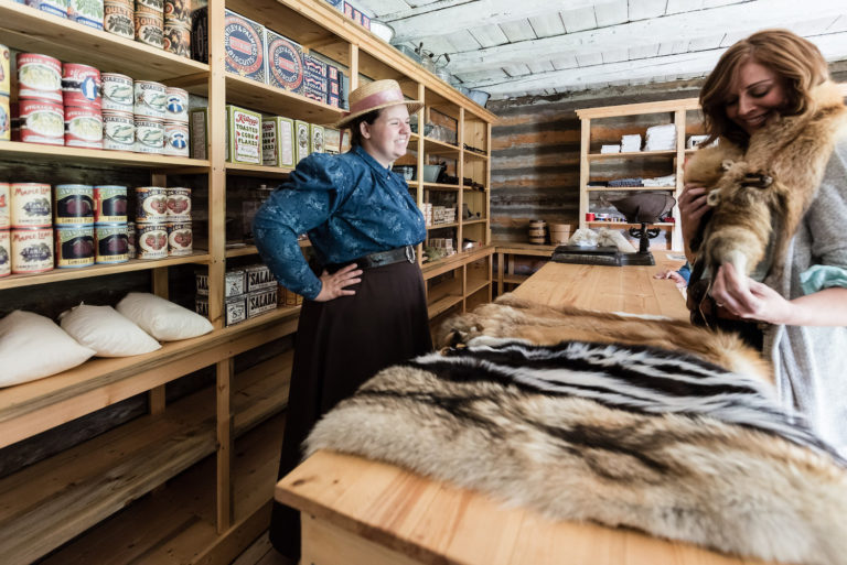
Historic Dunvegan is a provincially and nationally designated historic resource. Experience history through 4 original, authentically restored and furnished buildings and the stories of Indigenous, fur trade, and mission life that our historic interpreters are waiting to share with you. Located alongside the Peace River with a breathtaking view of Alberta’s longest vehicle suspension bridge, there are activities for the whole family! A visitors’ centre located near the entrance offers information as well as guided tours of the historic buildings. The Visitor Centre and historic buildings are open from May 18 through Labour Day, 10am-5pm Wednesday through Sunday and holiday Mondays. Admission fees apply.
2024 Special Events
Dunvegan Tsattine/Beaver Storytelling – June 22, 1pm
Canada Day – July 1, Noon-5pm
Fresh Air Market – August 4, 11-5pm
Sunday Funday – May 19 and June 30, 10am-5pm
Picnic in the Park – July 14 and August 11, 11am-3pmLocated 26km south of Fairview on Highway 2. For more information please visit www.historicdunvegan.ca or find us on Facebook by searching @historicdunvegan!
Other nearby amenities include a day use area and campground operated by Alberta Parks. A playground, fire pits, cook shelters, and horseshoe pitches are all available. The Maples Day use area is just down the road, and offers a picnic shelter, fire pits, and a playground. You can also stroll down to the neighbouring Dunvegan Market Gardens for ice cream, food, shopping, and mini golf!
Category: Arts & Culture, Attractions, On the Peace River, Dark Sky Adventures, District of Fairview, Guided Adventure, Mighty Peace Essentials, Motorcycle Tours, Museums, Places To See, Sights & Experiences, and Things To DoAddress: Township Rd 801A
md of fairview
Alberta
T0H 0L0
CanadaTelephone Number: 780-835-7150Email: Historic.Dunvegan@gov.ab.caHistoric Dunvegan is a provincially and nationally designated historic resource. Experience history through 4 original, authentically restored and furnished buildings and the stories of Indigenous, fur trade, and mission life that our historic interpreters are waiting to share with you. Located alongside the Peace River with a breathtaking view of Alberta’s longest vehicle suspension bridge, there are activities for the whole family! A visitors’ centre located near the entrance offers information as well as guided tours of the historic buildings. The Visitor Centre and historic buildings are open from May 18 through Labour Day, 10am-5pm Wednesday through Sunday and holiday Mondays. Admission fees apply.
2024 Special Events
Dunvegan Tsattine/Beaver Storytelling – June 22, 1pm
Canada Day – July 1, Noon-5pm
Fresh Air Market – August 4, 11-5pm
Sunday Funday – May 19 and June 30, 10am-5pm
Picnic in the Park – July 14 and August 11, 11am-3pmLocated 26km south of Fairview on Highway 2. For more information please visit www.historicdunvegan.ca or find us on Facebook by searching @historicdunvegan!
Other nearby amenities include a day use area and campground operated by Alberta Parks. A playground, fire pits, cook shelters, and horseshoe pitches are all available. The Maples Day use area is just down the road, and offers a picnic shelter, fire pits, and a playground. You can also stroll down to the neighbouring Dunvegan Market Gardens for ice cream, food, shopping, and mini golf!
-
SavePlace Title: The MaplesPlace Description:
Begin a beautiful Peace country day at the Maples Day Use area! Upon arriving at Historic Dunvegan simply turn right and proceed under the bridge to this beautiful river side area. Originally an Anglican Mission stood at this site in the 1880’s. Today visitors can enjoy picnicking, fishing, hiking or biking, a beautiful playground and exploring along the mighty Peace River. Historic Dunvegan is near by and well worth a visit to explore the history of this fascinating region. Dunvegan Gardens is located close by and offers mini golf, shopping and ice cream! Dunvegan Provincial Park is adjacent to Historic Dunvegan and offers overnight camping facilities.
The Maples Day Use area is 27km South of Fairview.
Address: Township Rd 801A
md of fairview
Alberta
T0H 1L0
CanadaTelephone Number: 780-835-4903Begin a beautiful Peace country day at the Maples Day Use area! Upon arriving at Historic Dunvegan simply turn right and proceed under the bridge to this beautiful river side area. Originally an Anglican Mission stood at this site in the 1880’s. Today visitors can enjoy picnicking, fishing, hiking or biking, a beautiful playground and exploring along the mighty Peace River. Historic Dunvegan is near by and well worth a visit to explore the history of this fascinating region. Dunvegan Gardens is located close by and offers mini golf, shopping and ice cream! Dunvegan Provincial Park is adjacent to Historic Dunvegan and offers overnight camping facilities.
The Maples Day Use area is 27km South of Fairview.
-
SavePlace Title: Many Islands Boat LaunchPlace Description:
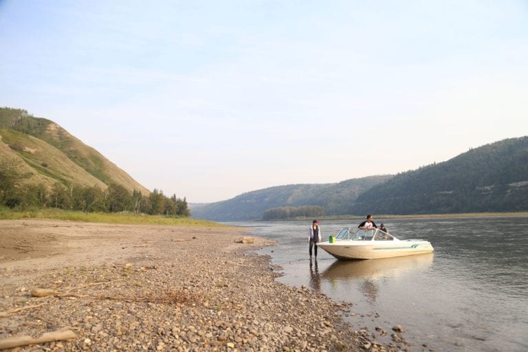
Launch a boat, canoe or kayak at this gravel boat launch on the Peace River at Many Islands Campground. Boating and paddling enthusiasts enjoying a Peace River adventure can launch here or stop in for a break at this beautiful riverside campground. This area, upriver from the Carter’s Camp boat launch, offers some stunning scenery of the river valley and the wildlife that call the area home. There are camp sites with fire pits, picnic tables, outhouses and camp kitchens for individuals or groups. The Many Islands Music Festival is held here every summer. A great weekend of music, dancing, wagon rides and much more. Many Islands Campground is 24km Southeast of Worsley off highway 64.
For information call –780-685-3925.
Address: 24km Southeast of Worsley off highway 64
Worsley
Alberta
T0H 3W0
CanadaLaunch a boat, canoe or kayak at this gravel boat launch on the Peace River at Many Islands Campground. Boating and paddling enthusiasts enjoying a Peace River adventure can launch here or stop in for a break at this beautiful riverside campground. This area, upriver from the Carter’s Camp boat launch, offers some stunning scenery of the river valley and the wildlife that call the area home. There are camp sites with fire pits, picnic tables, outhouses and camp kitchens for individuals or groups. The Many Islands Music Festival is held here every summer. A great weekend of music, dancing, wagon rides and much more. Many Islands Campground is 24km Southeast of Worsley off highway 64.
For information call –780-685-3925.
-
SavePlace Title: Pratt’s Landing Boat LaunchPlace Description:
Canoes, kayaks and river boats can access the river from the well-maintained gravel boat launch found at Pratt’s Landing campsite. Located along the Peace River downstream from Carter’s Camp boat launch and upstream from Dunvegan bridge, this is a great spot to start a day’s exploration on the river or take a break from a river adventure and stop in for a rest and a picnic. Care to stay longer in this beautiful spot? Choose from one of 15 overnight camping sites equipped with fire pits and picnic tables. Non-potable water, outdoor toilet facilities and firewood is also available for visitors. Pratt’s Landing can be found 32km west of Fairview on highway 682.
For information call –780-835-4903.
Address: 32km west of Fairview on highway 682
Fairview
Alberta
T0H 1L0
CanadaTelephone Number: 780-835-4903Canoes, kayaks and river boats can access the river from the well-maintained gravel boat launch found at Pratt’s Landing campsite. Located along the Peace River downstream from Carter’s Camp boat launch and upstream from Dunvegan bridge, this is a great spot to start a day’s exploration on the river or take a break from a river adventure and stop in for a rest and a picnic. Care to stay longer in this beautiful spot? Choose from one of 15 overnight camping sites equipped with fire pits and picnic tables. Non-potable water, outdoor toilet facilities and firewood is also available for visitors. Pratt’s Landing can be found 32km west of Fairview on highway 682.
For information call –780-835-4903.
-
SavePlace Title: Dunvegan Boat LaunchPlace Description:
Dunvegan’s boat launch can be found on the south side of the Peace River, road access begins on the west side of the Dunvegan bridge entrance. Parking can be found just above the boat launch area. This well-maintained gravel boat launch is situated on a narrow spot of the river where the water runs deep. Head down river to Shaftsbury and the Town of Peace River or up river to Pratt’s Landing and beyond. A great way to explore the Peace region and the river valley. Stay a few days and visit Historic Dunvegan, Dunvegan Provincial Park, The Maples Park and Dunvegan Market Gardens which are conveniently located along the shore line of the north side of the river. The Dunvegan boat launch is located 26km South of Fairview.
For information call –780-835-4903.
Address: 26km South of Fairview
Fairview
Alberta
T0H 1L0
CanadaTelephone Number: 780-835-4903Dunvegan’s boat launch can be found on the south side of the Peace River, road access begins on the west side of the Dunvegan bridge entrance. Parking can be found just above the boat launch area. This well-maintained gravel boat launch is situated on a narrow spot of the river where the water runs deep. Head down river to Shaftsbury and the Town of Peace River or up river to Pratt’s Landing and beyond. A great way to explore the Peace region and the river valley. Stay a few days and visit Historic Dunvegan, Dunvegan Provincial Park, The Maples Park and Dunvegan Market Gardens which are conveniently located along the shore line of the north side of the river. The Dunvegan boat launch is located 26km South of Fairview.
For information call –780-835-4903.
-
SavePlace Title: Haig LakePlace Description:
Known for fantastic fishing with a gorgeous backdrop, Haig Lake is worth the drive. Located in the Woodland Cree First Nation, this 881.8ha lake has pickerel, whitefish and jackfish. If you don’t feel like fishing, you can enjoy the day on your motorized boat, canoe, paddleboard or kayak. Nestled in pristine backcountry, the peace and tranquillity experienced here are second to none. They also have eight unserviced camping sites, firepits, picnic tables, a hiking trail and excellent cell phone service if you need to stay connected.
Get there: Take Highway 743 north to highway 986, turn left onto Township Road 871A. Haig Lake is approximately 1.5 hours northeast of Peace River.
Tags: Must-See FishingAddress: Haig Lake
Woodland Cree First Nation
Alberta
CanadaTelephone Number: (780) 629-3803Known for fantastic fishing with a gorgeous backdrop, Haig Lake is worth the drive. Located in the Woodland Cree First Nation, this 881.8ha lake has pickerel, whitefish and jackfish. If you don’t feel like fishing, you can enjoy the day on your motorized boat, canoe, paddleboard or kayak. Nestled in pristine backcountry, the peace and tranquillity experienced here are second to none. They also have eight unserviced camping sites, firepits, picnic tables, a hiking trail and excellent cell phone service if you need to stay connected.
Get there: Take Highway 743 north to highway 986, turn left onto Township Road 871A. Haig Lake is approximately 1.5 hours northeast of Peace River.
-
SavePlace Title: Condy Meadows PlaygroundPlace Description:
Just minutes north of Manning, Condy Meadows offers the perfect mix of recreation and relaxation. Play a round on the scenic 9-hole course, enjoy licensed food and drinks, and browse the pro shop. Stay the night at the family-friendly campground with 17 full-service and 15 powered sites, plus water, power, RV dump, playground, kitchen shelter, and a gazebo and group site are available for booking. Whether you’re after a quiet camping retreat or a golf getaway, Condy Meadows has it all.
Address: Township Road 932
Hotchkiss
Alberta
T0H 2B0
CanadaTelephone Number: 780-836-2176Just minutes north of Manning, Condy Meadows offers the perfect mix of recreation and relaxation. Play a round on the scenic 9-hole course, enjoy licensed food and drinks, and browse the pro shop. Stay the night at the family-friendly campground with 17 full-service and 15 powered sites, plus water, power, RV dump, playground, kitchen shelter, and a gazebo and group site are available for booking. Whether you’re after a quiet camping retreat or a golf getaway, Condy Meadows has it all.
-
SavePlace Title: High Prairie and District Golf ClubPlace Description:
Get ready to enjoy some incredible moments while discovering one of the most enjoyable golf courses in northwest Alberta. The High Prairie & District Golf Club is a friendly and welcoming par 36 course with a pro shop, that offers 9 beautiful holes for enjoyment by experienced as well as novice golfers. This scenic, spacious, and immaculately maintained course known for its excellent greens, is located just 7km west of the Town of High Prairie. Designed for maximum enjoyment regardless of your golfing abilities, this course welcomes beginners and offers a challenge for the low handicapper. The Iroquois Creek meanders through the course coming into play on five holes offering visitors some stunning views and challenging shots! The island green on hole #5 will get even the most seasoned golfer’s blood pumping! After a great day of golf, relax on the spacious patio and enjoy refreshments from the fully licensed restaurant and lounge.
Tournaments
May 24th: 2×2 Ball Flighted Scramble ($200/team)
June 21st: 2×4 Ball Flighted Scramble ($200/team)
August 9th & 10th: High Prairie Open ($140/member or $160/nonmember…meal included)
August 23rd: Fall 4 Person Flighted Scramble ($600/team)
September 20th: Club Championship including Sr/JR Championship & AGM ($50/person)Address: High Prairie (town)
High Prairie
Alberta
T0G 1E0
CanadaTelephone Number: (780) 523-2696Email: highprairiegolf@gmail.comGet ready to enjoy some incredible moments while discovering one of the most enjoyable golf courses in northwest Alberta. The High Prairie & District Golf Club is a friendly and welcoming par 36 course with a pro shop, that offers 9 beautiful holes for enjoyment by experienced as well as novice golfers. This scenic, spacious, and immaculately maintained course known for its excellent greens, is located just 7km west of the Town of High Prairie. Designed for maximum enjoyment regardless of your golfing abilities, this course welcomes beginners and offers a challenge for the low handicapper. The Iroquois Creek meanders through the course coming into play on five holes offering visitors some stunning views and challenging shots! The island green on hole #5 will get even the most seasoned golfer’s blood pumping! After a great day of golf, relax on the spacious patio and enjoy refreshments from the fully licensed restaurant and lounge.
Tournaments
May 24th: 2×2 Ball Flighted Scramble ($200/team)
June 21st: 2×4 Ball Flighted Scramble ($200/team)
August 9th & 10th: High Prairie Open ($140/member or $160/nonmember…meal included)
August 23rd: Fall 4 Person Flighted Scramble ($600/team)
September 20th: Club Championship including Sr/JR Championship & AGM ($50/person) -
SavePlace Title: Mighty Peace Golf Club & CampgroundPlace Description:
Mighty Peace Golf Club gives the golfer a feeling that is not found anywhere else in the country.
Mighty Peace Golf Club is a golf facility that lies between Grimshaw and Peace River in North West Alberta. Our 18-hole championship golf course features all the hallmarks of Northern Alberta golf, including lush fairways, undulating greens, various tee decks that will challenge novice to expert golfers alike and spectacular views.
The club gives our clientele a unique feeling that is hard to find anywhere else as we continually strive to exceed their expectations. To compliment our golf club we have a practice facility located near the clubhouse and a campground with water and power hook up.
You will not be disappointed when you check out our fully stocked Pro Shop and our restaurant to appease anyone’s appetite. Our Professional Team at Mighty Peace Golf Club is committed to the success of your event. From the planning, implementation and final wrap-up, we are here to serve you.
We will customize a package that best suits your specific needs whether it is a large charity event or a group of 12 on a golf getaway. We will work hard to ensure your complete satisfaction. Many corporations, associations and private groups choose us each year and return to The Mighty Peace Golf Club again and again!
Golf Days
KIX FM and River Country KIX FM and River Country have teamed up with us to give you discounted 18-Hole green fees for only $10.00.
May 14June 4June 18July 9July 23August 6August 20September 10Couples Night
Shotgun start at 6:00pm
$25 for members, $35 for non-members
Supper & Prizes
To register call the Pro Shop at 780-332-4653May 16June 6June 27July 18August 8August 29September 19Tribute Concerts
June 7: John FogertyJuly 11: Elton JohnAugust 15: ABBABee Gees: October 10Tournaments
May 11: Mothers DayJune 14: Randy Sturgeon Ducks Unlimited MemorialJune 15: Fathers DayJune 20: Private EventJune 21: Dale Fawcett MemorialJune 21: Rocky Mountain EquipmentJune 28: Private EventJuly 12: Ladies Shoot OutJuly 26: Rockin’ the GreensAugust 7: CNRLAugust 9: MercerAugust 14: CNRLAugust 16: Aces TournamentAugust 21: BaytexAugust 23: Couples TournamentSeptember 5: PR ChamberSeptember 7: 2 Person 4 Ball Cash ScrambleSeptember 13th: Ladies League WindupSeptember 15: Junior High ZonesSeptember 17: Obsidian EnergySeptember 20: Men’s WindupSeptember 22: Senior High ZonesSeptember 27: Miller League WindupSeptember 28: 2 Person 4 Ball Cash ScrambleOctober 4: Tombstone TournamentOctober 18: 1 Person 2 Ball Cash ScrambleOctober 19: 2 Person 4 Ball Cash ScrambleAddress: 833056 Range Rd 231, Grimshaw, AB T0H 1W0
Grimshaw
Alberta
T0H 1W0
CanadaTelephone Number: (780) 332-4653Mighty Peace Golf Club gives the golfer a feeling that is not found anywhere else in the country.
Mighty Peace Golf Club is a golf facility that lies between Grimshaw and Peace River in North West Alberta. Our 18-hole championship golf course features all the hallmarks of Northern Alberta golf, including lush fairways, undulating greens, various tee decks that will challenge novice to expert golfers alike and spectacular views.
The club gives our clientele a unique feeling that is hard to find anywhere else as we continually strive to exceed their expectations. To compliment our golf club we have a practice facility located near the clubhouse and a campground with water and power hook up.
You will not be disappointed when you check out our fully stocked Pro Shop and our restaurant to appease anyone’s appetite. Our Professional Team at Mighty Peace Golf Club is committed to the success of your event. From the planning, implementation and final wrap-up, we are here to serve you.
We will customize a package that best suits your specific needs whether it is a large charity event or a group of 12 on a golf getaway. We will work hard to ensure your complete satisfaction. Many corporations, associations and private groups choose us each year and return to The Mighty Peace Golf Club again and again!
Golf Days
KIX FM and River Country KIX FM and River Country have teamed up with us to give you discounted 18-Hole green fees for only $10.00.
May 14June 4June 18July 9July 23August 6August 20September 10Couples Night
Shotgun start at 6:00pm
$25 for members, $35 for non-members
Supper & Prizes
To register call the Pro Shop at 780-332-4653May 16June 6June 27July 18August 8August 29September 19Tribute Concerts
June 7: John FogertyJuly 11: Elton JohnAugust 15: ABBABee Gees: October 10Tournaments
May 11: Mothers DayJune 14: Randy Sturgeon Ducks Unlimited MemorialJune 15: Fathers DayJune 20: Private EventJune 21: Dale Fawcett MemorialJune 21: Rocky Mountain EquipmentJune 28: Private EventJuly 12: Ladies Shoot OutJuly 26: Rockin’ the GreensAugust 7: CNRLAugust 9: MercerAugust 14: CNRLAugust 16: Aces TournamentAugust 21: BaytexAugust 23: Couples TournamentSeptember 5: PR ChamberSeptember 7: 2 Person 4 Ball Cash ScrambleSeptember 13th: Ladies League WindupSeptember 15: Junior High ZonesSeptember 17: Obsidian EnergySeptember 20: Men’s WindupSeptember 22: Senior High ZonesSeptember 27: Miller League WindupSeptember 28: 2 Person 4 Ball Cash ScrambleOctober 4: Tombstone TournamentOctober 18: 1 Person 2 Ball Cash ScrambleOctober 19: 2 Person 4 Ball Cash Scramble -
SavePlace Title: Heart River Golf Course and CampgroundPlace Description:
It can be difficult to stay focused on the game when your surroundings are so stunning, but the Heart River Golf Course offers plenty of challenging play to keep you into the game. This golf course is a challenging nine hole course located on the scenic Heart River just East of Nampa. Features a driving range, pro shop and clubhouse. There is one of the best patios in the Mighty Peace overlooking the beautiful golf course’s lush greens and majestic scenery.
Check Facebook page for any events or tournaments this summer
Heart River Golf Course Campground
The Heart River Golf Course offers a small but beautiful Lion’s campground just below the first tee box. This golf course is a challenging nine-hole course located on the scenic Heart River just East of Nampa. Warm up on the driving range, check out the pro shop and enjoy the fully licensed clubhouse and restaurant. Heart River Golf Course offers one of the best patios in the Mighty Peace overlooking the beautiful and lush golf course as well as the majestic Heart River. A perfect place to stay on tournament weekends, or just to relax with friends. Surrounded by trees and wildlife, their campground makes a wonderful and private retreat. Choose from 13 serviced lots, firepits and fire wood included! Day use areas are also available. Check out their Play & Stay deal here Heart River Play & Stay
For more information, current rates, longer stays and seasonal deals call – 780-322-3977
Amenities & Rates
- Campground Fees: Includes water and power: $25 per day / $150 per week
- Power Sites: We have 13 serviced lots with power, water, fire pits, and picnic tables. There is a wood bin close by, and firewood is included. All of the sites are cozily nestled into the trees to maximize privacy for our campers.
Day Use
The location adjacent to the campground is the perfect spot for a family reunion, staff function, or a get-together with friends. There is a rental fee of $40.00 to rent the camp kitchen.- An enclosed camp kitchen
- Picnic tables
- Fire pits
- Playground
- Outhouses
Category: Accommodations, Campgrounds, Camping & Golf, Food & Drink, Golf, Golf, Northern Sunrise County, Outdoors, Restaurant, Things To Do, and Village of NampaAddress: Township Road 815
Nampa
Alberta
T0H 2R0
CanadaTelephone Number: (780) 322-3977It can be difficult to stay focused on the game when your surroundings are so stunning, but the Heart River Golf Course offers plenty of challenging play to keep you into the game. This golf course is a challenging nine hole course located on the scenic Heart River just East of Nampa. Features a driving range, pro shop and clubhouse. There is one of the best patios in the Mighty Peace overlooking the beautiful golf course’s lush greens and majestic scenery.
Check Facebook page for any events or tournaments this summer
Heart River Golf Course Campground
The Heart River Golf Course offers a small but beautiful Lion’s campground just below the first tee box. This golf course is a challenging nine-hole course located on the scenic Heart River just East of Nampa. Warm up on the driving range, check out the pro shop and enjoy the fully licensed clubhouse and restaurant. Heart River Golf Course offers one of the best patios in the Mighty Peace overlooking the beautiful and lush golf course as well as the majestic Heart River. A perfect place to stay on tournament weekends, or just to relax with friends. Surrounded by trees and wildlife, their campground makes a wonderful and private retreat. Choose from 13 serviced lots, firepits and fire wood included! Day use areas are also available. Check out their Play & Stay deal here Heart River Play & Stay
For more information, current rates, longer stays and seasonal deals call – 780-322-3977
Amenities & Rates
- Campground Fees: Includes water and power: $25 per day / $150 per week
- Power Sites: We have 13 serviced lots with power, water, fire pits, and picnic tables. There is a wood bin close by, and firewood is included. All of the sites are cozily nestled into the trees to maximize privacy for our campers.
Day Use
The location adjacent to the campground is the perfect spot for a family reunion, staff function, or a get-together with friends. There is a rental fee of $40.00 to rent the camp kitchen.- An enclosed camp kitchen
- Picnic tables
- Fire pits
- Playground
- Outhouses
-
SavePlace Title: Hines Creek Golf and Country ClubPlace Description:
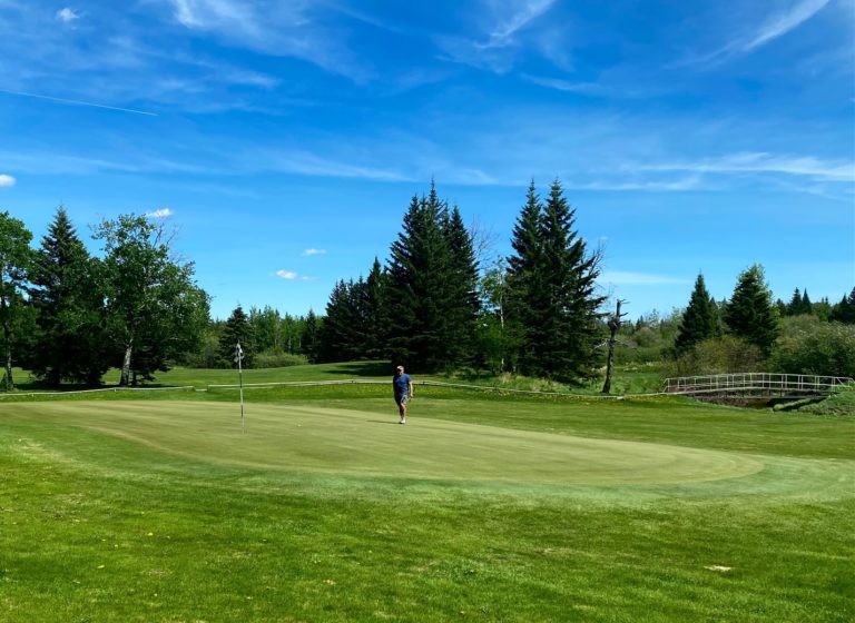
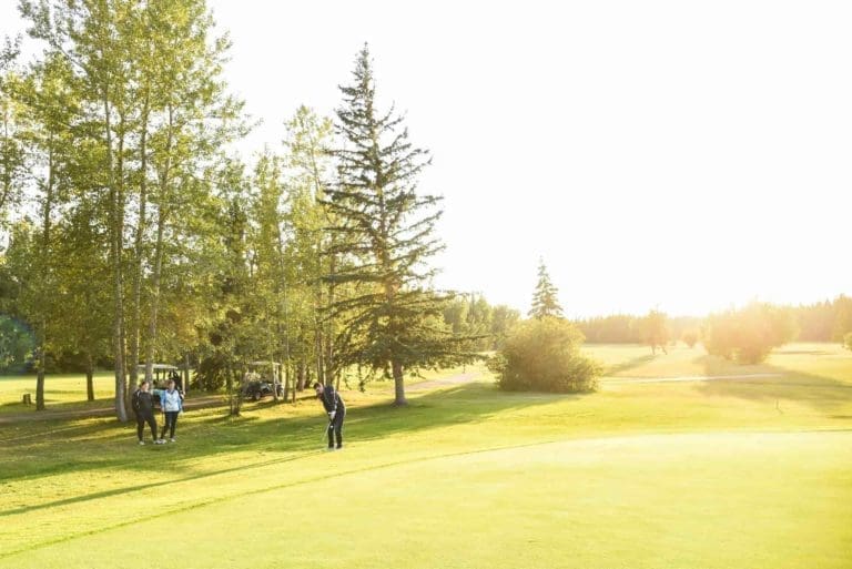
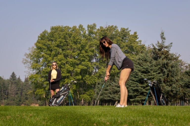
The Hines Creek Golf Course is truly a hidden gem in the Peace Country! Located 6 km south of Hines Creek just off of Highway 64, this family-friendly course is a short and scenic drive from both Grande Prairie and Peace River.
Enjoy an affordable and relaxing golf experience on this beautifully treed course in the spectacular Clear Hills County. This is the second oldest course in Northern Alberta and a wagon wheel monument on the course commemorates the Fort Saint John Wagon Trail which ran through the area many years ago.
Designed for maximum enjoyment regardless of your golfing abilities, this course welcomes beginners and offers a challenge for the low handicapper. The Hines Creek meanders through the course coming into play on five holes offering visitors some stunning views and challenging shots!
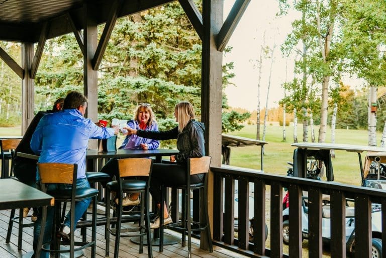
Eleven well-placed holes, grass greens and a full irrigation system ensure a quality experience every time. Relax with a beverage on the back patio of the new clubhouse and watch the putting action on the ninth green! The clubhouse restaurant offers a full menu and licensed bar. Cart rentals and public camping are available. OHV enthusiasts can access the Sand Lake trail system in this area offering more activities for visitors of all ages.
Check Facebook for upcoming events & tournaments!
Daily Food Specials / $10/night Public CampingLeauges
Tuesday night– Ladies’ League – drop-in welcome
Wednesday night – Men’s League – drop-in welcome
Thursday mornings – Seniors’ League – drop-in welcome
Thursday night – Couples’ League – drop-in welcomeTournaments
May 17 – Opening TournamentJune 20 – 22 – Skins TournamentJuly 12 – All in One TournamentJuly 26th – Fun TournamentAugust 16 – CouplesSeptember 6 – Glow BallHines Creek Golf Course Campground
Choose your own beautiful and cozy site at the Hines Creek Golf Course campground. Relax to the sound of the nearby Hines Creek and enjoy the scent of evergreens in this uncrowded area of the Mighty Peace Region. Enjoy an easily accessible and relaxed golf experience on this well-treed course in beautiful Clear Hills County. Finish up your round with a beverage on the back patio of the new clubhouse and watch the putting action on the ninth green!
Need a break from meal prep? Don’t worry, the clubhouse restaurant offers a full menu and a licensed bar. Bring your OHV! There is great access to the Sand Lake Trail System in this area, offering more activities for visitors of all ages. Firepits and tables are also available.
- Seasonal Lots Available
- Public Camping available $10/night.
- For more information and current rates call – 780-494-2217
Category: Accommodations, Camping & Golf, Golf, Golf, Village of Hines Creek, Outdoors, and Things To DoAddress: Unnamed Road
Hines Creek
Alberta
T0H 2A0
CanadaTelephone Number: (780) 494-2217The Hines Creek Golf Course is truly a hidden gem in the Peace Country! Located 6 km south of Hines Creek just off of Highway 64, this family-friendly course is a short and scenic drive from both Grande Prairie and Peace River.
Enjoy an affordable and relaxing golf experience on this beautifully treed course in the spectacular Clear Hills County. This is the second oldest course in Northern Alberta and a wagon wheel monument on the course commemorates the Fort Saint John Wagon Trail which ran through the area many years ago.
Designed for maximum enjoyment regardless of your golfing abilities, this course welcomes beginners and offers a challenge for the low handicapper. The Hines Creek meanders through the course coming into play on five holes offering visitors some stunning views and challenging shots!
Eleven well-placed holes, grass greens and a full irrigation system ensure a quality experience every time. Relax with a beverage on the back patio of the new clubhouse and watch the putting action on the ninth green! The clubhouse restaurant offers a full menu and licensed bar. Cart rentals and public camping are available. OHV enthusiasts can access the Sand Lake trail system in this area offering more activities for visitors of all ages.
Check Facebook for upcoming events & tournaments!
Daily Food Specials / $10/night Public CampingLeauges
Tuesday night– Ladies’ League – drop-in welcome
Wednesday night – Men’s League – drop-in welcome
Thursday mornings – Seniors’ League – drop-in welcome
Thursday night – Couples’ League – drop-in welcomeTournaments
May 17 – Opening TournamentJune 20 – 22 – Skins TournamentJuly 12 – All in One TournamentJuly 26th – Fun TournamentAugust 16 – CouplesSeptember 6 – Glow BallHines Creek Golf Course Campground
Choose your own beautiful and cozy site at the Hines Creek Golf Course campground. Relax to the sound of the nearby Hines Creek and enjoy the scent of evergreens in this uncrowded area of the Mighty Peace Region. Enjoy an easily accessible and relaxed golf experience on this well-treed course in beautiful Clear Hills County. Finish up your round with a beverage on the back patio of the new clubhouse and watch the putting action on the ninth green!
Need a break from meal prep? Don’t worry, the clubhouse restaurant offers a full menu and a licensed bar. Bring your OHV! There is great access to the Sand Lake Trail System in this area, offering more activities for visitors of all ages. Firepits and tables are also available.
- Seasonal Lots Available
- Public Camping available $10/night.
- For more information and current rates call – 780-494-2217
-
SavePlace Title: Five Star Golf ClubPlace Description:
5 Star Golf Course is a par 32, 9 hole gem, all on its own, that can be found in the Little Smoky River Region in the northern part of Alberta. It is a unique and inviting golf experience, surrounded by forest, that displays itself before you with it’s beautifully landscaped fairways, immaculate greens and challenging bunkers. The course is conveniently located in the picturesque river valley along the Little Smoky River. It is a favorite destination for golfers in the local area and also for those who are visiting that are just looking for a relaxing game to fit into their schedule.
Leagues
- Monday – Junior’s night
- Tuesday – Couples night
- Wednesday – Ladies’ League 7:00 pm (drop-in welcome)
- Thursdays – Men’s league 7:00 pm
Tournaments
May 3rd: Cinco de MayoMay 11th: Mother’s Day BrunchJune 15th: Father’s Day BrunchJune 20th: Centre Chevaliers FundraiserJuly 1st: Canada Day ParadeJuly 19th: Couples TournamentAugust 2nd: Poker RallyAugust 16th: Glow Ball NightSeptember 6th: Cash ScrambleGreen Fees and Memberships
Category: Accommodations, Attractions, Camping & Golf, Food & Drink, Golf, Golf, MD Smoky River, Outdoors, Things To Do, and Town of FalherAddress: Range Rd 222
Guy
Alberta
T0H 1Y0
CanadaTelephone Number: (780) 837-2100Email: fivestargolfclub@hotmail.com5 Star Golf Course is a par 32, 9 hole gem, all on its own, that can be found in the Little Smoky River Region in the northern part of Alberta. It is a unique and inviting golf experience, surrounded by forest, that displays itself before you with it’s beautifully landscaped fairways, immaculate greens and challenging bunkers. The course is conveniently located in the picturesque river valley along the Little Smoky River. It is a favorite destination for golfers in the local area and also for those who are visiting that are just looking for a relaxing game to fit into their schedule.
Leagues
- Monday – Junior’s night
- Tuesday – Couples night
- Wednesday – Ladies’ League 7:00 pm (drop-in welcome)
- Thursdays – Men’s league 7:00 pm
Tournaments
May 3rd: Cinco de MayoMay 11th: Mother’s Day BrunchJune 15th: Father’s Day BrunchJune 20th: Centre Chevaliers FundraiserJuly 1st: Canada Day ParadeJuly 19th: Couples TournamentAugust 2nd: Poker RallyAugust 16th: Glow Ball NightSeptember 6th: Cash ScrambleGreen Fees and Memberships
-
SavePlace Title: Sulphur LakePlace Description:
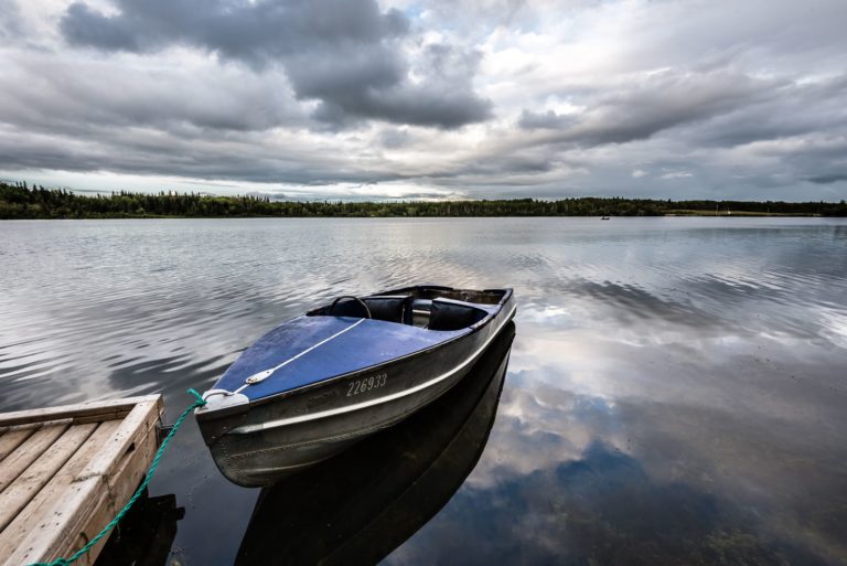
Begin your get away with the relaxing and scenic drive to Sulphur Lake Provincial Recreation area. This well forested campground is tucked into the shore of Sulphur Lake. Bring your own firewood and drinking water and relax around a crackling fire in one of the un-serviced sites. Campers of all ages will be entertained for hours canoeing, kayaking, paddle boarding and swimming on the calm friendly waters of Sulphur Lake. Fishing enthusiasts can use the hand launch for electric motor boats and the fish cleaning station. The lake is aerated to ensure theyear-roundsurvival of the stocked trout population. Kids will enjoy the park and playground adjacent to the campground. RV dumping station also available. Northern Alberta’s crisp clear winters can be enjoyed on and around our lakes while ice fishing, cross-country skiing and snowshoeing.
Sulphur Lake is 30 km Northeast of Hines Creek. Campground is open mid May to Mid September.
Address: Located 32 kilometers west of Dixonville and 24 km North.
Clear Hills County
Alberta
CanadaBegin your get away with the relaxing and scenic drive to Sulphur Lake Provincial Recreation area. This well forested campground is tucked into the shore of Sulphur Lake. Bring your own firewood and drinking water and relax around a crackling fire in one of the un-serviced sites. Campers of all ages will be entertained for hours canoeing, kayaking, paddle boarding and swimming on the calm friendly waters of Sulphur Lake. Fishing enthusiasts can use the hand launch for electric motor boats and the fish cleaning station. The lake is aerated to ensure theyear-roundsurvival of the stocked trout population. Kids will enjoy the park and playground adjacent to the campground. RV dumping station also available. Northern Alberta’s crisp clear winters can be enjoyed on and around our lakes while ice fishing, cross-country skiing and snowshoeing.
Sulphur Lake is 30 km Northeast of Hines Creek. Campground is open mid May to Mid September.
